分类: environment

  • Kenya triples its power target, aiming to expand use of nuclear and geothermal energy

    Kenya triples its power target, aiming to expand use of nuclear and geothermal energy

    In a landmark announcement that cements its role as a trailblazer in African clean energy transition, Kenya has dramatically scaled up its long-term renewable energy capacity goal, more than tripling the previous target to 5,500 megawatts from the current operational capacity of roughly 1,500 megawatts. The ambitious expansion plan lays out a diverse clean energy mix, including 2,000 megawatts of new nuclear capacity, 700 megawatts of additional hydropower, and a suite of new geothermal energy projects across the country.

    For a nation that already generates 93% of its total electricity from renewable sources, the updated target is set to strengthen Kenya’s standing as a global leader in green energy adoption. However, energy analysts and industry insiders warn that this dramatic growth in clean generation capacity will not automatically translate to lower electricity bills for domestic and industrial consumers – a pressing priority that has been pushed to the top of the national policy agenda by Kenya’s lawmakers.

    Peter Njenga, chief executive officer of KenGen, the state-owned power utility that produces roughly 60% of the country’s electricity, confirmed the recalibration of the national clean energy growth trajectory, saying “We have recalibrated our long-term growth trajectory from 1,500MW to a 5,500MW renewable energy development pipeline.”

    Kenyan lawmakers have repeatedly pressured the national government to cut retail electricity rates, arguing that cheaper power is critical to supporting the country’s industrialization goals and easing cost-of-living pressures for households. In July, Kenya’s parliament issued a formal directive to Energy Minister Opiyo Wandayi, ordering him to develop a framework to renegotiate existing power supply agreements with major independent energy producers. Lawmakers argue that lower wholesale electricity costs would give state-owned distribution firm Kenya Price enough financial flexibility to cut consumer rates without compromising its operational and financial stability.

    Energy experts across the board agree that Kenya’s urgent priority is not simply adding new generation capacity, but addressing systemic inefficiencies that keep consumer electricity prices far higher than regional peers. “The answer to this conundrum is not as straightforward as it may seem,” said Mugwe Manga, climate finance lead at the nonprofit Financial Sector Deepening Kenya. “One must look at the entire energy system holistically to understand the drivers of the end cost of power.”

    Unlike major emerging economies including Morocco, Egypt, and China, Kenya offers very limited direct government subsidies to buffer retail electricity prices for consumers. While the cost of generating renewable electricity in Kenya is broadly competitive with regional alternatives, end users ultimately bear the full weight of high project financing costs, significant transmission and distribution network losses, taxes, and volatility from foreign exchange rate movements.

    Latest market data underscores the stark gap between Kenya’s electricity prices and those of its neighbors: industrial consumers in Kenya pay between $0.18 and $0.23 per kilowatt-hour, compared to just $0.03 per kilowatt-hour in South Africa and Egypt, and roughly $0.05 per kilowatt-hour in Morocco and Ethiopia.

    Joseph Siror, CEO of Kenya Power, pushed back on widespread perceptions of excessive pricing in an earlier interview, noting “The perception that electricity is expensive is subjective. The consumer prices are dependent on infrastructure costs, electricity tariff structures, and outstanding bill recoveries.” Siror added that Kenya’s heavy reliance on capital-intensive green energy sources inherently adds to costs, as the specialized infrastructure required for renewable generation carries high upfront installation and long-term maintenance expenses.

    Manga identifies the country’s distribution network as one of the single biggest sources of inefficiency driving high consumer costs. “More than 20% of electricity is lost to technical failures and illegal connections, compared with a global average of 8%-10%,” he explained. “That offers a great low-hanging fruit to improve efficiency and pass that efficiency dividend to end consumers through reduced tariffs.”

    Prohibitively high financing costs represent a second major barrier to lower prices. Renewable energy developers across Africa face far higher borrowing interest rates than their counterparts in wealthy developed economies, because international investors perceive clean energy projects on the continent as carrying higher systemic risk. These elevated borrowing costs are ultimately passed through to end consumers in the form of higher tariffs.

    Kenya’s long-standing power purchase agreements (PPAs) with independent power producers (IPPs) have also come under renewed scrutiny in recent months. IPPs supply roughly 40% of Kenya’s total generation capacity, operating under long-term contracts signed after the country liberalized its electricity generation sector in the late 1990s. Many of these contracts include binding “take-or-pay” clauses that require the Kenyan government to make contracted payments even when the country does not need or consume all the electricity secured under the agreement. Critics argue these arrangements force consumers to pay for unused surplus electricity, though Manga notes that such guarantees were a necessary requirement to secure financing for the capital-intensive renewable projects built over the past two decades.

    “Kenya’s renewable resource base is a major advantage, but electricity prices are determined by the whole system, not only by the cost of power generation,” explained Albert Nganga, senior regulatory manager at CrossBoundary Energy. “They also reflect how power is contracted, transmitted, distributed and recovered.” Nganga added that recently proposed open-access electricity market reforms could boost competition by allowing large industrial consumers to purchase power directly from generators, potentially putting downward pressure on prices.

    Cynthia Angweya-Muhati, CEO of the Kenya Renewable Energy Association, emphasized that the country’s ambitious new generation targets will only deliver broad benefits if paired with systemic policy and regulatory reform. “The real test will be whether that additional clean generation is matched by reforms that lower electricity costs for consumers,” she said.

    This coverage of climate and energy issues by The Associated Press receives financial support from multiple private foundations, with AP retaining full editorial control over all content.
  • Belgian wildfire ‘encircled’ but situation still ‘complicated’

    Belgian wildfire ‘encircled’ but situation still ‘complicated’

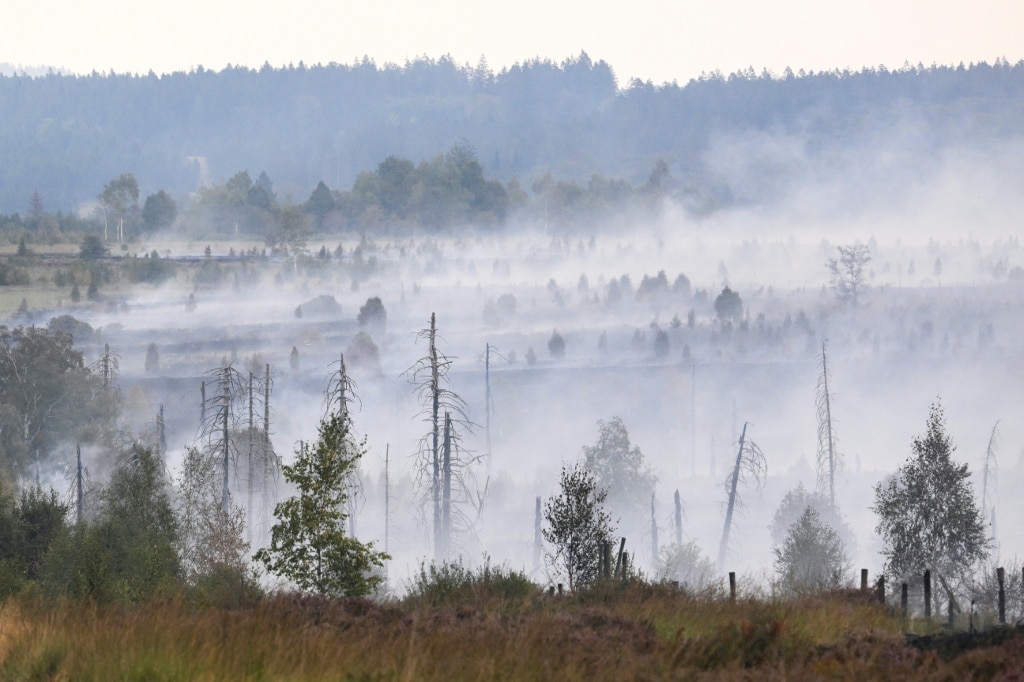
    One of the most destructive wildfires in Belgium’s recorded history has reached a critical turning point, but the battle to contain it is far from over, national crisis management authorities confirmed Wednesday. After working through the night under grueling terrain and weather constraints, firefighting crews have successfully established a full containment line around the massive blaze burning in the High Fens nature reserve, the largest wildfire to hit the country in 100 years.

    Crisis cell spokesperson Tony Hosmans told reporters that the blaze, which has scorched thousands of hectares of protected landscape, is no longer advancing east toward the German border. With containment now in place, the primary operational goal for the coming 24 hours is to fully bring the fire under control, with additional support from water-bombing aircraft expected if weather conditions allow.

    Despite the breakthrough on containment, Hosmans emphasized that the situation on the ground remains highly unstable. Multiple new flare-ups have ignited across different sections of the burned area, keeping hundreds of deployed crews on high alert around the clock. The blaze exploded in size over the past weekend, spreading across 3,000 hectares (7,500 acres) – an area roughly half the size of Manhattan – after breaking out on Friday in the protected wetland and forest reserve. That area was previously hit by a massive wildfire in 1911, during a historic heatwave remarkably similar to the ongoing extreme weather event across Europe.

    The final stretch of containment line, located along the hard-to-reach front near the German border, took all night to close. Ground crews advanced from the east and north through difficult terrain to seal the last gap, a feat made more challenging by the unique landscape of the High Fens. The reserve is made up of a patchwork of heathland, deep peat bogs, and narrow raised wooden hiking boardwalks, all of which slow heavy equipment and ground crew movement.

    To bolster local and national firefighting efforts, cross-border support has poured in from four neighboring European countries: Norway, Germany, Sweden, and the Netherlands, which deployed water-bombing aircraft to the site. However, poor weather has severely limited the use of these critical resources. Low cloud cover over the fire zone grounded all aerial operations on Tuesday, and intermittent rain that has fallen across the area since Monday has similarly blocked flights – even as that same precipitation has helped slow the fire’s spread by raising humidity and dampening surface fuel.

    The High Fens wildfire is just one of dozens of destructive blazes burning across the European continent, where weeks of record-breaking heat and extreme drought have created tinder-dry conditions across vast swathes of land. Major wildfires have also forced mass evacuations and burned thousands of hectares in France, Greece, Portugal, and Spain in recent weeks.

    In addition to the operational challenges on the surface, crews face a unique and long-term threat from the peat that makes up much of the High Fens landscape. Unlike surface fires that burn through trees and brush, this blaze is smoldering deep within the underground peat layers, meaning it can reignite unexpectedly weeks or even months after initial containment.

    Area fire chief David Covens explained the unique risk during a tour of the fire zone: “The fire is burning in the peat, so it is actually underground, sometimes quite deep. Whenever we disturb the ground, when we cut down a tree and expose the soil, the fire can reignite.” Even with all available resources committed to the operation, Covens acknowledged that full extinguishment will be a months-long process: “We’re doing everything we can with the resources available, but we know this is going to take a long time.”

    Thus far, the blaze has triggered mandatory evacuation orders for two Belgian villages and the German border town of Monschae. Residents of the Belgian hamlet of Sourbrodt have already been cleared to return to their homes, but other evacuations remain in place as crews continue to work to secure the area. Officials warned that even after the fire is declared under control, repeated soaking and targeted dousing will be required for weeks to eliminate hidden underground hotspots and prevent reignition.

  • After deadly floods in India’s Assam, experts call for better warnings and long-term planning

    After deadly floods in India’s Assam, experts call for better warnings and long-term planning

    GUWAHATI, India — In the remote village of Hulang Katoni in India’s northeastern Assam state, what began as a routine errand on July 19 ended in a devastating loss. When heavy monsoon rains cut power to his home, Rojo Neog set out on his bicycle to buy candles. By the time he headed back, the swelling Dikhow River, a major tributary of the Brahmaputra, had surged beyond its banks with terrifying speed. Floodwaters tore Neog away, and his family recovered his body three days later.

    Neog’s death is one of more than 100 fatalities linked to this year’s catastrophic flooding in Assam, an event state officials have labeled the worst the region has seen in nearly 60 years. For Neog’s niece Priyakshi Gogoi, the disaster was not just deadly, it was shockingly sudden. Flood levels near the village jumped from knee-deep to neck-deep in just 30 minutes, she said, and no advance warning reached the community. “In the morning we thought it’s fine, there is little flooding but it will subside, but we didn’t expect it to become so bad,” Gogoi told reporters.

    The tragedy repeats across hundreds of flood-ravaged communities in Assam. Just kilometers away in Nepalikhuti village, 42-year-old Krishna Karamkar lost his life saving his 12-year-old son, who had accidentally stepped into the churning overflowing Dikhow. Karamkar pulled his son to safety but was swept away by the powerful current, leaving his wife Sumi Karamkar to navigate an uncertain future. “I have received some assistance from the government but that’s not enough. Our family’s future has suddenly become so uncertain,” she said. Nepalikhuti is one of the hardest-hit villages, reporting more than 1,000 livestock washed away and 200 homes completely destroyed.

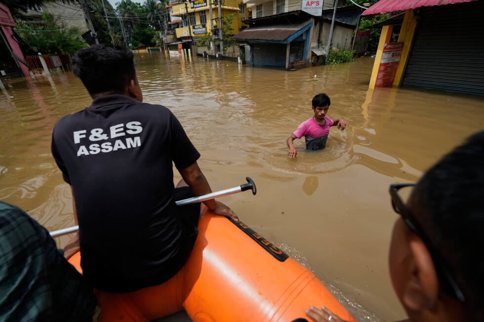
    Across the state, the full scale of the disaster is staggering: more than 700,000 people have been displaced, thousands are still sheltering in overcrowded relief camps even as waters slowly recede, vast swathes of farmland have been submerged, and critical road and utility infrastructure has been heavily damaged. Local resident Shravan Kumar, 26, from Bihubor village, described rushing his elderly parents to higher ground before returning with five small boats to rescue trapped neighbors. “People were clinging to trees, and rescuers had to break through a home’s roof to pull out two children and their parents,” Kumar said. “I have grown up in the area and have never seen such severe flooding before.”

    For dairy farmer Prakash Sharma in Nepalikhuti, the surge caught the village completely off guard. By 10 a.m. on the day the flood hit, the only road connecting the village to the outside world was already underwater. By mid-afternoon, the entire settlement sat under roughly 9 feet of churning water, forcing residents to climb to rooftops and tree canopies for safety. Rescuers pulled Sharma and his family out that same day, but he is still reckoning with catastrophic losses. “For me, it was not just floods, it was a natural calamity of humongous proportion we had never seen before,” he said.

    While seasonal flooding during the June-to-September monsoon has long been a fact of life in Assam — where roughly 40% of the land is inherently vulnerable to inundation from the Brahmaputra river system — climate and disaster experts warn that floods are growing far more unpredictable, destructive, and deadly due to a mix of human-caused climate change and harmful land use practices. Each year, monsoons bring critical moisture that cools the country, irrigates farms, and replenishes river systems, but rising global temperatures have made rainfall far more erratic and intense, creating the conditions for extreme flood events. India, one of the world’s top greenhouse gas emitters, is also one of the countries most vulnerable to the accelerating impacts of climate change.

    A recent analysis from World Weather Attribution (WWA) confirmed that unplanned rapid urbanization, upstream deforestation, unregulated sand mining, widespread wetland loss, and overreliance on hard engineering flood control structures have dramatically worsened risk across Assam and neighboring northeastern states. The Brahmaputra and its tributaries naturally carry massive volumes of sediment eroded from the Himalayas, constantly reshaping their channels, banks, and river islands, meaning seasonal flooding can never be fully eliminated. But human alteration of the natural landscape has overwhelmed the river system’s capacity to absorb heavy rain, leaving communities with almost no time to react when waters surge.

    For decades, Assam has poured millions of dollars into building embankments, flood walls, and erosion-control structures to hold back rivers. Experts agree this infrastructure still serves a purpose in densely populated areas, but they warn it creates new risks when it replaces natural flood absorption systems like forests, wetlands, and floodplains. While India has expanded national flood forecasting and early warning systems in recent years, researchers say critical gaps remain: warnings often get stuck in government bureaucracy and never reach at-risk rural communities, and even when alerts are delivered, there is rarely sufficient preparedness planning or accessible safe shelter for residents.

    “India is very good at rescuing people or providing relief after the disaster, but is particularly bad in doing anything significant to reduce the possibilities of such disasters,” said Himanshu Thakkar, coordinator of the South Asia Network on Dams, Rivers and People, an environmental advocacy group. “It’s very important to study and understand flood risks better in Assam. Once we understand, we can also forecast well. Then we can prepare well and less people will be affected.”

    Experts are now calling for a fundamental paradigm shift in how India manages flood risk, moving beyond a focus on building infrastructure to control rivers toward a strategy of working with natural systems and living with seasonal flooding. “True adaptation requires moving towards living with rivers through wetland restoration and proactive early action before floodwaters strike,” said Emmanuel Raju, director of the Copenhagen Centre for Disaster Research at the University of Copenhagen and a co-author of the WWA report.

    Independent researcher Mirza Zulfiqar Rahman, who has spent years studying the Brahmaputra basin, noted that flood risk management must cross administrative boundaries, since upstream changes including deforestation, mining, and urban development directly impact downstream water flow and sediment levels in Assam. “Flood planning should follow the natural contours of river basins rather than state and international borders,” he said, adding that disaster policy remains far too focused on post-flood response rather than pre-flood risk reduction.

    Climate change is already pushing flood events beyond the adaptive limits of communities that have lived with seasonal inundation for centuries, said Nihal Ranjit, a climate and disaster expert at the Indian Institute for Human Settlements. Historically, communities in flood-prone areas structured their farming and daily routines around seasonal flooding, but more frequent extreme events are making that traditional adaptation unworkable, driving rising displacement. “This always existed, but climate change and climate impacts like floods are increasing this movement,” Ranjit noted.

    Reporting for this story was contributed by Sibi Arasu from Bengaluru, India. The Associated Press’ climate and environmental coverage receives financial support from multiple private foundations, with AP retaining full editorial control over all content.

  • Nonprofit sues US as it pushes to auction massive tracks of water around American Samoa

    Nonprofit sues US as it pushes to auction massive tracks of water around American Samoa

    In a legal challenge that has put a spotlight on the growing global clash between critical mineral development and marine conservation, a prominent U.S. environmental nonprofit launched a federal lawsuit Tuesday to block the Trump administration’s plan to auction off 33 million acres of seabed off the coast of American Samoa for commercial deep-sea mining.

    Earthjustice filed the suit in federal court against the U.S. National Marine Fisheries Service (NMFS) and Commerce Secretary Howard Lutnick, acting on behalf of two Pacific conservation organizations: Fa‘asao Amerika Samoa and the Conservation Council for Hawai‘i. The legal complaint asks a federal judge to immediately halt all progress on the leasing plan and force NMFS to comply fully with the Endangered Species Act and other core federal environmental protection laws.

    “The United States has never opened its waters to deep-sea mining. Until now,” the lawsuit states. The administration’s plan would sell mineral extraction leases for a vast stretch of seabed rich in nickel, cobalt and manganese – minerals critical to manufacturing batteries, consumer electronics and a range of modern industrial products. The complaint argues that NMFS’ recent conclusion that mining leasing would not harm critical habitats or endangered and threatened species is “a wholly arbitrary and capricious determination” that ignores well-documented ecological risks.

    For the Indigenous communities of American Samoa, a healthy ocean ecosystem is not just an environmental asset but a foundation of daily life and cultural identity. The ecosystem supplies food for local households, buffers shorelines from storm damage, and has shaped cultural practices that have persisted for more than 1,000 years. Many native marine species found in American Samoan waters, including endangered sea turtles considered sacred (called *i‘a sa* by local communities), migrate between American Samoa and Hawaiian waters. American Samoa already enforces strict protections for sacred marine species including whales, sharks and giant manta rays, banning any capture or harm to these animals.

    The waters around American Samoa support an extraordinarily diverse array of rare marine life, including shallow and mesophotic coral reefs, deep-sea invertebrates, hundreds of fish and coral species, and multiple protected populations. The proposed mining lease area hosts five endangered sea turtle populations, four endangered whale species, five threatened coral species and four threatened marine animals including the giant manta ray. It sits just 57 miles from the protected Rose Atoll National Wildlife Refuge, one of the region’s most ecologically important intact marine ecosystems.

    The Trump administration’s push to expedite deep-sea mining permits runs directly counter to a growing global movement to restrict the untested practice. Dozens of countries have already called for a global moratorium or full ban on commercial deep-sea mining, citing major unresolved risks including underwater noise pollution, light disruption, and suffocating sediment plumes that can wipe out deep-sea ecosystems that have taken millennia to develop. Notably, no commercial deep-sea mining operation is currently operating anywhere in the world. The International Seabed Authority, the U.N. body that regulates mining in international waters, has only issued exploration licenses to date and has not approved any commercial extraction projects.

    Because the United States has not ratified the U.N. Convention on the Law of the Sea, domestic deep-sea mineral activity is regulated by the National Oceanic and Atmospheric Administration (NOAA). When contacted by the Associated Press on Tuesday, a NMFS spokesperson declined to comment on ongoing litigation, and the U.S. Department of Commerce did not immediately issue a response to requests for comment.

    The American Samoa leasing plan is not the administration’s only recent move to expand domestic deep-sea mining. Just one day before the lawsuit was filed, the federal government published a proposed leasing notice for 69 million acres of federal waters surrounding the Northern Mariana Islands, marking a massive expansion of the administration’s push for domestic seabed mineral development.

    In a statement supporting the expansion, Matt Giacona, acting director of the Marine Minerals Administration, framed the policy as a matter of national and economic security. “Critical minerals are essential to America’s national security, economic strength and resource sovereignty,” Giacona said. “The United States cannot afford to depend on foreign nations for the resources that power our economy and support our defense industrial base.”

    The administration’s moves have drawn sharp condemnation from the scientific and environmental communities. “It’s disgraceful that the Trump administration is bulldozing ahead with plans to allow deep-sea mining while the people who live closest to the proposed project are rightfully demanding that it be stopped,” said Nick Katkevich, oceans campaigner at the Center for Biological Diversity. “These massive mining projects are just too experimental and dangerous for marine life to allow them to go forward.”

  • US moves to open vast tracts of pristine forests to logging

    US moves to open vast tracts of pristine forests to logging

    On a Tuesday announcement, the administration of former U.S. President Donald Trump tabled a landmark regulatory change that would undo two decades of protections for some of the nation’s last untouched wild landscapes, clearing the way for road construction and commercial logging across 44 million acres of undisturbed national forest.

    The proposed rule would formally revoke the 2001 Roadless Area Conservation Rule, a signature environmental policy implemented in the final days of the Bill Clinton administration that banned almost all industrial development across vast swathes of public forests and grasslands categorized as “inventoried roadless areas.”

    U.S. Agriculture Secretary Brooke Rollins justified the rollback in an official statement, framing the existing protections as outdated barriers to critical forest management that the U.S. Forest Service needs to reduce wildfire risk. “Across the country, we’ve watched preventable conditions — overgrown stands, insect outbreaks and disease — turn healthy landscapes into tinderboxes,” Rollins said. “For too long, outdated restrictions have kept tens of millions of forested acres off-limits to the very treatments that improve forest health and reduce wildfire risk to our communities.”

    Early drafts of the regulation outline that the change will shift authority over decisions on road construction, reconstruction and timber harvesting in protected roadless areas to local state officials, aligned with site-level forest management planning. More than 95% of all inventoried roadless areas are located across 10 Western U.S. states: Alaska, Arizona, California, Montana, Nevada, New Mexico, Oregon, Utah, Washington, and Wyoming. The proposed rule does not extend to Colorado and Idaho’s national forests, due to pre-existing state-specific roadless conservation regulations.

    The proposal has drawn immediate fierce pushback from environmental conservation organizations, who have already signaled they intend to mount legal challenges to block the change. Randi Spivak, public lands policy director at the Center for Biological Diversity (CBD), a leading nonprofit environmental group, called the move the largest rollback of public land protections in U.S. history, noting it runs counter to widespread public opinion.

    Conservation groups warn that opening these roadless areas to development will cause irreversible damage to critical endangered species habitats. The CBD notes that Northern Rockies roadless areas act as essential lifelines for vulnerable populations of grizzly bears and Canada lynx. The proposal would also threaten ecologically critical salmon spawning streams and old-growth centuries-old Sitka spruce in Alaska’s Tongass National Forest, the nation’s largest national forest, which was explicitly named in the draft regulation. The targeted rollback for the Tongass follows an executive order Trump issued on the first day of his second term focused on “Unleashing Alaska’s Extraordinary Resource Potential.”

    Public opinion polling shows the administration’s proposal is deeply out of step with voter preferences. A recent survey conducted by Susquehanna Polling and Research found that 77% of likely U.S. voters rank conserving roadless national forests for current and future generations as a top priority, while only 11% support opening additional protected land to timber harvesting and mining.

    Critics also reject the Trump administration’s core argument that rolling back protections is necessary to reduce wildfire risk. Prior to the 2001 Roadless Rule, more than 370,000 miles of roads had already been built through U.S. national forests, leaving the federal government with a multi-billion dollar backlog in road maintenance. The CBD points to peer-reviewed research to refute the administration’s claim: a 2020s nationwide study published in the journal *Fire Ecology* found that wildfire ignitions are nearly four times more likely in lands within 50 meters of roads compared to untouched roadless areas, and that the majority of wildfires are human-caused, most often near existing developed areas.

    Critics further note that the Trump administration has consistently rejected policies to address climate change, the primary driver of increasingly frequent and severe wildfires across the American West, which has created hotter, drier conditions that amplify wildfire risk.

  • The UK and Google are testing changes to flight paths to tackle aviation’s climate impact

    The UK and Google are testing changes to flight paths to tackle aviation’s climate impact

    A landmark large-scale aviation climate trial, officially launched on Tuesday, will test a surprisingly simple solution to cut one of aviation’s most underrecognized contributions to global warming over the next two winter seasons. Backed by the British government and led by a cross-sector consortium that includes Google UK, the UK Department for Transport, and leading academic institutions, Operation Blue Skies will ask hundreds of commercial flights traversing the busy northeastern Atlantic to make minor altitude adjustments to avoid climate-warming condensation trails, more commonly known as contrails.

    Contrails form when jet engines emit soot particles that act as nucleation sites for ice crystals in cold, humid sections of the upper atmosphere. These thin, linear cloud formations trap heat in the Earth’s atmosphere far more effectively than many people realize. Research from non-profit research group Contrails.org — part of Breakthrough Energy, the climate initiative founded by Bill Gates — estimates contrails are responsible for 1% to 2% of total global warming. Because cold, humid conditions ideal for contrail formation are far more common in winter, the trial is scheduled exclusively across the upcoming two cold seasons in the Northern Hemisphere.

    The test will take place in the Shanwick Oceanic Control Area, a high-traffic air corridor that connects Europe and North America and is widely recognized as one of the world’s top contrail hotspots. Data modeling indicates this single airspace alone accounts for roughly 5% of global contrail-related warming, making it the perfect location to test the intervention. Over the 30-month research program, air traffic controllers will coordinate minor altitude changes — of up to 2,000 feet, within the bounds of standard commercial flight operations — through existing air traffic management communication channels. The test is scheduled for 20 to 40 low-traffic days per winter season, with an estimated 10,000 total flights passing through the trial airspace, and between 1% and 5% (several hundred) of these flights receiving adjusted altitudes.

    Google UK will bring its core AI expertise to the project, providing machine learning-powered forecasting tools to accurately identify atmospheric regions where contrails are most likely to form. This builds on earlier small-scale trials: earlier this year, Google and American Airlines released results of a partnership that demonstrated significant contrail reduction using the same AI forecasting tool. Unlike prior individual airline tests, however, Operation Blue Skies will roll out the intervention across an entire airspace, coordinating route changes for multiple carriers simultaneously to measure the aggregate impact on regional contrail formation.

    The UK government is covering more than half of the £5 million ($6.76 million) total project cost. Keir Mather, the UK’s aviation minister, emphasized that the partnership between the public sector and Google reflects the country’s commitment to supporting innovation that decarbonizes air travel. For Google, contrails represent an urgent but solvable climate challenge for the global aviation industry. Paul Hodgson, Google’s technical lead for Operation Blue Skies, explained that an airspace-scale trial fills a critical gap in existing research. Testing across the entire corridor, rather than on select flights from a single airline, will demonstrate that coordinated multi-plane diversions are logistically feasible, and will generate statistically significant data on overall regional contrail reduction that could be used as a blueprint for busy air corridors around the world.

    The idea that minor flight path adjustments could cut contrail-related climate impact dates back at least to a 2020 study from Imperial College London. Marc Stettler, a professor at Imperial College involved in that original research, noted that Operation Blue Skies offers the first chance to test the decades-old hypothesis in a real-world setting at an unprecedented scale. Additional project partners include the UK’s national weather service the Met Office, the country’s leading air navigation service provider NATS, Contrails.org, and the University of Cambridge.

    This reporting on climate and the environment from The Associated Press receives funding from private philanthropic foundations, and The AP maintains full editorial independence over all content.

  • Make it rain: Indonesia chases clouds to stem El Nino fires

    Make it rain: Indonesia chases clouds to stem El Nino fires

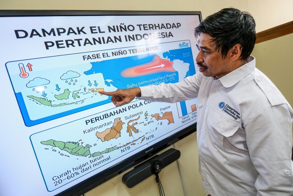
    On the tarmac of Tjilik Riwit Airport in Palangka Raya, Central Kalimantan, technicians from Indonesia’s National Disaster Management Agency carefully load canisters of sodium chloride into a waiting aircraft. This routine pre-flight preparation is part of a high-stakes gambit: the Southeast Asian nation is turning to cloud seeding to curb an unprecedented wildfire crisis amplified by one of the strongest El Niño events in recent decades.

    Indonesia’s biodiverse Borneo island, a region home to old-growth pristine rainforest and globally protected endangered species, is ablaze this dry season. Official government data confirms more than 100,000 hectares of land have already burned in the first six months of 2024. But independent analysis from deforestation monitoring project Nusantara Atlas paints a far grimmer picture, putting the total burned area through July at over 285,000 hectares—an expanse more than four times the geographic size of Indonesia’s capital Jakarta.

    Cloud seeding, a weather modification technique that disperses silver iodide, salt particles and other nucleating agents into existing clouds to stimulate rain formation, is not a common tool for wildfire suppression across the globe. But for Indonesia, the strategy carries urgent weight: the country is still recovering from the devastating 2015 wildfire season, which was also driven by a strong El Niño, burned millions of hectares of forest and peatland, and sparked a transboundary toxic haze crisis that disrupted daily life across Malaysia, Singapore and southern Thailand.

    Unlike popular misconception, cloud seeding does not create new clouds, explained meteorologist Safillah Anggie Wahyuni, who has accumulated more than 300 flight hours on cloud seeding missions since she carried out her first operation three years ago. Instead, the technique works by maximizing the rainfall potential of existing cloud formations. “Weather modification will only be effective if the conditions are right,” Safillah told AFP during an overflight of fire-stricken Central Kalimantan.

    Data from Indonesia’s national meteorological agency BMKG shows the country has dramatically scaled up cloud seeding operations in recent years: between 2021 and August 2024, crews carried out 252 missions, compared to just 85 operations across the entire preceding decade. While many of these missions have targeted flood reduction by drawing rain away from vulnerable populated areas, a growing share is now focused on dousing active wildfire hotspots and wetting down parched, highly flammable peatland ecosystems. Currently, dozens of helicopters and fixed-wing aircraft are on standby across the country to deploy cloud seeding at short notice, with security officials maintaining round-the-clock monitoring for any formation of rain-bearing clouds.

    Still, the technique remains controversial, and the vast majority of Indonesia’s firefighting work still happens on the ground, where nearly 50,000 frontline firefighters are currently deployed across fire-prone regions. Critics point out that during the peak dry season, when wildfires are most intense and El Niño brings prolonged drought, clouds are often too scarce for cloud seeding to deliver meaningful results.

    “Its effectiveness will be very low because of the lack of clouds,” said I Putu Santikayasa, a hydroclimatology lecturer at IPB University, located south of Jakarta. Beyond the issue of limited cloud cover, researchers have also noted that measuring the actual efficacy of cloud seeding remains methodologically challenging, while concerns have been raised about potential environmental harm from widespread silver iodide use and the high cost of sustained operations.

    BMKG’s weather modification director Budi Harsoyo acknowledged that cloud seeding is only a temporary mitigation measure, not a long-term solution to Indonesia’s wildfire crisis. He also pushed back on safety concerns, noting there is no peer-reviewed evidence of harm from the levels of silver iodide used in current operations. A 2023 study authored by Harsoyo found that a 12-day cloud seeding operation in Central Kalimantan doubled expected rainfall and eliminated all mapped active fire hotspots during the operation period.

    Environmental activists go further, arguing that technical fixes like cloud seeding distract from the root causes of Indonesia’s recurring wildfire crises. A large share of the country’s fire-prone land is made up of tropical peatlands: carbon-dense ecosystems that are highly water-retentive and fire-resistant when intact, but turn extremely flammable when drained for agricultural development, with underground fires that can smolder for months and reignite suddenly when conditions are dry.

    Uli Arta Siagian, campaign coordinator for local environmental advocacy group WALHI, argues the core solution is protecting these vulnerable ecosystems from unsustainable development, rather than relying on emergency interventions after fires break out. “The responsibility for protection lies with the state by not issuing permits in areas that are vulnerable to fire,” she told AFP.

    The 2024 wildfire season has already renewed regional concerns about transboundary haze, a recurring diplomatic and public health issue for Indonesia’s neighbors Malaysia and Singapore. In recent weeks, elevated haze from Borneo fires has pushed air pollution levels far past safe limits in the Malaysian portion of the island, forcing authorities to close hundreds of schools to protect children’s health.

    Beyond cloud seeding, the Indonesian government has deployed a suite of additional response measures: ongoing peatland rewetting projects to restore water levels in drained ecosystems, satellite and ground-based monitoring of fire hotspots, and new enforcement directives for local governments. Large-scale plantation operators are banned from using fire to clear land, though the exemption for small-scale smallholders means the practice remains widespread, and is blamed for igniting the majority of annual wildfires. The country’s environment minister has now ordered local authorities to strengthen preventive patrols and pursue full legal penalties, including fines and criminal prosecution, for anyone caught carrying out illegal burning.

    Climate scientists warn that this year’s extreme fire activity has been supercharged by the powerful El Niño event, a naturally occurring climate pattern that alters global wind, pressure and rainfall patterns, typically bringing severe drought to Indonesia. Already, the total burned area in just the first half of 2024 exceeds the total burned across the whole of 2023, the last year El Niño formed. Climate campaign group 350.org warned this week that human-caused climate change is amplifying the risk of extreme El Niño-driven fire seasons, noting that current El Niño conditions are occurring on top of already elevated global average temperatures that make extreme drought and fire far more likely.

  • A looming rock collapse threatens a Swiss village as thawing permafrost destabilizes the Alps

    A looming rock collapse threatens a Swiss village as thawing permafrost destabilizes the Alps

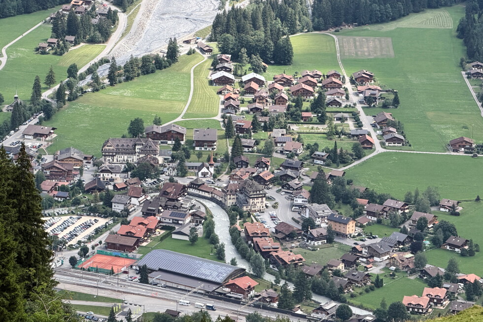
    Perched in the dramatic Alpine landscapes of Switzerland’s Bern canton, the postcard-perfect village of Kandersteg — home to 1,300 residents, surrounded by jagged peaks, receding white glaciers and lush green valleys, with the faint, familiar chime of cowbells drifting across mountain air — now faces an imminent existential threat tied to a rapidly changing climate. A massive unstable rock formation known as Spitze Stei, perched thousands of feet above the village, is at growing risk of collapse, a disaster that experts warn could match the scale of last year’s devastating landslide that destroyed the nearby community of Blatten.

    The growing risk of large-scale mountain collapses across the Swiss Alps is directly linked to rising global temperatures, which are driving the steady thaw of permafrost — the permanently frozen layer of soil, sediment and rock that acts as natural cement binding mountain slopes together — and shifting glacier dynamics. Climate scientists warn that as this frozen infrastructure melts, once-stable alpine terrain becomes increasingly prone to catastrophic movement.

    For residents of Kandersteg, the threat hangs over daily life, balanced between cautious calm and the unavoidable uncertainty of natural forces. “You are aware that it’s happening, but not afraid,” said long-time local Brigitte Jüni, noting that cantonal and federal authorities have implemented every feasible precaution to protect the community. “But then it’s nature. It’s nature and you never know,” she added.

    The scale of the potential collapse is staggering: geologists estimate the unstable portion of Spitze Stei holds between 15 and 20 million cubic meters of rock. Should the entire formation collapse at once, it would bury large parts of Kandersteg’s valley under debris. However, constant real-time monitoring of the rock’s movement and preparedness efforts have eased some anxiety among locals. Experts also note that a gradual, incremental breakdown of the formation is far more likely than a single massive collapse. Evacuation routes and emergency protocols are already finalized and updated regularly to ensure residents can move to safety if warning signs escalate.

    Many locals draw a clear distinction between their current situation and the 2025 disaster in Blatten, located in the nearby Loetschental valley. In that event, a huge mass of rock and ice broke free from a warming glacier, thundering down the mountainside just weeks after the entire village was evacuated as a precaution. The entire settlement was coated in thick mud, leaving almost no structures undamaged. “This isn’t the same case as in Blatten. It’s a different situation,” said local resident Rudolf Isler. “We are not afraid of the Spitze Stei rock. It’s been many years seeing stones falling from up there. The problem here is about global warming and rising temperatures.”

    Markus Stoffel, a professor of climate change and natural risks at the University of Geneva, explained the scientific mechanism behind the growing risk: “In the mountains and in the unconsolidated debris, there is lots of ice. Once this ice is melting, it removes the binding that holds the slope together. These mountain slopes will become increasingly unstable.”

    The threat to Kandersteg is part of a broader pattern of escalating natural hazard risk across the European Alps, driven by human-caused climate change. Climate advocates warn that if current warming trends continue, entire Alpine communities may need to be relocated in coming decades. “Climate change means landslides or avalanches will become more common,” said Nathan Solothurnmann, a climate and energy expert for Greenpeace Switzerland. “Maybe even one day we will have to abandon certain valleys or certain villages because it’s becoming impossible to live there. Or the measure you will need to take to protect infrastructure is so expensive, the efforts are so big, that it’s not worthwhile anymore living there.”

  • Whales spark joy in New York but face threats from boat traffic

    Whales spark joy in New York but face threats from boat traffic

    The cry of “whale at one o’clock!” has become a familiar, electrifying sound for cruise passengers exploring New York’s southern shorelines. When a humpback whale breaches the Atlantic surface against the backdrop of Manhattan’s world-famous skyline, crowds rush to the starboard bow, scrambling to catch a glimpse of one of the ocean’s most magnificent creatures. What was once a once-in-a-lifetime rarity is now a regular occurrence in the city’s coastal waters, bringing unbridled joy to wildlife enthusiasts while forcing policymakers and marine experts to confront a growing threat: heavy boat traffic in one of the United States’ busiest port regions.

    Decades ago, commercial hunting pushed humpback whale populations to the brink of extinction, and their remarkable recovery today stands as one of the global conservation movement’s most celebrated success stories. A growing population, dominated by young juvenile humpbacks, is now thriving off New York’s coast, where abundant food sources have transformed the area from a temporary migratory stopover into a permanent home.

    “People travel across the globe for African safaris, but what most don’t know is that a world-class marine safari is right on our doorstep,” explained Carl LoBue, New York oceans director for The Nature Conservancy. Raised on nearby Long Island, LoBue recalled that whale sightings off the state’s coast were once almost unheard of. Now, he spots marine mammals on virtually every trip out on the water. While humpbacks are the most common visitors, the region also hosts rare sightings of the critically endangered North Atlantic Right whale. For LoBue, this new normal is nothing short of spectacular: “I never dreamed I would see whales this abundant right off New York’s coast.”

    Several interconnected factors have driven this population shift, turning the New York Bight—the vast marine region stretching from New York City and Long Island to New Jersey—from a migratory highway into a permanent feeding ground. First, decades of federal protections including the U.S. Endangered Species Act allowed humpback populations to rebound, while stricter air and water quality regulations cleaned up coastal habitats that were once uninhabitable for large marine life. Second, new fishing regulations have supported the recovery of Atlantic menhaden, an oily small fish that serves as a primary food source for whales, dolphins, and seabirds, in addition to being harvested for commercial bait and dietary supplements. An adult humpback, which can grow to the size of a full-size city bus, consumes up to 3,000 pounds of fish every day, making abundant menhaden populations critical to supporting the growing whale community.

    Climate change has also accelerated this shift, according to Chris St. Lawrence, a naturalist who leads whale watching tours and works for Gotham Whale, a non-profit marine research organization that monitors whale populations in the New York Bight. Warming ocean temperatures have shifted the distribution of bait fish, pushing whales to abandon traditional migratory routes in search of reliable food sources closer to New York’s coast.

    When Gotham Whale launched its formal tracking program in 2012, the organization’s catalog included just five individual humpbacks. Today, St. Lawrence reports the group documents 80 to 100 unique whales every year, and recently identified its 500th distinct individual whale spotted around New York City since monitoring began. Some whales have even become minor celebrities among local whale watchers: NYC0318, a humpback spotted by AFP during a recent outing, regularly delights crowds with dramatic displays of lunge-feeding and full breaching that leave spectators screaming with delight.

    Gotham Whale identifies individual whales by their unique fluke prints—distinctive pigment patterns on the underside of their tails that are as unique as human fingerprints, St. Lawrence explained. But many whales are also recognizable by the scars they carry, most often from collisions with vessels ranging from massive tankers and cargo ships to smaller recreational fishing and leisure boats.

    For all the abundance of food New York’s coast offers, the region’s extremely heavy maritime traffic creates serious new risks for the growing whale population. While humpbacks in the New York area were removed from the endangered species list in 2016, just one year later the U.S. National Oceanic and Atmospheric Administration (NOAA) declared an Unusual Mortality Event for humpbacks along the entire Atlantic coast. This designation, granted under the Marine Mammal Protection Act, is triggered when unexpected mass die-offs occur, and it initiates formal investigation and response. The Unusual Mortality Event for humpbacks remains in effect today.

    Global marine advocacy groups and government researchers confirm that vessel strikes and fishing gear entanglement are the two leading causes of preventable whale deaths worldwide. To address this growing risk in New York, Governor Kathy Hochul recently signed the Whale Awareness Act into law. The new legislation requires that marine mammal protection and education be integrated into mandatory state boater safety courses and vessel registration processes.

    LoBue has helped develop new educational resources for the policy, including an online course that teaches boaters of all kinds how to recognize whale behavior, report sightings to regulators, and adjust navigation to avoid collisions. He notes that even experienced commercial fishermen never learned how to operate boats around whales, because the animals were not present in the region for generations. “We all have to learn new skills to adapt to this change,” LoBue said. “And at the end of the day, nobody wants to hit a whale.”

  • US pauses construction of border project in Texas national park

    US pauses construction of border project in Texas national park

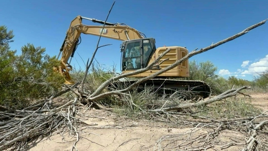
    A high-stakes border infrastructure project in one of America’s most ecologically diverse national parks has been put on hold, after days of bipartisan local pushback and growing legal challenges over its potential environmental harm. The $1.7 billion project, pushed forward by the Trump administration as part of its broader border security initiative along the U.S.-Mexico boundary, broke ground earlier this month at Big Bend National Park in southern Texas. On Monday, Customs and Border Protection (CBP) Commissioner Rodney Scott announced the construction pause in a video posted to social platform X.

    Big Bend National Park draws visitors from across the globe for its dramatic, one-of-a-kind landscape: it blends arid desert ecosystems, the winding Rio Grande, and towering mountain ranges, including the iconic Santa Elena Canyon. The protected area hosts extraordinary biodiversity, home to hundreds of native bird species, bobcats, black bears, and dozens of other threatened and endemic wildlife. The administration’s plans call for new vehicle barriers, expanded patrol roads, enhanced lighting, and high-tech detection systems to be built across the park’s public lands. Official project maps show the proposed patrol route and technology corridor cutting across the rugged slopes of Mariscal Mountain, a stretch that critics warn would require widespread dynamite blasting to clear, leaving irreversible damage to the fragile terrain.

    In his announcement, Scott confirmed that all construction activity within the park has been halted pending an on-site review. “Last night, I put a pause on all activity in that park as far as construction goes, until I get down there and do a personal evaluation,” Scott said, noting he would meet with local stakeholders and share additional updates later this week.

    The project has sparked unified, cross-party opposition from local communities and officials since it was first unveiled. All 14 Texas border county judges signed an open letter affirming their support for responsible border security while rejecting the current proposal, calling for more practical, less environmentally destructive alternatives. Data from CBP itself undermines the project’s core security justification: between January 2024 and July 2026, just 9,624 migrant apprehensions were recorded in the Big Bend Sector, a fraction of the 23,080 apprehensions recorded over the same period in the Swanton Sector along the far less contested U.S.-Canada border.

    Local opponents emphasize that the rugged, remote terrain of Big Bend is already nearly impossible to traverse from Mexico, making the new barriers unnecessary. “It’s quite literally impossible to traverse, whether on foot or in a vehicle, from the other side into this area. Furthermore, this is not the will of the people of this region,” Jake Knight, executive director of the Big Bend Protection Alliance, told reporters during on-site protests.

    Critics have also raised alarms over the procurement process and the scope of environmental rollbacks used to approve the project. The Trump administration has waived dozens of longstanding federal environmental protection laws to greenlight the construction, which was awarded through a no-bid, non-competitive contract – a provision that has drawn anger from local residents. “There’s a no-bid contract for $1.7 billion in our national park. And that’s an awful lot of money to spend. So we know that they will destroy things. They’re already in there right now,” 63-year-old local teacher Bernadette Devine said at a recent protest against the plan.

    Legal challenges are already moving forward to block the project permanently. The Center for Biological Diversity, a national nonprofit conservation group, has filed a lawsuit against the federal government arguing the sweeping environmental waivers violate the U.S. Constitution. The group plans to submit an emergency injunction request Monday to halt construction permanently if the pause is lifted.

    Laiken Jordahl, a national public lands advocate with the Center for Biological Diversity, noted that local opposition has reached an unprecedented level of unity. “I’ve never seen communities so outraged and unified on a single issue, this has become a serious force to be reckoned with,” Jordahl told AFP. While activists have welcomed the temporary halt to construction, they have cautioned that the fight to protect the park is far from over. “And while it’s certainly welcome news that the bulldozers aren’t carving in the national park today, it is very likely that the pause will be lifted, we’re not considering this a victory yet,” Jordahl added.