分类: environment

  • How narwhal ‘scientists’ track Arctic warming

    How narwhal ‘scientists’ track Arctic warming

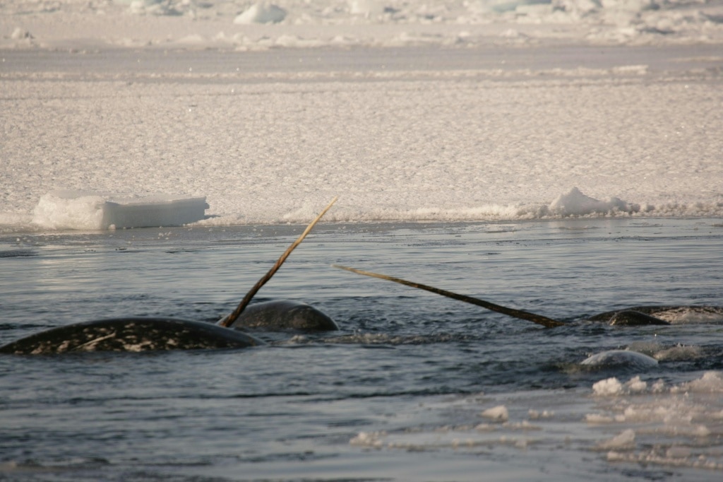
    The global battle against climate change has gained an unexpected, tusked contributor: the Arctic narwhal, often nicknamed the “unicorns of the sea.” A groundbreaking study published Wednesday in *Science Advances* outlines how researchers turned these elusive deep-diving whales into citizen scientists of sorts, outfitting six individuals with custom satellite transmitters to collect data in one of the planet’s most inaccessible regions: remote East Greenland fjords.

    Between 2017 and 2020, these non-traditional research partners gathered more than 2,000 high-quality measurements of ocean temperature and salinity. The data they collected has filled a critical gap in scientific understanding, revealing how masses of warm Atlantic water are pushing deep into East Greenland’s fjord systems and accelerating the melt of marine-terminating glaciers. This glacial melt does not stay confined to the Arctic: it carries wide-reaching consequences for global ocean circulation and weather patterns that impact communities across the Northern Hemisphere.

    “We have used a completely novel technique,” explained Mads Peter Heide-Jorgensen, professor at the Greenland Institute of Natural Resources and lead author of the study, in an interview with AFP. Unlike traditional research methods that require scientists to brave the region’s harsh conditions, “we can sit at our warm offices and drink coffee while the data comes in,” he added.

    ### Global Climate Impacts at Stake
    Meltwater from East Greenland’s glaciers flows into the coastal shelf and fjords before feeding into two major Arctic ocean currents. One of these, the East Greenland Current, acts as a foundational regulator for the Atlantic Meridional Overturning Circulation (AMOC)—a vast, planet-scale system of ocean currents that distributes heat across the globe. Climate researchers have warned that a complete collapse of the AMOC, which is increasingly likely as Arctic warming accelerates, could trigger severe winter cooling across Europe, plunging much of the continent into prolonged deep freezes and disrupting agricultural and economic activity.

    Despite the urgency of understanding this process, studying the “Atlantification” of East Greenland waters has long been a major challenge. The region’s remote location, frigid temperatures, and thick year-round ice make traditional research dangerous, logistically complex, and prohibitively expensive. For decades, the only data available came from research ship crews that manually sampled water columns as they navigated open waters. In recent years, fixed electronic sensors have been deployed, but these are limited to summer months when ice cover retreats enough to allow installation. Icebreakers, the only vessels capable of navigating year-round ice, are rare and cost prohibitive to operate for extended research missions, and crews face constant risk from glacial calving events that release massive ice chunks capable of damaging or capsizing ships.

    Narwhals, however, are perfectly adapted to this harsh environment, making them ideal research partners. These deep-diving mammals regularly descend to more than 1,500 meters below the ocean surface, allowing them to collect continuous data across entire water columns. The transmitters attached to their backs record temperature, salinity, depth, and geographic location, which researchers then use to calculate water density and distinguish between warm Atlantic-origin water and colder polar-origin water.

    One of the study’s most striking findings was the detection of Atlantic-origin water deep beneath glaciers in the Scoresby Sound fjord complex, more than 350 kilometers inland from the open coast. This confirms that warm water is penetrating much farther into glacial systems than previously documented, explaining the faster-than-expected melt rates scientists have observed in the region in recent years.

    ### Reluctant But Invaluable Partners
    While researchers have experimented with using other marine mammals including seals, beluga whales, and bowhead whales for data collection, narwhals offer a unique advantage: they exhibit strong site fidelity, returning to the same locations year after year. This allows scientists to collect consistent, repeated measurements over time, a core requirement for tracking long-term changes in ocean conditions.

    The research team grew fond of their four-legged (well, flippered) collaborators, even naming individual narwhals after ancient Nordic deities including Freya and Balder—though the whales did not earn co-authorship on the paper. For their part, the narwhals are far from enthusiastic partners. “I wouldn’t say they enjoy interacting with humans,” Heide-Jorgensen noted, adding “they do it under protest.”

    Capturing narwhals in nets and fitting the non-invasive tags takes roughly 20 minutes, a short stressful interruption after which the animals quickly return to their normal behavior. The tags are designed to detach from the whales’ skin naturally after several months, leaving the animals unharmed.

    The study team emphasized that this successful partnership showcases how creative, unconventional approaches can revolutionize oceanographic research in regions that are nearly inaccessible to human scientists. Even as narwhals help us track the impacts of climate change, however, they are among the species most vulnerable to a warming Arctic. As Heide-Jorgensen pointed out, narwhals are ultimately “losers in the climate game”: rising ocean temperatures are shrinking their cold-water habitat, and climate projections indicate the species will be forced to shift their range hundreds of kilometers further north to survive in the coming decades.

  • Invasive green crabs are bad for the environment so New Englanders are starting to eat more of them

    Invasive green crabs are bad for the environment so New Englanders are starting to eat more of them

    YORK, Maine — On a June morning in 2026, when the thin coastal fog finally lifted from Maine’s York River, former marine science teacher Mike Masi and two interns leaned over a wooden dock, sorting through a teeming mound of one of the Northeast’s most destructive invasive species: the European green crab. Their goal? Separate out the crabs on the cusp of molting their hard outer shells to sell as a premium menu item to high-end restaurants across New England.

    Green crabs (Carcinus maenas) first arrived on North America’s East Coast hundreds of years ago, hitching a ride in the ballast water of transatlantic trade ships from their native European waters. Today, their population along the New England coast numbers in the tens of millions, and climate change-fueled ocean warming has supercharged their spread: warmer winters allow more crabs to survive the cold season, and their extreme adaptability lets them thrive in nearly every coastal habitat. A single female green crab can release up to 185,000 eggs once or twice annually, helping the species outcompete native Atlantic rock crabs and juvenile lobsters, destroy critical eelgrass beds, erode salt marsh banks, and decimate native shellfish populations. The invasion costs the region’s commercial shellfish industry tens of millions of dollars every year, as green crabs prey on commercially valuable mussels, oysters, and soft-shell clams. Maine state data shows soft-shell clam landings have plummeted from more than 7.8 million pounds of meat in 1978 to just 1.3 million pounds in 2025, a decline veteran clam fisherman Chad Coffin attributes directly to the green crab takeover.

    Now classified as one of the world’s most successful invasive species, green crabs have spread far beyond the East Coast: they have established populations along the U.S. West Coast, reached Alaska, and invaded coastal ecosystems across South Africa, Japan, Argentina, and Australia. “They’re really pretty resilient little guys,” explained Carolyn Tepolt, an evolutionary biologist at the Woods Hole Oceanographic Institution who has studied green crabs for 20 years. “Their adaptability is why we use them to research what allows some species to thrive in new, changing environments.”

    To combat the invasion, a growing grassroots movement across New England is taking an unconventional approach: turning the invasive pest into a profitable commercial product, encouraging targeted harvesting to reduce population numbers while creating new revenue streams for local fisheries. Masi, whose company shell+claw is the only commercial enterprise focused on cultivating soft-shell green crabs, says the model turns a universally hated pest into an asset. The economics already make sense for soft-shell pre-molt crabs: Masi can sell each for $3 at market, compared to just 8 cents for a hard-shell green crab. Beyond profit, harvesting the crabs directly helps restore balance to damaged coastal ecosystems.

    Masi is far from alone in this effort. Other producers across the region have developed green crab-based products including pet treats, fish sauce, and even a specialty green crab whiskey released in New Hampshire. Consumer interest is also growing: the number of New England restaurants offering green crab dishes has increased more than 10-fold since 2021, with many establishments hosting special “green crab weeks” during the two-month soft-shell molting season. Chefs praise the species’ richer, deeper flavor compared to more common commercial crabs. “King, stone, and Jonah crabs all have that mild, sweet light crab flavor,” said Tracy Chang, owner and chef of Cambridge, Massachusetts tapas restaurant PAGU, which serves green crab laksa and tempura soft-shell green crab bao. “Green crab has this really rich, deep, luscious crab flavor that’s far more potent.” Many diners have embraced the product too: physician and author William Li called his first green crab bao “spectacular, filled with flavor, easy to eat, and very tasty.”

    Despite this growing momentum, large-scale commercial green crab harvesting remains out of reach for most New England fishermen. The current grassroots campaign has had only minimal impact on overall green crab populations, held back by a lack of processing infrastructure, distribution networks, and government support. There is not even sufficient research to confirm what a sustainable commercial harvest level would be, though experts agree the current catch is a tiny fraction of what the region’s massive green crab population could support. A major barrier is distribution: fishermen in northern Maine near the Canadian border report they can catch unlimited numbers of green crabs, but lack affordable transportation to move the catch to major consumer markets in Boston, New Bedford, and New York City.

    A handful of states have taken small regulatory steps to lower barriers for green crab fisheries: Rhode Island offers green crab fishing licenses for just $10, Connecticut removed extra permitting requirements for selling green crabs to restaurants, and Maine has streamlined market access. Only Massachusetts offers direct financial incentives, paying fishermen 40 cents per pound in addition to market revenue, totaling just over $100,000 per year. That level of support stands in stark contrast to Washington state, which declared a state of emergency over green crab invasions in 2022 and plans to spend more than $38 million in state and federal funds through 2027 to eradicate the species. To date in 2026, nearly 2 million green crabs have been caught in Washington, most processed into organic fertilizer. Coastal tribal nations there also use caught crabs for compost, as they work to protect native treaty-protected fisheries from the same devastating impacts seen on the East Coast. “We’ve got treaty-protected fisheries at risk and critical habitats that are used by all sorts of native species,” said Raquel Crosier, deputy director of Washington state’s Fish Program. “We’re really worried that we’ll start to see those types of effects that they saw on the East Coast if we let the population get established.”

    Back on the York River, Masi’s operation remains small and labor-intensive. His crew sorts through thousands of wild-caught crabs by hand to identify pre-molt individuals, which are then held in submerged floating cages until they shed their shells. Since launching his business five years ago, Masi has grown annual revenue to as much as $20,000, still roughly the size of a part-time hobby. He draws inspiration from Venice, where green crabs are a native delicacy caught and sold by generations of family fishermen, and remains cautiously optimistic about the future of the New England green crab market. “I am cautiously optimistic about the potential for green crabs,” he said. “We are one breakthrough from making this a profitable business.”

    This coverage of climate and invasive species issues is supported by private foundation funding, with The Associated Press maintaining full editorial control over all content.

  • Hundreds missing and at least 8 killed after avalanche triggers deadly flash floods in Nepal

    Hundreds missing and at least 8 killed after avalanche triggers deadly flash floods in Nepal

    A catastrophic natural disaster has struck northern Nepal, where a combined ice and rock avalanche unleashed devastating flash floods on Wednesday, leaving at least eight people dead, hundreds unaccounted for, and critical local infrastructure in ruins. Among the 384 people reported missing are 291 international tourists hailing from nations including India, the United States, the United Kingdom, and Malaysia, according to official government statements.

    The destructive floodwaters surged along the Bhotekoshi River starting around 9 a.m. local time, wiping out entire riverside villages, key travel routes, and large-scale hydropower projects along its path. In response to the crisis, Nepali authorities issued urgent evacuation and safety warnings to communities across multiple districts, urging residents to immediately relocate to higher ground away from the banks of the Bhotekoshi, Trishuli, and Narayani rivers, all at risk of dangerous surging waters.

    To bolster ongoing search and recovery operations, the Nepali government has formally requested international assistance from neighboring India and China, confirmed Sasmit Pokharel, a spokesperson for the national administration.

    The hardest-hit region, Rasuwa district, faced an almost identical disaster just 14 months prior, in August 2023. On that occasion, outburst flooding from a glacial lake in the adjacent Tibet Autonomous Region of China, driven by record high temperatures in the high Himalayas, killed nine people and destroyed critical cross-border infrastructure, including a key bridge connecting Nepal and China.

    Climate and disaster researchers based at the International Centre for Integrated Mountain Development (ICIMOD), a Kathmandu-based leading regional research institution, have pinpointed the cause of Wednesday’s disaster: a sudden avalanche breaking loose from a Nepal-based glacier. Experts explain that the avalanche deposited a massive block of ice and rock into the Lhende Khola River, a major tributary of the Bhotekoshi, temporarily damming the waterway before the accumulated pressure triggered a catastrophic sudden surge downstream that turned into the destructive flash flood. This marks the second major flood event on the Lhende Khola in just over a year, a striking increase in frequency for the region.

    Scientists warn that this disaster is far from an isolated event, and is directly tied to accelerating human-caused climate change heating the Hindu Kush Himalaya region far faster than the global average. This rapid warming has made the entire mountain range exponentially more vulnerable to extreme events including avalanches, outburst floods, landslides, and glacial melt events. Earlier research published by ICIMOD this year confirmed that glacial ice loss across the entire Hindu Kush Himalaya region has doubled since 2000, with rising global temperatures identified as the primary driver of the accelerating melt.

    “In a warming Himalaya, functional early warning systems are the first line of adaptation for at-risk communities,” said Saswata Sanyal, a disaster risk reduction specialist at ICIMOD, emphasizing the urgent need for improved preparedness as extreme weather events grow more frequent.

    This reporting is part of the Associated Press’ global climate and environmental coverage, which receives philanthropic funding from multiple private foundations, with the AP retaining full editorial control over all independent content.

  • Nepal floods at China border kill 8, cause ‘major casualties’ in Tibet

    Nepal floods at China border kill 8, cause ‘major casualties’ in Tibet

    A catastrophic flash flood and subsequent mudslide event along the shared Nepal-China border has left at least eight people dead in Nepal and caused “major casualties” on the Chinese side of the boundary, authorities confirmed Wednesday. The disaster, which unfolded in the Himalayan border region, has destroyed infrastructure, swept away homes and vehicles, and disrupted critical services across both sides of the frontier.

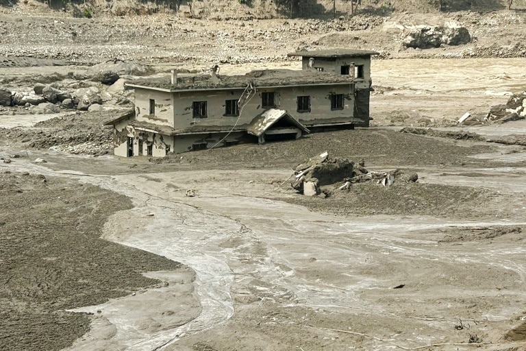
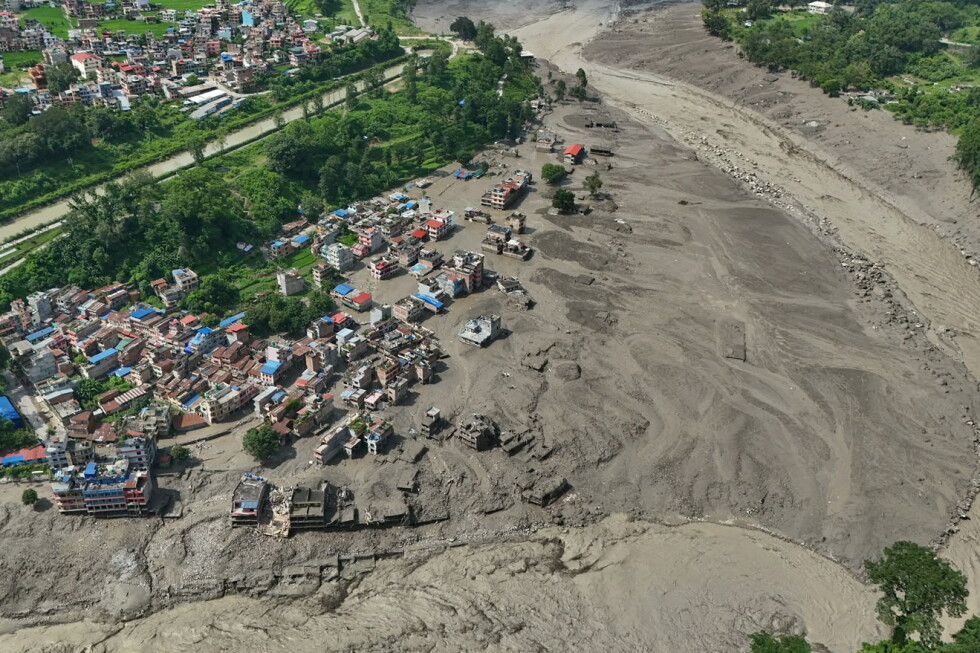
    Eyewitness accounts and visual evidence captured the devastating scale of the flood. Images released by Nepal Police show muddy floodwaters surging through river valleys, with only the top floors of submerged homes visible above the silt. Social media videos shared by law enforcement and local residents document torrents of brown water crashing through mountain valleys in Nuwakot, the Nepali district that forms the border with China’s Tibet Autonomous Region.

    “I witnessed the flood sweep away eight or nine trucks, along with houses and people,” 34-year-old local teacher Suman Chalise told AFP from Nuwakot. “It was absolutely heart-wrenching. I had not witnessed such devastation before.”

    As of Wednesday evening, Nepali police had recovered eight bodies, with search and rescue operations still ongoing across the affected zone. “So far, eight bodies have been found. Rescue operations are underway,” Nepal police spokesman Abi Narayan Kafle told AFP. Early in the response, authorities had already issued evacuation orders for communities located along the region’s riverbanks, as officials initially worked to assess the full extent of the damage.

    The Nepal Army has deployed helicopters and specialized disaster response teams to the hard-hit area to support search and recovery efforts. Critical energy infrastructure has also been heavily impacted: the Nepal Electricity Authority announced that approximately 430 megawatts of power generation capacity from hydropower and solar facilities was damaged by the flood. Floodwaters damaged generation stations, transmission lines and distribution networks, cutting electricity service to large parts of the affected region.

    Preliminary geoscientific assessments point to a natural geological trigger for the disaster originating on Nepali territory. Sarthak Shrestha, a remote sensing and geo-information analyst at the Kathmandu-based International Centre for Integrated Mountain Development (ICIMOD), said initial surveys found no unusual activity on the Chinese side of the border. “We believe a rock-ice avalanche occurred in Nepal, blocking the Lhende river and causing the cascading flood event,” Shrestha explained.

    On the Chinese side of the border, the disaster triggered a major mudslide at Gyirong Port, a key trade hub connecting Tibet and Nepal. Chinese state broadcaster CCTV reported Wednesday that the mudslide originating on the Nepali side caused major casualties and multiple missing people at the port. AFP has not yet been able to independently verify the footage released by CCTV, which shows floodwaters carrying debris and tree branches across a submerged road.

    Chinese President Xi Jinping has ordered full-scale rescue operations in the affected area of Tibet, according to Chinese state media. “The most urgent task is doing everything possible to search for and rescue the missing people… quickly treat injured people and minimise casualties to the greatest extent possible,” Xi stated, per CCTV. No official figures for deaths or injuries on the Chinese side have been released as of Wednesday. Local traffic authorities in Tibet’s Shigatse City have warned that roads in the area remain at high risk of additional mudslides and are unsafe for travel. This is not the first deadly disaster to strike the region: last July, 17 people went missing following a mudslide near Gyirong Port, according to official Chinese reports.

    The disaster comes amid annual monsoon season that spans from June to September across South Asia, a period that regularly brings deadly floods and landslides to the Himalayan region. Climate scientists have warned that human-caused climate change is increasing both the frequency and intensity of these extreme weather events across the Hindu Kush Himalaya region.

    Authorities are already warning of a second imminent flood threat. A blocked river channel remains upstream along the border river, and Qianggong Zhang, head of climate and environmental risks at ICIMOD, told AFP that a secondary flood event could occur in the coming days as response efforts continue.

  • ‘Serious warning’ for Aussie wildlife as suspected bird flu case detected in red fox in Adelaide

    ‘Serious warning’ for Aussie wildlife as suspected bird flu case detected in red fox in Adelaide

    Australia is facing a growing threat from the spread of highly pathogenic H5N1 bird flu across its wild animal populations, with a new suspected case in an urban red fox triggering urgent alerts from conservation experts over risks to vulnerable native species. The detection, discovered in Adelaide, marks the second suspected mammal infection recorded in South Australia, coming shortly after the state confirmed its first case of the virus in a seal. It is one of five new suspected cases reported across the state in the latest update, with four other samples collected from different bird species: an Australian raven in Robe, a little penguin in Southend, a Pacific gull on Kangaroo Island, and a crested tern at Coonalpyn. All collected samples are currently en route to Australia’s national animal health testing facility in Geelong for formal confirmation of the virus. While all suspected cases are closely monitored, the fox infection has sparked the most significant alarm among wildlife and conservation specialists, who warn that scavenging mammal species are now at direct risk of exposure.

    Rob Brewster, rewilding manager at the Invasive Species Council, emphasized that the detection in a fox serves as a critical wake-up call for Australia’s unique scavenger ecosystem. “Finding bird flu in a fox is a serious warning about what this virus could mean for Australia’s scavenging animals,” Brewster explained. He noted that native scavenger species including quolls and Tasmanian devils that feed on dead wild animals could soon face widespread exposure as bird flu-related bird deaths increase across the country. Unlike introduced predators, these native species already face significant population pressures, as mainland Australia retains only a small fraction of its original native scavenger populations. Brewster warned that invasive generalist predators like red foxes and feral cats are likely to emerge as “superspreaders” of the virus, as they move across large ranges, interact with multiple carcasses, and come into contact with native wildlife. He called on state and federal governments to step up control programs for these invasive species, noting that while it may not be possible to stop the virus from spreading through wild populations, targeted management can reduce additional pressures on vulnerable native wildlife.

    The latest warnings come as H5N1 bird flu continues its steady spread across the Australian continent, with infections recorded in both native and migratory bird populations. To date, national authorities have documented more than 300 separate infection events across the country, with South Australia accounting for the vast majority of confirmed cases at 195. In response to the growing crisis, the South Australian government announced this week that it is rolling out the first targeted vaccination program for at-risk native birds, with initial doses administered at Cleland Wildlife Park, located roughly 18 kilometers east of Adelaide. Under the program, around 100 captive native birds at the park – including magpie geese, Australian pelicans, and endangered red-tailed black cockatoos – will receive vaccinations against the virus. Clare Scriven, South Australia’s Minister for Primary Industries and Regional Development, said that protecting the state’s one-of-a-kind native wildlife is a top government priority, calling the vaccination program a critical step to shield vulnerable native bird species from the growing threat of H5 bird flu.

  • Drought-hit Danube gives way to fossil hunt in Bulgaria

    Drought-hit Danube gives way to fossil hunt in Bulgaria

    As record-breaking drought parches much of Europe, the shrinking waters of the Danube, the continent’s second-longest river, have exposed long-submerged lands along its banks – creating an unexpected opportunity for fossil hunters and historians to uncover artifacts hidden for thousands of years. In northern Bulgaria, just a short distance from where a massive mammoth skeleton was uncovered last month, around 20 volunteer enthusiasts gathered for a guided fossil-hunting expedition organized by the Ruse Regional History Museum, hunting for more prehistoric remains exposed by the retreating river.

    Among the participants was Aleksandar Denkov, a 30-year-old amateur photographer, who excitedly called out his discovery: a small yellowish fossil tooth protruding from the dry river sand. While the group did not locate additional full mammoth remains to match last month’s find, their day of searching yielded a range of significant discoveries. Museum experts identified the recovered artifacts as the remains of an ancient large mammal likely to be an aurochs or ancient European bison, a partially preserved subfossil horse jawbone, and a cluster of fossilized oysters dating back an estimated 60 to 65 million years.

    Climate scientists have repeatedly confirmed that the ongoing extreme drought gripping Europe has been intensified by human-caused climate change, bringing widespread disruption to communities across the continent. Low river levels have crippled commercial cargo shipping operations and forced output cuts at nuclear power plants that rely on river water for cooling. But alongside these serious negative impacts, the dropping water levels have unlocked a trove of historical and prehistoric remains that have remained hidden for decades, even millennia.

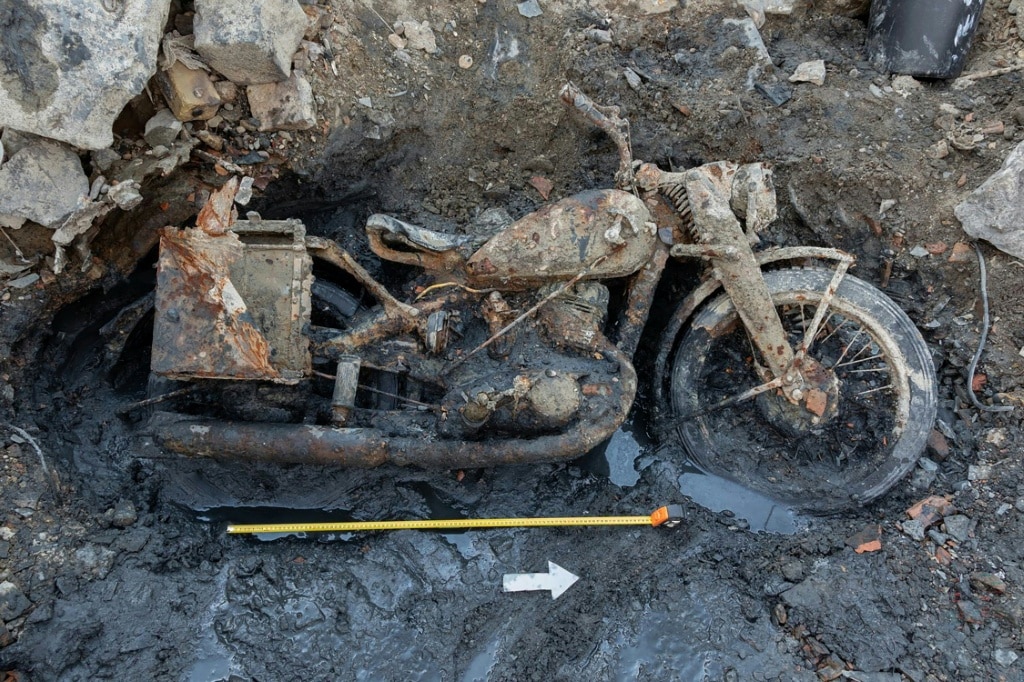
    Recent weeks have seen a steady stream of discoveries along the full length of the Danube. Beyond the Bulgarian fossil finds, receding waters have revealed World War II-era shipwrecks in Austria and Serbia, as well as the remains of two German World War II soldiers and a preserved military motorbike in the heart of Budapest, Hungary.

    Krasimir Kirov, a curator at the Ruse Regional History Museum, explained that the museum launched the guided expedition to introduce the public to fossil identification, share guidance for safe exploration, and foster public interest in local history. After the initial mammoth discovery was announced last month, Kirov says he received dozens of calls from local residents reporting potential finds of their own. That initial discovery was made by a local resident from the nearby village of Ryahovo, located roughly 30 kilometers from Ruse, who spotted a massive mammoth jawbone, tusk fragments, shoulder blade remains, and a femur by chance while walking the newly exposed banks.

    News of the guided search spread quickly on social media, drawing a flood of interested participants and already generating requests for a follow-up expedition. Before the search began, organizers shared simple ground rules: volunteers would move forward in a coordinated line, stop the entire group when a find was spotted by raising a hand, and strictly avoid touching any unknown metal objects that could be leftover unexploded ammunition. But enthusiasm quickly overtook discipline, and the organized line dissolved within minutes as participants scattered to explore the exposed banks on their own.

    For many participants, the expedition offered a once-in-a-lifetime chance to connect directly with ancient history. “It’s a very rare opportunity to feel this close to history,” explained Ekaterina Yordanova, a 34-year-old psychologist who joined the hunt. She acknowledged the concern over the Danube’s record-low levels: “Seeing the Danube in this state is worrying, but it also gives us the chance to discover new things that we would never have access to otherwise.” Vladimir Tsvyatkov, a 44-year-old local business owner who attended the expedition with his wife and two children, said the family came primarily “for the adventure.” Having grown up along the Danube’s banks, he noted he had “never seen the Danube so dried up” in his lifetime.

    The discoveries stretch far beyond the Bulgarian stretch of the river. Further upstream in Bulgaria, the low water levels have allowed archaeologists to fully document the foundations of a 2-kilometer Roman bridge first inaugurated under Emperor Constantine I in 328 AD, a structure that has remained largely submerged for centuries. Along other parts of the river, dozens of World War II military remnants have been exposed. In central Austria, two sunken German warships that were damaged during 1945 fighting with American tanks and scuttled by their own crews now jut clearly from the water. In Serbia, near the town of Prahovo, the receding river has exposed dozens of additional German warships scuttled in 1945 by retreating German forces to block the river and slow the advance of the Soviet Red Army. In Budapest, the German War Graves Commission has confirmed the discovery of two German soldiers’ remains and a preserved military motorbike.

    Data from the European climate observatory Copernicus confirms that these record-low water levels are unprecedented for the month of July across most of Europe’s major river basins, highlighting the severity of the ongoing climate-driven drought.

  • How do tornadoes form?

    How do tornadoes form?

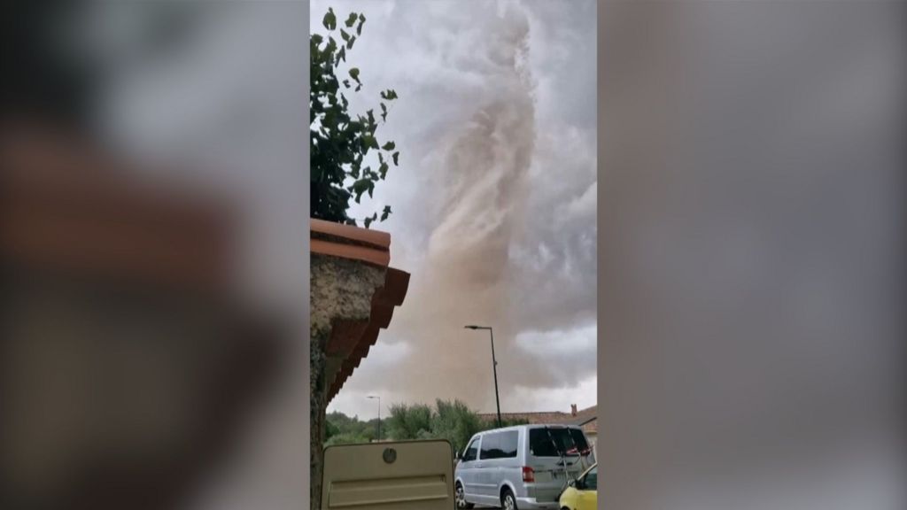
    On a destructive day for rural southwestern France, a powerful tornado cut a devastating path through the small village of Pomas, leaving a wake of injury and widespread property damage in its wake. As emergency response teams rushed to the affected area, early official reports confirmed that 39 people had been injured, with several listed in critical condition as of initial assessments, while local authorities continue to evaluate the full scope of harm.

    Hundreds of residential structures have been impacted by the storm, with many suffering severe structural damage that has left dozens of families displaced and in need of temporary shelter. Local fire departments, search and rescue teams, and municipal emergency services have been deployed to clear debris, repair damaged utility lines, and support residents who have lost their homes.

    To understand how such events occur, tornadoes form when specific atmospheric conditions align: a layer of warm, moist air near the ground becomes trapped beneath a layer of much cooler, drier air. When an initiating disturbance, such as a advancing cold front or wind shear that changes wind speed and direction with height, creates rotation in the lower atmosphere, this rotating column of air can tighten and intensify, eventually extending from the base of a thunderstorm down to the ground. The extreme low pressure and high wind speeds inside a tornado – which can exceed 300 kilometers per hour in the most powerful events – are what cause widespread damage to infrastructure and pose severe risks to human safety.

    While tornadoes are far less common in Western Europe than they are in regions like the Great Plains of the United States, climate researchers have noted that shifting atmospheric patterns linked to climate change have increased the frequency of extreme convective storm events across parts of Europe in recent decades. Local officials have urged residents to remain alert for further severe weather warnings, as residual storm systems continue to move through the region.

  • ‘Wartime situation’: tornado ravages French village

    ‘Wartime situation’: tornado ravages French village

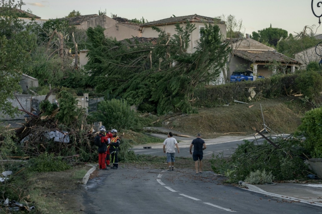
    On a late Monday afternoon in southern France’s Aude department, an unusually powerful tornado tore through local communities, leaving a trail of catastrophic destruction in its wake that local leaders have compared to a war zone. The small village of Pomas, home to roughly 1,000 residents, bore the brunt of the extreme weather event, with the storm collapsing building walls, tearing entire roofs off structures, and flattening centuries-old trees.

    As of initial emergency updates, 39 people have been confirmed injured, two of whom are in critical condition, and 17 injured residents have been admitted to local hospitals for ongoing care. In an interview with reporters Tuesday, Pomas mayor Herve Gine described the chaotic aftermath as an experience akin to living through active conflict. “We were bombed by nature,” Gine said, noting that many residents are reeling from shock after losing all their personal property in the storm. Key public infrastructure, including the village nursery school and town hall, have been completely destroyed, he added. Gine also emphasized that a complete loss of life was avoided by what he called a miracle, noting that the scale of destruction easily could have killed dozens of people.

    Walking tours of the village Tuesday revealed the full force of the tornado: narrow streets were choked with fallen debris, uprooted trees blocked access to many neighborhoods, broken roof tiles covered sidewalks, multiple cars were flipped onto their roofs, and nearly every residential building suffered broken windows or torn away shutters. Of Pomas’ 476 residential properties, approximately 300 sustained varying levels of damage, and Gine confirmed that large swathes of the village will require full reconstruction.

    French Interior Minister Laurent Nunez characterized the tornado as an event of “rare intensity” in a social media post Tuesday, while regional deputy prefect Marie-Helene Bouissac called it “an exceptional and highly traumatic event” for the local community. Power grid operator Enedis reported that by early Tuesday, 7,250 households across the broader Languedoc-Roussillon region remained without electricity, 1,600 of which are located in Aude department. An AFP reporter on the ground observed that crews had already covered exposed, roofless buildings with blue and green tarpaulins to shield remaining interiors from further damage under clear Tuesday skies. Nearby agricultural areas, including commercial vineyards, were scattered with debris carried by high winds, ranging from broken outdoor furniture to fragments of building insulation and shredded wire fencing.

    Emergency response teams worked through the night to clear debris, search for trapped victims and support displaced residents, assisted by canine search units and specialized reinforcement teams. As of Tuesday afternoon, search and safety inspections were still ongoing, with 75 firefighters deployed to the impacted area. Overnight, dozens of displaced residents were housed in a repurposed community hall that served as a temporary emergency shelter, while hundreds more stayed with friends or family in undamaged nearby towns. At police checkpoints controlling access to the damaged village, relatives of local residents gathered to drop off emergency supplies and wait for clearance to help loved ones salvage belongings.

    Local residents shared harrowing accounts of the storm’s impact. Jose Gomes, a resident of neighboring Trebes, told reporters that his friend’s home completely collapsed while the friend was inside, leaving him with a head injury and multiple broken ribs. The injured man was released from the hospital Tuesday morning, Gomes added. Abdallah Wakkas, a local grandfather of two teenagers aged 13 and 17, said that while his grandchildren’s home escaped major damage, the pair are still traumatized after seeing their grandmother’s home destroyed.

    France typically records several dozen tornadoes of varying intensity each year, according to national weather service Meteo-France. This summer, the country has already faced three back-to-back heatwaves, with a record 52 days of extreme high temperatures amplified by human-caused climate change. These extreme weather conditions have already triggered severe droughts, widespread wildfires, and a record number of dangerous rockfalls in the French Alps. While international climate scientists note that the explicit link between global warming and changing tornado frequency or intensity remains under ongoing research, the devastating impact of this rare extreme event has underscored growing risks of severe weather across Europe.

  • Trees ‘giving up’: climate change hammers historic English gardens

    Trees ‘giving up’: climate change hammers historic English gardens

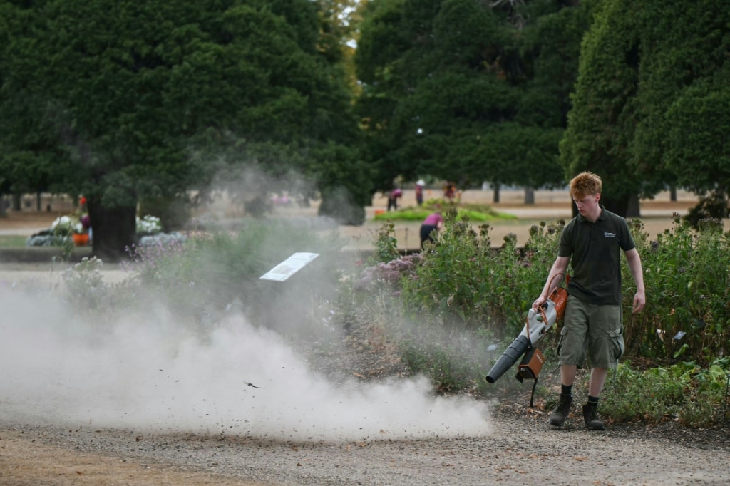
    Southwest of London, the 17th-century formal gardens of Hampton Court Palace stretch out under a late summer sky, but the lush green lawns that have welcomed visitors for centuries are now a parched, straw-colored beige — a stark visual marker of how climate change is reshaping one of the United Kingdom’s most cherished cultural landscapes. For Graham Dillamore, Hampton Court’s head gardener who has spent more than two decades tending the grounds of Henry VIII’s former royal residence, this summer’s record-breaking heat and prolonged drought have brought unprecedented uncertainty to the future of these historic spaces.

    Designed by some of the most influential landscape architects in British history — including Lancelot “Capability” Brown and William Kent — the sprawling gardens of stately homes like Hampton Court, Blenheim Palace, Chatsworth House, and Chiswick House rank among England’s most popular tourist attractions, drawing millions of visitors annually to experience their iconic blend of curated design and centuries-old natural growth. Today, however, their historic planting schemes and ancient mature trees are facing unprecedented stress from shifting weather patterns amplified by human-caused climate change.

    Gardeners who tend these spaces are not overly concerned about the temporary sight of browned lawns; most agree that visitors, who are also navigating domestic water restrictions, understand the broader context. It is the long-term survival of irreplaceable, decades-old tree stock that keeps them up at night. By mid-August this year, many mature trees already showed severe stress signals: leaves turning brown, branches drooping, and whole ecosystems pushed past their tolerance for heat and dryness.

    “Some of these trees have actually given up. They’re not going to come back, they’re finished,” Dillamore, who also oversees the gardens at Kensington Palace, told AFP. “We’re losing mature tree stock and that’s tragic in a historic garden.”

    Rosie Fyles, head of gardens at west London’s Chiswick House, where William Kent designed the iconic tree-dotted lawns and cedar groves in the 18th century, echoed that concern. Her team manages 1,800 trees, and the species most iconic to the classic English garden landscape — oaks, sycamores, birches, and limes — are suffering the worst damage. “I think there’s only so much stress they can withstand,” she said.

    Watering large, mature trees is simply not logistically feasible, gardeners across all sites explain. Even for smaller shrubs that teams can target for irrigation, the lack of water has reached a crisis point. Chiswick House expanded its rainwater harvesting capacity in recent years, but its entire reserve was depleted months ago. “There’s only so much we can intervene and control,” Fyles said, adding that the loss of control over a landscape she has spent years caring for is a humbling, difficult reality to accept. “It’s sobering. It means that we’re having to think about what we plant going forward, what trees will be sustainable going forward in the future climate.”

    For Dillamore, the current crisis feels like uncharted territory. “I’ve never felt so uncertain about the future in historic gardens and landscapes as I do now,” he said.

    A recent survey of historic garden staff conducted by the National Lottery Heritage Fund found every single respondent reported measurable impacts from climate change — not just summer drought, but also increasingly severe winter storms and excessive rainfall that fosters fungal growth and pest infestations. Drew Bennellick, head of lands, seas and nature policy at the Heritage Fund, says historic gardens are on the absolute front lines of climate change, with shifts happening far faster than many conservationists predicted. “We’ve seen sites that lost 80 percent of their tree cover,” he told reporters.

    Modelling from researchers at the Royal Botanic Gardens, Kew — a UNESCO World Heritage Site — paints an even bleaker long-term picture: by 2090, half of Kew’s existing tree population could be at risk of death.

    Conservation leaders and garden managers agree that these iconic landscapes must be protected to preserve their cultural and historical value, but they also acknowledge that radical adaptation is unavoidable if they are to survive. “But they’ve also got to change over the next few years — otherwise we’re going to lose them,” Dillamore said, acknowledging that this shift will require “some very, very difficult decisions.”

    Already, many sites are testing adaptive changes to planting and management. Some are shifting to drought-tolerant Mediterranean plant species, and increasing the proportion of tough grasses and herbaceous perennials that can survive extended dry periods. At Hampton Court, Dillamore has already launched test beds of heat-resistant perennial plants created by garden designer Ann-Marie Powell. Planted this past April without automatic irrigation, species like the southern U.S.-native Siskiyou Pink and prairie-grown echinaceas have remained vibrant through the record heat, exceeding Dillamore’s expectations.

    Many gardens have also adjusted their maintenance practices: Hampton Court and Chiswick have stopped annual digging of flowerbeds and adopted a more lenient approach to weeds, both of which help retain soil moisture and reduce stress to existing plants. Even the Royal Horticultural Society, the UK’s leading gardening charity, announced this month it is considering relocating its heat-stressed hydrangea collection from Surrey to cooler regions of northern England.

    For Dillamore, adaptation does not mean erasing the historical identity of these iconic landscapes. “The gardens tell the story of Hampton Court just as much as the palace, so I can’t pack this garden up and move it,” he said. “We’ve got to retain that feel, the spirit of the place” — while making the hard changes needed to keep that spirit alive for future generations.

  • Indonesians brave choking smoke to pray for rain as country battles wildfires

    Indonesians brave choking smoke to pray for rain as country battles wildfires

    As raging wildfires continue to devour vast swathes of forest and peatland across Indonesia’s South Sumatra, the province with the nation’s highest concentration of active hot spots, local authorities have paired conventional firefighting efforts with an extraordinary spiritual intervention: a mass public prayer for rain to end the catastrophic dry spell fueling the blazes.

    The crisis has been amplified by a prolonged dry season supercharged by the developing El Niño climate pattern, which has created tinder-dry conditions across much of Indonesia’s Sumatra and Kalimantan islands. Latest satellite data released by Indonesia’s Environment Ministry confirms South Sumatra leads all provinces with 1,429 detected hot spots, followed by West Kalimantan at 1,226 and Central Kalimantan at 811. Data from the Forestry Ministry adds that nearly 940 square kilometers of land were destroyed by fire in July alone, with more than 20 square kilometers burned within South Sumatra’s borders.

    On Tuesday, roughly 3,000 residents gathered in the courtyard of the governor’s office in Palembang, South Sumatra’s capital, to hold *salat istisqa*—a special Islamic ritual for requesting rain. Standing shoulder to shoulder through the thick, acrid haze that already shrouded the city, participants prayed as smoke cut visibility to dangerous levels, forcing motorists to keep their headlights switched on through daylight hours.

    South Sumatra Governor Herman Deru addressed the crowd ahead of the prayer, noting that every feasible conventional response has already been deployed across the province. “We have done everything we can and worked closely with all relevant parties,” Deru said. “As people of faith, we are also praying to God to send rain so that life can return to normal.” He emphasized that the collective prayer is not a replacement for active firefighting and drought mitigation, but rather a complementary measure that unites communities in facing the shared environmental crisis.

    Indonesia’s national disaster management agency confirmed that emergency crews have been working around the clock to contain the fires, which have generated toxic haze thick enough to drift across national borders into neighboring Malaysia and Brunei. To boost response efforts, the country has ramped up large-scale weather modification operations, deploying more than 50 aircraft across Sumatra and Kalimantan for cloud-seeding—an initiative that disperses salt particles into rain-ready clouds to trigger precipitation—and targeted water-bombing missions on active fire lines.

    Alongside firefighting and weather interventions, Indonesian law enforcement has taken action against the human factor driving much of the annual dry season fire crisis. Authorities have arrested 72 people suspected of deliberately starting fires to clear land, and four agribusiness companies are currently under investigation for allegedly using illegal, low-cost slash-and-burn clearing tactics. This practice is common among both small-scale traditional farmers and large plantation operators, who set fires to clear vegetation cheaply ahead of planting season.

    Recurring annual dry season fires are a long-standing environmental and public health challenge for Indonesia, a majority-Muslim nation that is home to some of the world’s most biodiverse tropical peatlands and rainforests. Beyond domestic disruption that cuts visibility, halts air and land transport, and worsens chronic respiratory conditions, the transboundary haze from Indonesian wildfires has repeatedly sparked diplomatic protests from neighboring Southeast Asian nations in past years.