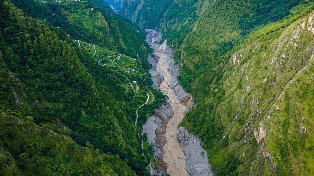
The catastrophic flood disaster that has struck southern Nepal near the Tibet border has already claimed more than 1,000 lives, sending a urgent transboundary warning that stretches far beyond Nepal’s national boundaries. As hydrological and climate experts emphasize, Nepal and India share an interconnected network of Himalayan river systems, and the link between upstream flooding in Nepal and downstream disaster in India is far more complex than the simple narrative of water flowing south across the border.
Nepal is home to more than 6,000 rivers and streams, the vast majority of which drain southward into India’s Ganges river basin. Four major transboundary systems dominate the region: the Kosi in eastern Nepal, the Gandaki (known as Gandak in India) in central Nepal, the Karnali (called Ghaghara in India) in western Nepal, and the Mahakali (Sharda) that runs along the two countries’ western border. Dozens of smaller rivers, including the Bagmati, Kamala, Rapti, and Babai that originate in Nepal’s Siwalik and Chure hill ranges, are far less well known but pose outsized risk: their small, steep catchment areas produce far faster, more unpredictable flash floods that can catch communities off guard.
Manish Shrestha, a hydrologist at the International Centre for Integrated Mountain Development (ICIMOD), confirms that between 7 to 9 major river systems flow from Nepal into India’s northern plains, and these systems are the primary source of flood hazards across northern India. India’s Central Water Commission formally lists the Kosi, Gandak, Bagmati, and Ghaghara as the highest-risk transboundary watercourses.
Among Indian states, Bihar is by far the most vulnerable to cross-border floods, with approximately 75% of northern Bihar officially designated as flood-prone territory. Nearly every major river that floods the state originates in Nepal, with the Kosi—long infamously known as the “sorrow of Bihar”—toping the list of high-risk systems, followed by the Gandak, Bagmati, and Kamala. But the hazard extends far beyond Bihar’s borders: eastern Uttar Pradesh is regularly impacted by flooding from the Ghaghara, Rapti, and Gandak rivers, with districts including Gorakhpur, Bahraich, Lakhimpur Kheri, and Shravasti facing repeated disaster. Uttarakhand shares the Mahakali-Sharda river system with Nepal, while North Bengal receives floodwaters from the Mechi and Mahananda. Pradeep Man Dangol, another ICIMOD hydrologist, notes that while Bihar bears the largest scale of flood risk, Uttar Pradesh is the second most affected and its vulnerability is chronically underreported.
Hydrologists break down transboundary flood risk into a clear three-stage chain of causality. First, the rainfall: flood peaks that reach Indian territory are most often generated not in the high Himalayas, but in the lower elevation Siwalik, Chure, and Terai regions, where intense monsoon downpours fall on steep, small catchments that can channel massive volumes of water downstream very quickly. Second, the river itself: after rushing out of the mountains, Nepal’s rivers hit a sharp break in slope at the mountain front, drop their heavy sediment load, and spread across the plains as wide, braided, constantly shifting channels. Third, when the water crosses into India, the final severity of the disaster depends entirely on local conditions: how much rain has fallen on the Indian side, the existing water level of the Ganges, the condition of embankments and barrages, and how much natural drainage has been blocked by roads, railways, and expanding settlements on the floodplain.
To put this simply: while the volume of flood flow arriving at the Indo-Nepal border is determined primarily by rainfall in Nepal, the ultimate severity of flooding depends at least as much on local conditions in India. The 2008 Kosi disaster offers a clear illustration of this dynamic. When the Kosi breached an embankment in Nepal and flooded large swathes of Bihar, killing nearly 400 people, the event was not caused by an unprecedented high-flow event. According to Rajiv Sinha, a professor of earth sciences at the Indian Institute of Technology (IIT) Kanpur, the actual river flow during the 2008 event was only around one-tenth of the channel’s designed carrying capacity. The catastrophe was triggered by a breach in decades-old embankments that had never been properly maintained. “The embankments constructed in the 1950s and 1960s had not been properly maintained. They had become eroded and eventually developed a weak point. The river breached its embankment through these vulnerable points and entered parts of India that had not seen flooding for perhaps 100 years,” Sinha explained. Saswata Sanyal, ICIMOD’s intervention manager for disaster risk reduction, summarizes this failure: “The failure was structural, not hydrological.”
For routine monsoon floods, India typically receives between 12 hours and two days of advance warning before floodwaters arrive, depending on how quickly water travels downstream. It takes roughly one full day for floodwaters to travel from the Nepal mountain front to the Bihar plains along the Kosi and Gandak, and slightly longer for the Ghaghara. Flash floods from the steep Chure hill rivers can arrive in just a few hours, and surges from landslide dam bursts or debris flows move even faster: during the 2026 Nepal floods, the peak flood surge from Rasuwa reached the Indian border near Triveni in just seven and a half hours.
Currently, India and Nepal do share real-time rainfall and river level data through a network of monitoring stations, with Nepal’s Department of Hydrology and Meteorology sharing data with India’s Central Water Commission to support flood forecasting. But experts warn that critical gaps remain in the existing cooperation framework. There are far too few real-time monitoring stations in the fast-flowing Chure catchments that produce the most dangerous flash floods. The two countries also do not have a single shared cross-border flood forecasting model, and there is limited routine information sharing on embankment conditions, shifting river channels, and sediment buildup. Even when forecasts are successful, gaps remain in the “last mile” of warning delivery: a notification reaching a district government office does not guarantee that at-risk families in rural floodplains receive the warning in time to evacuate.
Scientists are also eager to correct a common public misconception: the idea that Nepal intentionally “releases” floodwater into India. Nepal has almost no large-scale reservoirs capable of storing and releasing large volumes of water; the country’s largest storage dam, the Kulekhani, holds less than one-tenth of a cubic kilometre of water, far too little to create a large-scale flood. “So there’s nothing to release,” Sanyal says. In fact, the Kosi and Gandak barrages that regulate flow along the border are operated by India, not Nepal. When floodwater crosses the border, it is almost entirely the result of heavy rainfall upstream, not deliberate gate openings by Nepal.
That said, the basic fact remains: the majority of floodwater that hits northern Bihar and eastern Uttar Pradesh originates as rain in Nepal, so Nepal’s rainfall patterns set the timing and size of flood peaks that reach India. Overall, Nepal supplies roughly 40% of the Ganges’ average annual flow, and a far larger share during the dry season, making Nepal’s hydrology critical to India’s water security and flood risk. But experts emphasize that blaming Nepal for downstream floods is overly simplistic. “Rain is not a decision,” Sanyal points out. Whether a given flow becomes a disaster depends on conditions in India as much as Nepal: the Ganges’ baseline water level, local rainfall, embankment integrity, drainage infrastructure, and sediment buildup.
Crucially, the impacts of water management on one side of the border also affect the other: infrastructure like embankments and barrages built for flood protection in India have raised upstream water levels and caused backwater flooding in Nepal’s Terai region, a longstanding concern for Nepali authorities. Since Nepal and India share a single integrated river system, with one country positioned upstream and the other downstream, the solution to growing flood risk is not blame, but expanded cross-border cooperation on data sharing, joint forecasting, and integrated river basin management.
Experts note that the 2026 Nepal flood disaster carries a broader warning beyond transboundary management: it highlights the growing risk of extreme, debris-laden catastrophic flood events driven by climate change across the entire Himalayan region. Sinha points out that the 2026 Nepal disaster follows a pattern of similar catastrophic events that have struck India in recent years, including the 2021 Chamoli disaster and the 2025 Dharali disaster in Uttarakhand, and the 2026 Nepal event was between five to 10 times larger than those earlier disasters.
“The fundamental point is that these are not normal hydrological floods,” Sinha explains. Conventional floods are composed almost entirely of water, but these new extreme events mix intense rainfall, melting glacial ice, or sudden glacial lake discharge with massive volumes of rock and sediment, creating a thick, high-energy debris slurry that can destroy almost every structure in its path. This was exactly what happened during the 2021 Chamoli disaster, when a large section of a Himalayan glacier collapsed, sending a debris and water cascade downstream that killed more than 200 people and destroyed major hydropower infrastructure. The same dynamic was seen in the 2025 Dharali disaster, where heavy rain triggered a flash flood that buried large parts of a village under meters of rock and sediment.
Climate change is amplifying these risks across the board. Experts confirm that extreme rainfall events are intensifying across the Himalayan region, which is warming faster than the global average. A warmer atmosphere holds more moisture, leading the monsoon to deliver more total rain in fewer, more intense downpours. High mountain hazards are also growing: as permafrost degrades, glacial lake outburst events and rock-ice avalanches are projected to become more common, creating faster, debris-heavy floods that are far harder to forecast. More extreme events also trigger more landslides, adding larger volumes of sediment to rivers, which raises riverbeds and reduces channel capacity on both sides of the border. All these hazards are part of a single interconnected Himalayan risk system, and India’s exposure to these events is very significant.