分类: environment

  • Australia usually hosts the world’s biggest cuttlefish mating event – not this year

    Australia usually hosts the world’s biggest cuttlefish mating event – not this year

    Each winter, a narrow stretch of South Australia’s iconic Cuttlefish Coast becomes the global stage for the world’s largest aggregation of breeding Australian giant cuttlefish, a one-of-a-kind marine species found nowhere else on Earth. In abundant years, hundreds of thousands of these color-changing, shape-shifting cephalopods gather in the area’s shallow coastal waters to mate, drawing thousands of enthusiastic recreational and scientific divers eager to witness the spectacular natural event. This year, however, that yearly gathering has hit an unprecedented historical low, triggering urgent warnings of a potential catastrophic collapse of the local population.

    Official population data published this month puts the total number of breeding cuttlefish at just 1,811, marking a staggering 97% drop from the 63,000 counted during last year’s mating season. State environmental officials point to a persistent toxic algal bloom that has ravaged South Australia’s coastline for more than 18 months as the most likely driver of this sharp decline. The plummeting numbers have also reignited calls for the species to be formally listed as endangered under Australian conservation legislation.

    Unlike many marine species, adult giant cuttlefish have an extremely short lifespan of just 12 to 18 months, and die immediately after breeding. This means every annual mating season is make-or-break for the next generation of the population. This year, survey teams only counted 440 cuttlefish eggs across the entire breeding grounds, a stark contrast to the millions of eggs that are typically laid during a healthy season.

    Manny Katz, a 28-year-old diver commissioned by South Australia’s Department of Environment and Water (DEW) to conduct the underwater egg survey, explained the urgency of the work. “Because there have been so few cuttlefish, DEW thought it would be worth going out and trying to do an assessment of how many eggs there currently are around the coastline to understand what the population is going to be next year,” he said. Over two days in July, Katz and three other divers completed eight hour-long dives, combing the undersides of rocky reefs across 8 kilometers of coastline to count every egg. “Along the eight kilometers of coastline, there would normally be millions of eggs, because each female can lay dozens of eggs and tens of thousands usually turn up to breed,” Katz noted. “We pretty much looked under every single rock that we could have and we only found about 440 eggs.”

    With the species’ one-year lifespan, the outcome of this breeding season will directly determine the size of next year’s population, leaving the future of the aggregation uncertain. “Under our current circumstances, with there being so few eggs along the coastline, we don’t know if the population is ever going to be able to recover,” Katz said. While it will take 12 to 24 months to confirm the long-term impact of this year’s low numbers, Katz said the result aligns with expectations, given the ongoing damage from the toxic algal bloom first detected in South Australian waters in March 2024.

    During his survey, Katz also observed unusual behavior in the small number of adult cuttlefish his team encountered. Where tens of thousands would normally be visible, the team spotted only around a dozen individuals, all of which were far more skittish than usual, spending most of their time hiding under rocks. “Because there’s so few cuttlefish hanging out at the moment, they don’t have strength in numbers,” he explained.

    While toxic algal blooms are a naturally occurring phenomenon, the current prolonged event is driven by a combination of ocean warming, marine heatwaves, and nutrient runoff, all of which are being amplified by human-caused climate change. For conservation advocates, the plummeting cuttlefish numbers are a warning sign of broader systemic damage to Australia’s coastal marine ecosystems. “Our marine habitats have been getting wiped out for the past year and a half now… this is an indicator that our marine ecosystems are in real big trouble – the canary in the coal mine, so to speak,” Katz said.

    Last year’s breeding season was largely unaffected, as the algal bloom had not yet reached Cuttlefish Coast by winter 2024, but low concentrations of the toxic algae have been recorded in the area since late last year. Cuttlefish, along with other cephalopods including octopus and squid, are uniquely sensitive to the toxins produced by the bloom, making the spread especially concerning for the species.

    Stefan Andrews, co-founder of the Great Southern Reef Foundation, has formally called for the Australian giant cuttlefish to be listed as a threatened species in response to what his organization describes as a catastrophic decline. Andrews acknowledges that while the algal bloom is the most plausible explanation for the collapse, current data does not yet confirm it is the sole cause. Even so, he warned that the lack of breeding activity this year will almost certainly lead to a very small cohort of young cuttlefish entering the population next year. “That will make the next breeding season especially challenging,” he said.

    In response to the findings, a spokesperson for South Australia’s Department of Primary Industries and Regions noted that giant cuttlefish populations have naturally fluctuated significantly in response to changing environmental conditions in the past. Previous surveys have recorded population lows of 13,500 in 2013, and highs of 247,000 just seven years later in 2020. “The cuttlefish population estimate rebounded to more than 100,000 just two years following the low numbers in 2013,” the spokesperson said. “While it appears likely the algal bloom has impacted cuttlefish numbers, researchers are working to determine whether this contributed to the reduced population or was just one of the potential impacts.”

    Professor Mike Steer, executive director of the South Australian Research and Development Institute, which assisted with the 2025 underwater surveys, called the unprecedented low count “disheartening.” But he echoed the government’s cautious optimism, pointing to the species’ history of rapid recovery when environmental conditions improve. “We know from the past that this population has the capacity to recover when conditions are favourable,” Steer said, adding that there are early positive signs: adult cuttlefish are still successfully laying eggs, meaning the population could rebound over the next several years if conditions improve.
  • Scientists investigate if a herpes virus is behind the mass deaths of sardines off South Africa

    Scientists investigate if a herpes virus is behind the mass deaths of sardines off South Africa

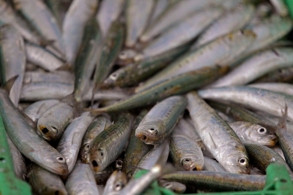
    JOHANNESBURG — A mysterious and widespread mass mortality event involving thousands of sardines washing onto South Africa’s western and southern shorelines has left fisheries and environmental experts working to pinpoint the exact cause, with a newly identified fish herpes virus emerging as the primary suspect. This month’s unprecedented die-off has so far puzzled officials from South Africa’s Department of Forestry, Fisheries and the Environment, though researchers have already confirmed one groundbreaking finding: this marks the first recorded detection of pilchard herpesvirus (PHV) in sardine populations off the South African coast.

    According to department statements, PHV is not a new pathogen to global marine science: the virus was connected to two separate large-scale sardine mortality events in Australian waters during the 1990s. When PHV infects sardines — which are the juvenile, smaller variant of pilchard, the same fish species — it triggers inflammation and thickening of the gill tissue. This physiological damage severely disrupts the fish’s ability to absorb oxygen from water, ultimately leading to suffocation and death.

    Crucially, environmental officials have moved quickly to reassure the public that PHV poses no documented threat to human health. The detection of the virus in wild sardine populations does not render commercially caught fresh sardines or processed canned sardine products unsafe for human consumption, the department emphasized.

    To unravel the full context of the die-off, research teams from the South African Institute for Aquatic Biodiversity and a local partner university have been conducting detailed analysis on dozens of samples collected from affected coastal areas, including both deceased and still-living sardines. Early test results have already revealed a clear pattern: dead sardines recovered from mortality event sites consistently showed very high viral loads of PHV, while surviving fish tested had widely varying levels of the virus.

    Beyond PHV, researchers have explored a range of other potential contributing factors, including toxic harmful algal blooms, unusually cold offshore water temperatures, and widespread low-oxygen conditions in nearshore waters. Even with these alternative lines of inquiry, the department noted that accumulating evidence increasingly points to PHV as the leading explanation for the mass die-off.

    Still, some independent marine biologists not involved in the official investigation caution that the viral detection may not explain the entire event. Dalene Vosloo, a lecturer in biological sciences at South Africa’s University of KwaZulu-Natal, noted that it remains highly plausible that multiple overlapping stressors combined to cause the large-scale mortality. She explained that shifts in water quality or unexpected temperature fluctuations can weaken fish immune systems, leaving them far more susceptible to fatal viral infection.

    As the scientific investigation proceeds, the sardine die-off has already created unforeseen secondary disruptions to critical national infrastructure. Eskom, South Africa’s national power utility, confirmed that the Koeberg Nuclear Power Station — located north of Cape Town on the country’s west coast and the only operational nuclear power facility on the African continent — was forced to cut power output by 50% at one of its two generation units. The shutdown occurred after large volumes of dead sardines clogged the plant’s seawater intake pipeline, which draws cooling water for the reactor systems.

  • Europe’s summer drought threatens fish in rivers, lakes and farms

    Europe’s summer drought threatens fish in rivers, lakes and farms

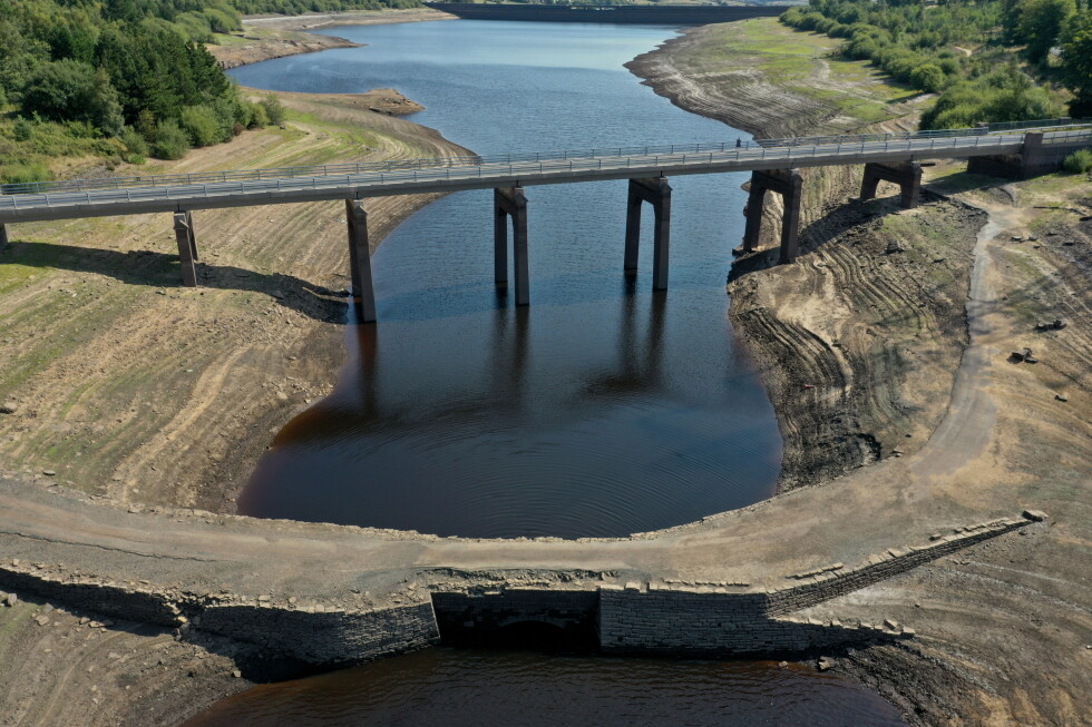
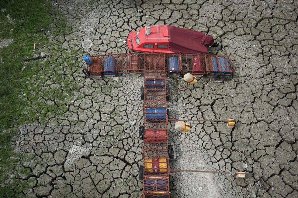
    Across Central and Southeastern Europe, this summer’s record-breaking persistent drought and searing heat have triggered an ecological and economic crisis that has hit the region’s aquaculture and fishing sectors harder than most other industries. From the shrinking tributaries of the Danube in northern Serbia to fish farms spanning Hungary, Romania, Bosnia, the Czech Republic and Slovenia, water levels have plummeted to historic lows, leaving aquatic life teetering on the edge of mass mortality.

    In Novi Sad, Serbia, the once-navigable side channel of the Danube now lies cracked and dry, with only two small, shrinking ponds holding the remaining fish. Fisherman Dusan Jovanovic, pointing to juvenile fish circling in the shallow, 30-degree-Celsius (86-degree-Fahrenheit) water, warned that a mass die-off could happen suddenly if conditions do not improve. “If they start to die, they will all die at once,” Jovanovic said.

    The crisis extends far beyond Serbia’s riverbanks. Hungary’s national meteorological service reports that nearly 99% of the country’s territory is currently grappling with severe or extreme drought, pushing large swathes of the Great Hungarian Plain toward accelerating desertification. Of Hungary’s roughly 27,000 hectares (67,000 acres of commercial fish ponds, more than 1,588 hectares (3,924 acres) have completely dried out. The national Agriculture and Food Economy Ministry confirmed that nearly 280 metric tons of fish have already died across 20 affected farms, causing an estimated $4.2 million (1.3 billion forints) in direct revenue losses. Industry representatives note that restocking to replace lost fish could take multiple years, and in some cases, operators have been forced to drain smaller ponds to divert water to larger stocks in a last-ditch effort to save what they can.

    For Romanian fish farmers, the 2025 crisis compounds the cumulative damage of consecutive severe droughts in 2023 and 2024. Catalin Platon, president of the ROMFISH National Association of Fish Producers, explained that the three-to-four-year production cycle for carp, the country’s most commonly farmed fish, means losses from past droughts continue to ripple through the industry year after year. “So what we lost in 2023 has had an impact every year since,” Platon said. He also criticized water allocation policies that prioritized agricultural irrigation during previous dry spells, leaving aquaculture producers with no viable water reserves to draw from.

    Czech fish farmers have rolled out a suite of emergency measures to slow losses: they have reduced or halted fish feeding to cut oxygen demand, deployed aeration systems to oxygenate shrinking ponds, and drained vulnerable marginal ponds early to harvest what stock they can. Jan Sokolik, a technician at the Rybarstvi Trebon fishery, noted that producers are now bracing for impacts to the region’s large, core production ponds. “Now we’re just starting to plan what to do with the big ponds,” Sokolik said. Czech fishing industry officials stress that while sustained rainfall would ease the immediate emergency, long-term structural changes to retain more water in the landscape are required to adapt to repeated extreme weather.

    In mountainous Bosnia, where cold-water trout farming is a key commercial and culinary staple, producers are fighting just to stay operational. “Trout is a cold water fish, which requires cold water with a lot of oxygen,” said Veljko Budjen, who owns a trout farm near Trebinje in southeast Bosnia. “So during the summer you are forced to reduce trout production and feeding so the business can just barely survive.” Many producers are forced to invest in costly liquid oxygen additives to keep water oxygen levels high, while others have no option but to wait for rain to cool and replenish their water supplies.

    In eastern Slovenia, emergency crews have been working around the clock to save a popular recreational fishing lake, Lake Pristava, from a total mass fish die-off. Low water and rising temperatures have fueled explosive overgrowth of water chestnut, which covers the lake surface and depletes oxygen levels critical for fish survival. Firefighters have already pumped 8 million liters (2 million gallons) of additional water into the lake, but local fishing association official Danijel Fras told public broadcaster RTV Slovenia that even that massive intervention may not be enough. “We are surprised that any fish has survived at all,” Fras said.

    Back in Serbia, fishermen say the only viable solution to save the remaining fish in the Novi Sad Danube side channel is to relocate them to deeper, cooler water bodies. Jovanovic noted that this summer’s temperatures are unprecedented. “No one can remember anything like this,” he said.

    Across the region, total damage to the fishing industry already runs into millions of euros, adding to broader economic losses from disrupted river transport, decimated crop yields, and strained energy and drinking water supplies. The crisis has exposed widespread lack of preparedness for recurring extreme weather events, which climate scientists have repeatedly linked to human-caused climate change. Governments and industry stakeholders are now scrambling to develop long-term adaptation strategies to reduce the impact of future drought and heat events on regional ecosystems and livelihoods.

  • United Nations talks in Mongolia expose growing drought crisis as climate impacts worsen

    United Nations talks in Mongolia expose growing drought crisis as climate impacts worsen

    ULAANBAATAR, Mongolia — After 12 days of intensive negotiations, delegates from nearly 200 nations concluded the United Nations Convention to Combat Desertification (UNCCD) biennial summit Friday, leaving the Mongolian capital with landmark funding commitments for land restoration but without resolving a years-long deadlock over a proposed global legally binding drought pact.
    The summit convened amid growing alarm over accelerating land degradation across the globe: UNCCD data confirms 40 percent of the world’s total land area is already degraded, a crisis that erodes soil fertility, disrupts water storage, and threatens the livelihoods of billions of people. Yasmine Fouad, executive secretary of the UNCCD, told reporters that drought, amplified by rising global temperatures, is spreading to regions once considered low-risk for dry conditions, growing more frequent, intense and prolonged than at any point in recorded history.
    Experts at the conference emphasized a underrecognized link between land health and drought resilience: unlike the common framing of drought as purely a product of insufficient rainfall, modern research shows pre-existing land degradation drastically worsens dry period impacts. Healthy, well-managed soil acts as a natural water reservoir, absorbing and retaining moisture to sustain crops, grasslands and ecosystems through extended dry spells. Degraded soils, by contrast, shed water rapidly, lose agricultural productivity, and leave communities far more vulnerable to erratic rainfall and rising temperatures. This interconnectedness means water management cannot be separated from land health, Fouad noted, arguing that sustainable water systems depend entirely on healthy, productive soils.
    This interconnectedness is particularly critical for global food security, said Joao Campari, global leader for food and agriculture at WWF International. Treating land and water as separate policy issues ignores the basic requirements for stable food production, Campari explained: without access to both healthy land and reliable water, agricultural systems cannot function. The pressure on global land resources is set to intensify dramatically in coming decades: UN projections show the world will need to produce 50 percent more food by 2050 than it did in 2012 to feed a growing population. But expanding agricultural production by clearing natural grasslands and savannas only worsens land degradation, releases stored carbon from soils into the atmosphere, and reduces landscapes’ ability to store water. Land degradation also amplifies the frequency and severity of sand and dust storms, Fouad added: while these storms travel across continents through the air, their origins lie in unsustainable land management that leaves topsoil exposed. Restoring native vegetation and improving land management practices keeps soil anchored and reduces the intensity of these events.
    Despite the deadlock on the drought agreement, the summit delivered tangible progress on funding for land restoration efforts. Delegates launched a new global rangelands initiative backed by $1.2 billion across 45 targeted projects, and the Asian Development Bank announced an additional $2 billion to combat land degradation across the Asia-Pacific region. Rangelands—which include grasslands, savannas, and other grazing lands that support pastoral communities—cover 54 percent of the Earth’s total land surface and sustain roughly 2 billion people globally. Campari warned that these ecosystems are being converted to other land uses at four times the rate of the world’s forests, and hold twice as much carbon in their soils as is currently present in the atmosphere. Clearing these lands for agricultural expansion releases massive volumes of greenhouse gases even when few trees are cut, he added, making their protection critical to both climate and food security goals.
    Even with new pledges, global land restoration efforts face a massive annual funding gap. UN estimates show $355 billion in annual investment is required through 2030 to meet existing global land restoration commitments, but current annual investment totals only $77 billion, leaving a $278 billion shortfall. Private capital contributes just 6 percent of current global investment in land restoration, and most existing national drought plans lack the funding needed to turn early warning systems, sustainable water management and adaptive agriculture into on-the-ground action. While 70 countries now maintain national drought plans, up from just three in 2013, most remain unimplemented due to lack of resources. To address this gap, summit participants announced a new Drought Resilience Investment Facility, designed to mobilize up to $400 million in combined public and private capital for projects focused on water security, sustainable agriculture, nature-based solutions and land restoration.
    Negotiators left Ulaanbaatar agreeing to defer a decision on the proposed legally binding global drought agreement until the next UNCCD summit, scheduled to take place in Egypt in two years—a delay that marks the second consecutive deferral of the decision. But many stakeholders rejected calls to wait for a formal global agreement to act. “We cannot wait for COP18 for solutions,” said Esther Penunia, secretary general of the Asian Farmers Association. “We know we have solutions and we can do them as long as we have the necessary resources.”
    Fouad echoed that call, urging governments to shift from planning to investment, and to create inclusive national platforms that bring private companies, local communities, women and young people into the process of developing projects and attracting financing to address land degradation and drought resilience.
    This reporting is part of AP’s ongoing global climate and environment coverage, which receives philanthropic funding from private foundations, with AP retaining full editorial control over all content.

  • Damage being assessed after ‘significant’ Killarney flash floods

    Damage being assessed after ‘significant’ Killarney flash floods

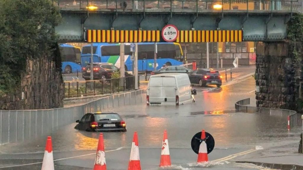
    A sudden, intense flash flooding event has hit the popular town of Killarney in County Kerry, Republic of Ireland, after extreme rainfall overwhelmed local drainage systems on Thursday evening. Over just four hours, the area recorded a total of 57 millimeters of rain, with a staggering 30 millimeters falling within a single hour – a volume that overwhelmed local infrastructure quickly. According to local authorities, this extreme downpour triggered widespread surface flooding across most of the town’s road network, leaving many routes completely impassable to motorists and pedestrians for several hours.

    Emergency response teams were mobilized rapidly to the affected area, with crews from Kerry County Council, Kerry Fire Service and Kerry Civil Defence all arriving on scene by approximately 7:00 PM local time. Fire service crews deployed high-capacity pumps to clear standing water from critical road corridors, working through the evening to reopen blocked routes. In the aftermath of the flooding, Kerry County Council teams have begun systematic assessments of damage across the town, while also coordinating directly with residential and commercial properties that have been impacted by floodwater. The local authority has confirmed it will offer all necessary support to affected property owners as they begin recovery efforts.

    One major local facility, the Killarney Sports and Leisure Centre, has already announced an extended closure in response to the flood damage. The centre will remain shut for the entire weekend and until further notice, as engineers carry out a full structural and safety assessment to address flood-related damage before it can reopen to the public.

  • Why a newly formed lake is sparking fears of more flooding along the Nepal-China border

    Why a newly formed lake is sparking fears of more flooding along the Nepal-China border

    Rescue teams continued digging through thick mud and debris across flood-ravaged terrain along the Nepal-China Himalayan border on Friday, even as disaster officials issued an urgent new warning: a dammed glacial lake formed by this week’s catastrophic event is growing and could overflow, triggering a second round of destructive flash flooding.

    Nepalese authorities have ordered all security personnel, rescue workers, and local civilians involved in search and relief operations to remain on the highest alert, with standing instructions to evacuate immediately to higher ground if conditions deteriorate. Nepal Police spokesperson Abi Narayan Kafle confirmed to the Associated Press that rescue work has not been suspended, but operations are proceeding with extreme caution amid the fresh danger.

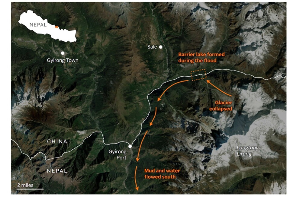
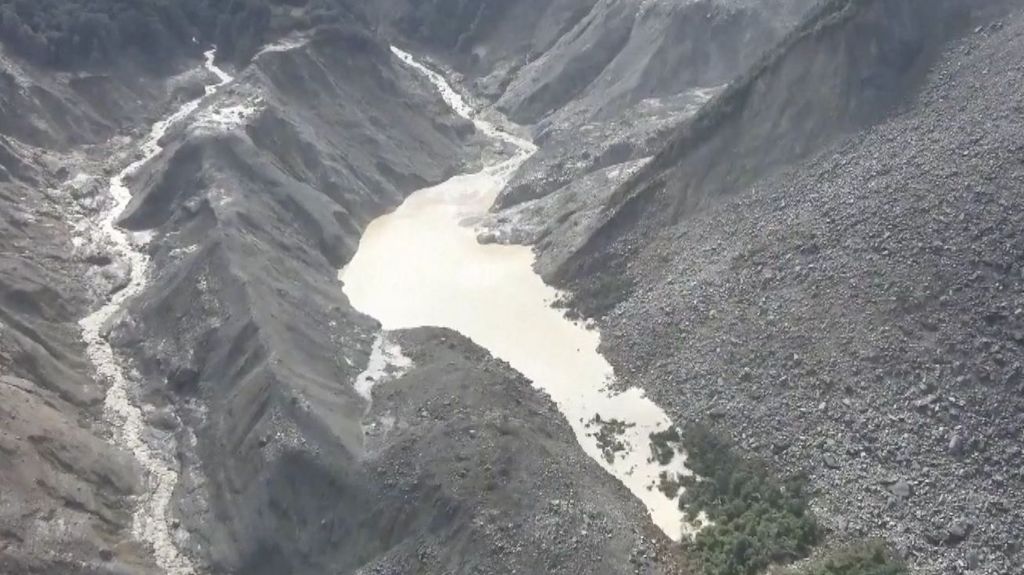
    Satellite imagery analyzed by China’s state broadcaster CCTV places the newly formed lake in the exact same area as a glacial detachment that occurred on Wednesday, the initial event that set off a chain reaction of downstream destruction that left hundreds dead and more than 1,500 unaccounted for. The lake formed after glacial debris blocked the flow of an upstream river, and according to Nepal’s national disaster management authority, preliminary satellite assessments confirm the water body is expanding, raising the risk of a sudden barrier breach and catastrophic downstream flooding.

    CCTV reports place the natural debris barrier holding the lake more than 10 kilometers from Gyirong Port, the key Nepal-China border crossing that was already completely submerged by mud and floodwater earlier this week. The lake sits at an elevation of 2,950 meters, roughly 1,000 meters above the already inundated border crossing.

    Climate researchers tracking the fast-moving situation in the Himalayas explain that Wednesday’s ice-rock avalanche scattered massive amounts of rock and debris across river valleys, creating several small, unstable water bodies in its wake. “Another dammed lake was formed by the August 26th ice-rock avalanche and this has begun to outflow,” explained Qianggong Zhang, head of climate and environmental risks at the Kathmandu-based International Center for Integrated Mountain Development. Zhang noted the lake holds roughly a few million cubic meters of water — enough to fill around 1,200 Olympic-sized swimming pools — and sits in a valley segment with minimal elevation change between the lake and downstream population centers.

    As the region grapples with the aftermath of the initial disaster, the threat of a second catastrophic event has sent urgent alarm through response teams. Climate and geoscience experts note that ongoing high temperatures are accelerating glacial melt across the region, leading to more water accumulation behind the unstable debris dam, which is already obstructing the natural flow of the river.

    While both Zhang and Jakob Steiner, a Dhaka-based geoscientist from Austria’s University of Graz, emphasize that the current high alert must be taken seriously to protect rescue workers on the ground, they add that a second flash flood on the same scale as Wednesday’s deadly event is unlikely.

    This reporting features contributions from Huizhong Wu in Bangkok, and is part of the Associated Press’ ongoing climate and environmental coverage, which receives philanthropic funding from private foundations. The AP maintains full editorial control over all content.

  • Watch: The lake prompting fears of second flood in Nepal-Tibet border

    Watch: The lake prompting fears of second flood in Nepal-Tibet border

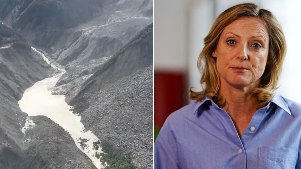
    A newly formed natural lake, created by a recent massive landslide along the rugged Nepal-Tibet border, has triggered growing alarm among regional authorities and communities over the rising risk of a catastrophic secondary flood. In an on-site analysis of the unfolding situation, BBC correspondent Laura Bicker has broken down how this unexpected body of water is creating a dangerous hazard for downstream settlements.

    The landslide, which occurred recently in the mountainous cross-border region, blocked a natural river channel, leading water to accumulate rapidly and form the new unstable lake. Geologists and disaster response teams warn that if the earthen dam created by the landslide gives way under the growing pressure of rising water, a sudden surge of floodwater could rush through downstream valleys, threatening homes, infrastructure, and the lives of thousands of people living in the area.

    Local disaster management agencies have already stepped up monitoring of the lake’s water levels and are preparing emergency evacuation plans for at-risk communities, as climate experts note that changing weather patterns in the Himalayan region have increased the frequency of such landslide and flood events in recent years.

  • ‘High risk’ of lake breaching and causing second flood, warns China

    ‘High risk’ of lake breaching and causing second flood, warns China

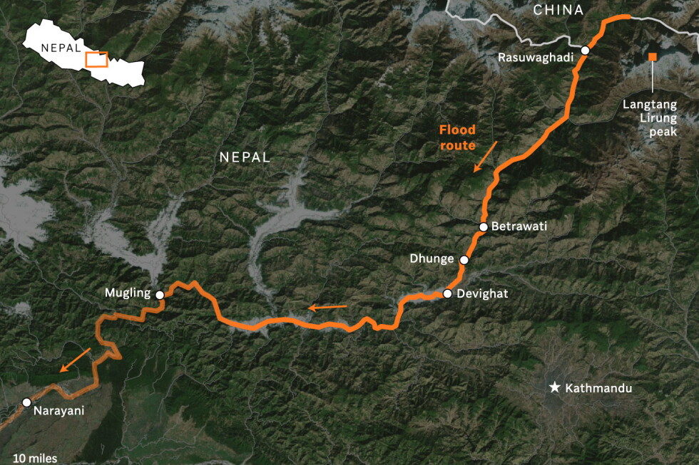
    A new and urgent threat has emerged along the Nepal-Tibet border just days after a catastrophic glacial collapse triggered a deadly flash flood, with Chinese authorities warning that a newly formed barrier lake faces a “high risk” of bursting its natural debris dam and unleashing a second catastrophic downstream deluge. The new water body formed upstream from the site of Wednesday’s deadly flood, which glaciologists and disaster researchers confirm was sparked when a large section of a mountain glacier near Langtang Lirung peak broke free and crashed into a river below.

    As of Friday morning, state broadcaster CCTV reports that approximately 2.5 million cubic meters of water have already collected behind the debris dam that created the barrier lake – a natural water formation that occurs when landslide or glacial debris blocks a river channel. Officials added that an additional 3 million cubic meters of water is projected to flow into the lake between Thursday and the end of the weekend, pushing the structure far past its capacity and creating extreme conditions for a potential breach. The Chinese Ministry of Water Resources confirmed that the lake, located at the intersection of the Chhochen Khola and Purepu Tsangpo rivers, has already begun overflowing its dam, and the region has been battered by unseasonably heavy rainfall that is worsening the already unstable situation.

    In response to the unfolding emergency, authorities have deployed specialized engineering teams to conduct round-the-clock monitoring of water levels, geological stability, and local atmospheric conditions. However, access to the high-risk site remains severely limited. Friday morning’s CCTV report noted that the bulk of Chinese emergency response teams are currently stranded roughly seven kilometers from Gyirong Port, the critical overland border crossing between China and Nepal that was heavily damaged in Wednesday’s flood. The ongoing non-stop overflow of the barrier lake has created immediate risks of new flash floods and debris flows, forcing officials to temporarily pause all search and rescue operations for victims of the initial disaster across the border region.

    The barrier lake sits in the same high-altitude region as Langtang Lirung, the mountain where the original glacial collapse originated, and is located several kilometers upstream from the damaged Gyirong Port. In a separate warning issued in Kathmandu, Nepali authorities have also flagged growing risks of additional flooding along the Bhote Koshi and Trishuli rivers, where new debris blockages could form and trigger sudden surges. Officials have urged all residents and visitors in river basins across the region to stay clear of waterways until further official notice that the threat has passed.

    The initial flash flood on Wednesday has already left a devastating toll across the region. Hundreds of people have been confirmed dead in Nepal, with hundreds more still unaccounted for. On the Tibetan side of the border alone, more than 550 people remain missing, nearly half of whom are foreign nationals. Scientists have emphasized that the glacial collapse that triggered this disaster is consistent with growing risks of glacial outburst floods across the Himalayan region, as rising global temperatures destabilize high-altitude ice formations. Chinese state media has also released aerial footage of the newly formed barrier lake to document the ongoing emergency for the public.

  • Fresh flood warnings for disaster-hit Nepal and Tibet, 1,400 still missing

    Fresh flood warnings for disaster-hit Nepal and Tibet, 1,400 still missing

    A catastrophic glacial collapse along the remote Himalayan border between Nepal and Tibet has triggered a devastating “inland tsunami” of freezing mud and debris that has killed at least 392 people, left more than 1,400 unaccounted for, and forced rescuers to navigate new, urgent flood risks as search efforts enter their third day.

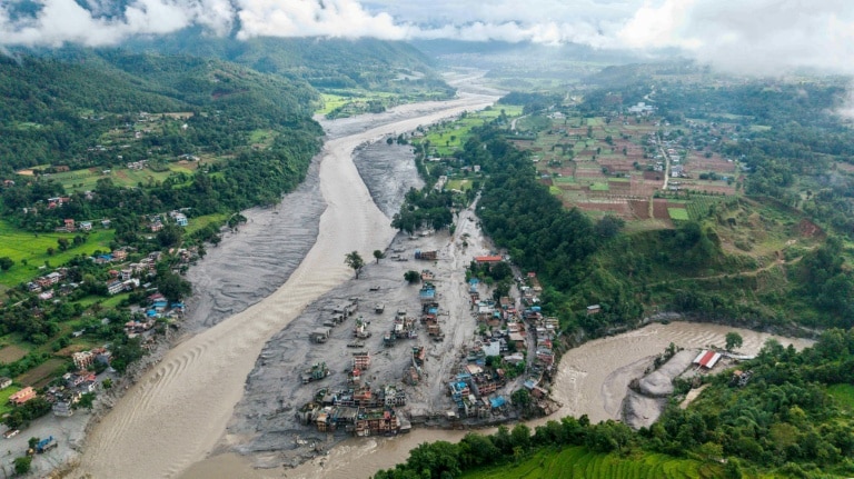
    The disaster, which struck on Wednesday, was initially misidentified as a magnitude 4.4 earthquake by global seismic monitors, but the U.S. Geological Survey (USGS) later confirmed it was caused by a sudden glacial collapse that sent a torrent of icy sludge cascading downstream across the border. The debris flow, which traveled roughly 170 kilometers south into Nepal, leveled entire villages, buried homes, crumpled bridges and dams, and swept vehicles away like discarded toys.

    Among the missing are hundreds of foreign nationals, many of whom were either trekking through Nepal’s Himalayan trails or completing a sacred pilgrimage to Tibet’s snow-capped Mount Kailash. Nepal’s police force has confirmed 389 recovered bodies within its borders, with 910 people still out of contact—517 of whom are foreign tourists. Beijing adds that another 100 Chinese citizens missing in Nepal are not included in that count. Indians make up the largest group of missing foreigners, with 90 U.S. citizens also reported unaccounted for, alongside nationals from Australia, Britain, Malaysia, the Netherlands, Portugal, South Africa and South Korea. Across the border in Tibet, Chinese authorities report three deaths and hundreds more missing, while 555 stranded tourists and 499 local residents have already been evacuated from high-risk zones.

    As emergency teams, soldiers, and specialized rescue units race against time to pull survivors from debris fields and locate remains of the missing, their efforts have been significantly complicated by new flood warnings. Enormous piles of landslide debris have blocked mountain valleys, trapping water that has formed new unstable lakes behind the rubble. On Thursday, Chinese state media warned that one of these newly formed lakes faces a “high risk of breaching” that would send a second destructive flood downstream. Nepal’s own Flood Forecasting Division echoed the alert, issuing a special warning that urged rescue teams and local residents to exercise extreme caution.

    For survivors waiting in makeshift hospitals and relief camps, the days since the disaster have been marked by agonizing uncertainty. Kula Priya, a Nepali resident who lost three homes to the deluge and her eldest son who remains missing, told reporters “I don’t care for wealth. I just want my son back. We had three houses, all of which were washed away by the floods.” In Malaysia, 26-year-old Logadarrsiny Raman waits for news of her parents, aunt, and uncle, who were part of a 17-person pilgrimage group that lost contact minutes before the flood hit the area they were traveling through. “I’m very anxious,” she told AFP. “My only hope is to hear back from them that they are safe.”

    Rescue operations have mobilized extensive resources across both sides of the border: Chinese authorities have deployed nearly 800 emergency workers, supported by sniffer dogs, speed boats, satellite imagery and drones to navigate the hard-to-reach mountain terrain, while Nepali soldiers are also using sniffer dogs to locate bodies buried under thick layers of mud. Nepal’s Prime Minister Balendra Shah, who called on the nation to unite in the immediate aftermath of the disaster, toured the hardest-hit regions on Thursday, ordering local officials to prioritize immediate relief for displaced families and clear blocked access routes to cut off affected zones.

    Experts link the rising risk of such glacial disasters to the broader impacts of climate change, which is accelerating glacial melt across the Himalayas and around the world, increasing the frequency of glacial collapses and outburst floods from glacial lakes. Ruth Gamble, an environmental historian at Australia’s La Trobe University, described the sudden debris flow as “like an inland tsunami” that caught communities and visitors off guard. In a message of condolence, exiled Buddhist spiritual leader the Dalai Lama said he would pray for all those who had lost their lives in the disaster.

  • Scientists find clues in satellite imagery to the cause of catastrophic floods in Nepal and Tibet

    Scientists find clues in satellite imagery to the cause of catastrophic floods in Nepal and Tibet

    In the wake of catastrophic flash flooding that ripped through mountain valleys along the Nepal-China border Wednesday, rescue crews continued a grim search for dozens of missing people Thursday, while a team of international earth scientists used satellite imagery to unpack the sequence of events that triggered the disaster. The flooding has already claimed hundreds of lives across Nepal and the Tibet Autonomous Region of China, with scores of unaccounted people still unaccounted for, including foreign travelers and religious pilgrims visiting the region’s sacred high-altitude sites.

    Initial analysis of Wednesday’s satellite imagery was hampered by heavy cloud cover and dust kicked up by tons of falling debris and ice, but clearer scans taken Thursday allowed geomorphologists Kristen Cook of France’s Université Grenoble Alpes and Dan Shugar, an associate professor at the University of Calgary, to piece together the full scope of the geologic failure. Early observations had only confirmed that a large section of glacier had broken away from Langtang Lirung, a 7,234-meter peak that sits just kilometers from the international border. But the sharper Thursday images revealed that the collapse extended far deeper than the glacial ice: the entire underlying bedrock of the mountainside had fractured and slid into the steep valley below, carrying the massive glacial ice chunk, thousands of tons of boulders, and loose sediment with it.

    “It shows the whole area without anything hidden, and we could see that, yes, it looked like there was not only this glacier that had failed, but a much larger chunk of the bedrock of the mountainside itself that had given way,” Shugar explained. “You have this big bedrock failure that took part of the glacier with it.” Describing the downstream view captured in the imagery, Shugar called the scene of entire villages buried under meters of debris “heart-wrenching.”

    Cook explained that after the collapse slammed into the valley floor, momentum carried the massive debris flow down the steep, narrow gorge, even as the fallen glacial ice began to melt rapidly. The mixture of meltwater, mud, rock, and ice grew to heights equal to several multi-story buildings before it swept through settled communities along the river banks.

    Before-and-after satellite comparisons of the affected river systems paint a stark picture of the flood’s destructive power. Nepal’s Trishuli River, a major waterway in the region, is now far wider than its pre-flood course, with water that has shifted from its usual greenish hue to a dark, muddy brown—a visible marker of the massive volume of sediment the flood dragged downstream. Entire riverbank towns and villages now lie submerged under thick layers of debris, appearing as uniform brown expanses in imagery, with only the roofs of a handful of partially buried houses visible in the Betrawati area. Syapru Besi, a popular tourist hub and the main starting point for treks into the Langtang Valley, saw all riverside buildings toppled and swept away; the force of the debris flow was so powerful that it pushed a side tributary off its original course, widening its channel permanently.

    Alton Byers, a mountain geographer at the University of Colorado Boulder’s Institute of Arctic and Alpine Research who has studied glacial hazards in Nepal for decades and visits the country annually to work with local communities on disaster preparedness, called this event the most destructive glacial flood he has ever observed. He noted the destruction has left a barren wasteland in the disaster zone that will require decades to recover.

    Byers also linked the disaster directly to human-caused climate change, arguing that rising global temperatures are thawing high-altitude permafrost that has held mountain rock, soil, and ice together for thousands of years. As permafrost weakens, it leaves steep mountainsides unstable, increasing the risk of large collapses that can trigger cascading hazards like glacial outburst floods and debris flows.

    “All the indicators, to me, point to the impacts of warming trends,” Byers said. “In this case, the permafrost that for millennia has helped to hold together high-altitude rock and ice and soil and glaciers is now weakening and becoming unstable.”

    Cook and Shugar cautioned that it is too early to confirm a direct causal link between this specific massive collapse and climate change, noting that bedrock failures and landslides are natural geologic processes that have occurred for millennia. Still, both scientists acknowledged that thawing permafrost driven by a warming climate does increase overall slope instability across the Himalaya, and that more large events of this type should be expected as global temperatures continue to rise.

    “While we cannot at this point directly link this collapse to climate change, it is not unexpected to see more events of this type with a warming climate,” Cook said. “Not this big, hopefully not this big.”

    This reporting from The Associated Press, which receives funding from private foundations for its climate and environmental coverage, is independently edited and produced by AP.