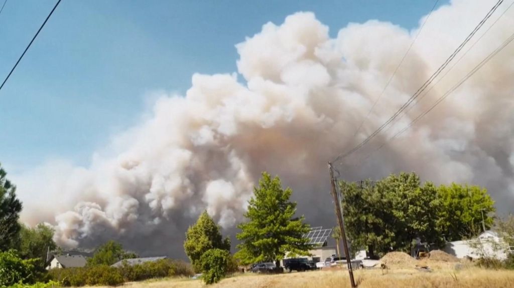
Wildfire season has brought unprecedented emergency conditions to Washington State, as fast-spreading blazes have scorched more than 250,000 acres of land across the region, prompting state officials to order widespread evacuation orders and leaving thousands of residents without access to electrical power. The scale of the infernos has stretched emergency response resources thin, with flames advancing through dry, vegetation-heavy landscapes that have been primed for rapid spread by record-high temperatures and prolonged drought conditions that have gripped the Pacific Northwest in recent months. Local emergency management teams have been working around the clock to move vulnerable residents out of harm’s way, set up temporary emergency shelters for displaced people, and coordinate with fire crews from neighboring regions to contain the blaze’s expansion. Power infrastructure has been heavily impacted by the advancing fires, with utility providers forced to shut down transmission lines and distribution networks to avoid further damage or safety hazards to workers and residents. As firefighters continue to battle the multiple concurrent blazes, authorities are urging residents in at-risk zones to stay alert, adhere to evacuation orders immediately, and prepare for potential extended disruptions to basic services before containment efforts can be completed.
分类: environment
-
Fire toll mounts in Greece as blazes spread
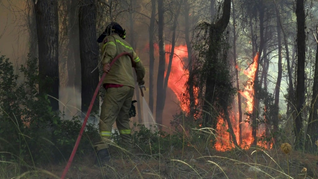
Greece is grappling with an expanding wildfire crisis that has left vast swathes of forest and agricultural land destroyed, with top officials warning that the most challenging days still lie ahead as high gale-force winds hamper suppression efforts.
Prime Minister Kyriakos Mitsotakis noted that the nation has been battered by unprecedented extreme weather, with wind speeds regularly hitting 62 miles per hour — speeds so intense that even the dozens of aerial firefighting assets deployed across the country cannot operate safely. “There are moments when nature and the intensity of weather phenomena surpass any human planning and any operational capability,” Mitsotakis wrote in a public post on Facebook Sunday.
As of Sunday, nearly 500 firefighters were focused on containing a major blaze burning near Porto Germeno, a popular coastal village located roughly 45 miles northwest of the Greek capital Athens. The fire crossed a mountain range overnight, and crews are working around the clock to stop its advance toward Athens’ western outskirts. Additional blazes are burning across the country: 100 firefighters are tackling a second large wildfire in Aigialia, located in the northern Peloponnese peninsula, while a new outbreak was reported on the Ionian Sea island of Cephalonia late Saturday.
Early damage assessments from the National Observatory’s climate tracking service meteo.gr initially estimated that more than 16,000 acres of land had been burned in outbreaks across the Gulf of Corinth region, which includes the Porto Germeno blaze. But Theodore Giannaros, a wildfire meteorologist and senior researcher at the National Observatory, said Sunday that the actual burned area for the Porto Germeno fire alone is likely over 24,700 acres — nearly double the initial estimate. “Unfortunately, it is highly likely (if not almost certain) that this particular wildfire will be classified as a megafire,” Giannaros wrote on Facebook.
Evacuation orders were issued for Porto Germeno and neighboring villages on Friday when the fire first broke out, but local authorities confirm that dozens of residential properties have already been damaged or destroyed. Nikos Georgopoulos, a forest management researcher at Aristotle University of Thessaloniki, told Greek state broadcaster ERT that the speed of the blaze took observers by surprise. “We could not believe what we were seeing, the fire spread extremely rapidly,” he said, adding that the same area was hit by a smaller wildfire just three years ago.
The crisis has stretched Greece’s emergency response resources to breaking point. Civil Protection Minister Evangelos Tournas confirmed Saturday that the national fire department has been “pushed to its limits”, after crews have responded to dozens of new fire outbreaks every day this week. Three firefighters have already died in the line of duty this week: two on the island of Crete, and one in the Peloponnese. Tournas explained that extreme wind and turbulence have grounded most aerial firefighting assets for much of the crisis, leaving ground crews to handle fast-moving blazes without air support.
While winds moderated slightly late Saturday, the Greek civil protection ministry warned Sunday that the greater Athens metropolitan area, nearby Voiotia region, and the island of Evia all remain under near-maximum wildfire risk. Like much of the Mediterranean basin, Greece faces increasing wildfire risk every summer due to rising temperatures, more frequent and intense heat waves, and prolonged drought driven by human-caused climate change. Earlier this week, separate wildfires on the Greek islands of Crete and Paros burned another 14,800 acres of land, according to meteo.gr data.
-
Dry, hot summers are putting Dutch dikes at risk and threatening German river trade
Across sweltering Western Europe, a record-breaking summer drought has left iconic infrastructure, agricultural sectors and key shipping routes reeling, with the low-lying Netherlands — a nation defined by its centuries-long battle to hold back water — facing an unprecedented test of its famed flood defense network. As wildfires rage across southern France and Spain, and major waterways including the Danube and Rhine drop to historic lows, the Netherlands has mobilized hundreds of volunteers to patrol its thousands of kilometers of dikes, hunting for hidden cracks and weaknesses that could spell disaster in future rain events.
Near the small agricultural town of Waddinxveen, located east of The Hague and roughly 5 meters below sea level, volunteers Jeroen Wouda and Dirk Boom follow a slow, methodical route along an inland peat dike, probing the bone-dry earthen embankment with metal rods and scanning parched grass for subtle patches of green that signal an unseen leak. This modern patrol echoes the centuries-old folk tale of the Dutch boy who plugged a dike breach with his finger, but today’s monitoring uses 21st-century tools: volunteers log potential flaws directly in a mobile app, alerting water authorities who can dispatch repair crews within hours.
Peter van Duijvendijk, flood defense manager at the Schieland en de Krimpenerwaard water corporation, one of 21 regional water management bodies that oversee flood protection across the Netherlands, says 140 trained volunteers in his district alone patrol 100 kilometers of dikes throughout the dry season. So far, no major structural damage has been detected, but patrols will remain active through the fall as soil conditions stay unstable. “These volunteers are our eyes and ears on the dike,” van Duijvendijk explained to the Associated Press. Unlike concrete coastal flood barriers, inland dikes in the Netherlands are often built from peat, a porous organic soil that relies on consistent moisture to retain its structural strength. When peat dries out, it shrinks and weakens, creating gaps that can allow water to breach the barrier and flood low-lying reclaimed polder land during periods of heavy rain. “Because it is so dry right now the peat loses moisture, and because of that it becomes weaker,” van Duijvendijk said. “If that peat becomes weaker, then there is a chance that water will flow through the dike.”
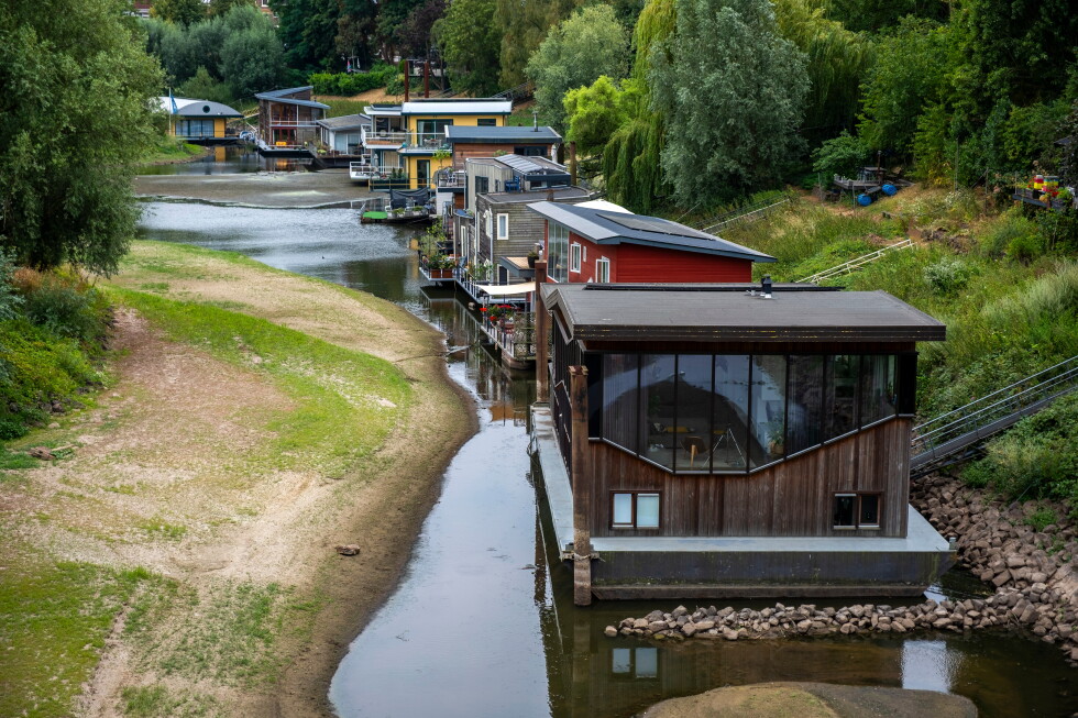
The drought’s impacts extend far beyond dike integrity, rippling through regional economies and critical transport networks. The Rhine, Europe’s most vital inland freight waterway that connects North Sea ports to industrial heartlands in Germany and landlocked Central Europe, dropped below its 2018 record low near Cologne, Germany, over the weekend. Marcel Beck, manager of the western German ports of Neuss, Düsseldorf and Cologne for logistics firm RheinCargo, called the low water levels “devastating” for commercial shipping. Whereas a single cargo vessel can typically carry 2,000 to 2,500 metric tons of freight along the Rhine, water depths are now so shallow that most ships can only load 400 to 600 metric tons to avoid running aground on sandbars. “This places an enormous burden on the entire transport chain to reorganize everything in order to still get the goods inland,” Beck said. In the eastern Netherlands, the Waal river — the main Dutch branch of the Rhine — has receded so far that long-submerged items like rusted bicycles and discarded shopping carts are now exposed on the dry riverbed, and dozens of houseboats are sitting directly on the exposed sandy river bottom. Frans Schilte, a houseboat owner in the city of Nijmegen, has observed that low-water seasons have grown longer and more severe in recent years, extending from the historic one-month average to three full months. His own steel-hulled boat now rests on the riverbed, sitting slightly off-level as a result. “It’s not a big problem,” Schilte said, “but it’s the negative effect of climate change.”
For the Netherlands, a country where roughly one-third of total land sits below sea level, managing water has always required a delicate balancing act: winter brings the constant threat of catastrophic flooding, while extended summer droughts increasingly bring the opposite problem of water scarcity. Deltares, an independent Dutch water research institute, says the country has enough total annual freshwater to meet all needs, but seasonal distribution is the core challenge. “In the winter we drain it away quickly because we want to keep our feet dry and we don’t want water on the land,” explained Vince Kaandorp, a groundwater hydrologist at Deltares. “How can you ensure that you do that slowly and give water time to sink into the ground?” Kaandorp notes that solutions don’t require massive high-tech infrastructure: simple adjustments like adding hedgerows along river banks can slow runoff, giving rainwater more time to seep into deep groundwater reserves. Dutch water authorities are currently researching how to modify agricultural and riparian soil to act like natural sponges, holding more moisture through dry summer months.
Even with these adaptive measures, the drought has already caused significant disruption for Dutch agriculture. Some regions have banned farmers from pumping canal water for crop irrigation as authorities work to preserve freshwater supplies and prevent saltwater intrusion into low-lying reclaimed lands. Western Dutch polders, which produce much of the country’s fruit and vegetable crops, are facing increasing salinization as freshwater levels drop and seawater seeps into groundwater reserves. Farmers are warning of reduced harvests and higher consumer prices for summer fruit this year. “It is an extremely challenging year for growers,” said John Kusters, chair of the Netherlands Fruit Growers’ Organization, in a public statement.
-
How Australia combines modern tech and Indigenous knowledge to fight fire
As southern Europe grapples with devastating, record-breaking wildfires that have forced Spain to declare a national state of emergency, a groundbreaking wildfire research project based in Australia is highlighting how merging millennia-old Indigenous ecological knowledge with cutting-edge modern technology can reshape global wildfire risk management.
Marta Yebra, a Spain-born bushfire expert based in Canberra, leads the Bushfire Research Centre of Excellence, an institution established after Australia’s catastrophic 2019-2020 Black Summer fires that burned an area roughly the size of the United Kingdom. Yebra has spent years developing advanced wildfire detection and prevention strategies for Australia, one of the most fire-prone regions on Earth, and now believes her country’s hard-won experience holds critical lessons for Europe as it faces its worst wildfire season in decades.
At the core of Yebra’s work is an innovative collaboration that combines two vastly different sources of expertise: high-resolution satellite data that measures landscape fuel moisture content, and the generations-old environmental knowledge of Australia’s Indigenous communities. While satellites can identify areas with high concentrations of dry, flammable vegetation such as dead leaves, grass, shrubs, and bark, that raw data lacks on-the-ground context that makes it actionable. That gap is filled by Indigenous land managers like Adrian Webster, who learned to read the Australian landscape – what his community calls “country” – from his elders.
Webster uses traditional observations, from plant color and scent to canopy shade, to verify and contextualize satellite data. He also assesses subsurface conditions to build a complete picture of fire risk, from underground moisture levels all the way up to the top of forest canopies. “She had all this amazing data, but there was no translation to what it meant on the ground, so it was kind of useless,” Webster explained of Yebra’s satellite information. “But through an Indigenous perspective, it was not useless. It was a map that could guide you through the country and, if you understood it, take you directly into a place that is ready to burn.” Yebra noted that Webster’s on-the-ground assessments showed remarkable alignment with satellite readings, proving that combining Indigenous ecological expertise and Western science creates a far more accurate picture of fire risk than either approach can deliver alone. Her team is now seeking additional funding to expand the project and co-design fire management plans directly with Indigenous communities.
This merging of ancient wisdom and modern science extends beyond risk detection to proactive fire management, centered on the traditional Indigenous practice of cultural burning. For more than 60,000 years, Indigenous Australians have used small, controlled “cool burns” to reduce accumulated flammable fuel across the landscape, creating patchy vegetation that prevents large, catastrophic blazes from developing. Unlike modern prescribed burns, which are large-scale hazard reduction operations conducted during cooler months, cultural burning is tied to a deep spiritual connection to the land, and its principles are increasingly being adopted around the world.
Pointing to the massive fuel buildup that has amplified Spain’s current wildfire crisis, Yebra noted that this proactive, risk-focused approach is largely absent from European landscape management. “It is difficult to watch what is happening in Spain, but it is not surprising,” she said. “Particularly as climate change is increasing the frequency of extreme fire weather across southern Europe.” Australia’s decades of experience living with high-intensity wildfires have driven a key shift in strategy: moving from only reacting to blazes after they start to proactively identifying and reducing risk long before ignition occurs. That shift, Yebra argues, could drastically improve wildfire outcomes across southern Europe.
Webster echoes that message, emphasizing that the core lesson from Indigenous fire management is proactive action. “The longer you leave it, the more fuel there is to burn, so the fire is naturally going to be bigger and harder to extinguish,” he said. “Indigenous people always knew that, so we burnt continuously all the time. That way there was no fuel for big fires.”
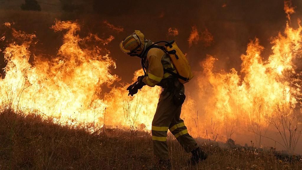
Modern Australian firefighting has expanded on these traditional practices with additional tactics that are gaining traction globally. Backburning – the practice of intentionally setting controlled fires ahead of an advancing main blaze to strip it of fuel – has long been a standard tactic in Australia, but it was rarely used in Canada until recent years. When Australian firefighter Damian Hatfield deployed to Alberta to help tackle Canada’s 2023 record wildfire season, backburning was not widely implemented; when he returned in 2024, the tactic had become a core part of Canadian firefighting operations. Technology has also transformed response efforts: NSW Rural Fire Service’s Trent Curtin notes that drones now provide fast, detailed situational awareness to ground crews, deliver critical equipment, support backburning operations, and assess post-fire damage long before larger aircraft can be deployed.
As Australia braces for what forecasters warn could be an extremely severe 2026 summer fire season, amplified by a predicted super El Niño that will bring more extreme heat and drought, fire leaders are emphasizing the need for global cooperation. Country Fire Authority Chief Officer Jason Heffernan, based in Victoria where the 2009 Black Saturday bushfires – Australia’s deadliest on record – remain a searing memory, notes that fire seasons are growing longer and more intense across the globe, even in regions that rarely faced major wildfires in the past.
“No fire service can do this on their own and the key is to have formal and trusted networks,” Heffernan said, pointing to the growing need for cross-border resource sharing. That cooperation is already in action: just this week, France made its first-ever request for Australian firefighting support, with two dozen crew and several aircraft set to deploy to help tackle the country’s own record-breaking wildfires amid a prolonged heatwave. Australia already regularly exchanges firefighting resources with the United States and Canada, and Heffernan expects requests from Europe to grow as the global wildfire threat intensifies and the global fire community becomes more interconnected. For Webster, this global collaboration rooted in traditional knowledge is about more than just fighting fires: it’s about “allowing our mother – the planet Earth – a voice again.”
-

Italy putting nearly all major cities on highest heat alert
A sweeping heatwave, fueled by a strengthening North African subtropical anticyclone hovering over the Mediterranean, has pushed most of Italy’s major urban centers into the country’s highest temperature risk category, triggering urgent public health warnings across the continent as wildfires rage through multiple southern European nations.
Italian health authorities confirmed Saturday that 19 cities stretching from the northern industrial hub of Milan to the southern metropolis of Naples, including the capital Rome and canal city Venice, are already under a red alert for extreme heat. By the start of the coming week, that number will jump to 25 of Italy’s 27 major population centers, leaving only two locations – Reggio Calabria on the southern tip of the Italian mainland and the Sicilian city of Messina – on the second-highest amber warning level.
Officials stress that the risk of heat-related illness extends beyond traditionally vulnerable groups, which include older adults, infants and young children, and people living with chronic medical conditions. Even healthy, physically active people face dangerous health impacts from the current conditions, they warn. Residents in high-risk areas have been instructed to stay indoors between 11 a.m. and 6 p.m., avoid prolonged exposure to heat and direct sunlight, and maintain steady hydration to prevent heat stroke and other heat-related emergencies.
Italy’s extreme heat alert comes as a cascade of overlapping heatwaves across the continent has created tinder-dry conditions ideal for the spread of destructive wildfires. Across Greece, France, Portugal and Spain, thousands of firefighters are working around the clock to contain blazes that have already burned hundreds of thousands of hectares of land.
In southeastern France, local authorities reported Friday evening that a wildfire that had been contained for several days reignited in the Var region, forcing the evacuation of roughly 2,500 residents and visitors. In the southwestern Gironde region, by contrast, a large wildfire that displaced hundreds of thousands of people has finally been brought under control, allowing roughly 200,000 evacuated residents to return to their homes over the weekend.
In Greece, hundreds of people, the majority of whom were traveling tourists, were evacuated by sea from the coastal town of Viotia after wildfires surrounded the area, cutting off overland escape routes. EU climate data shows that 2026 is already on track to be an unprecedented year for wildfire damage across the Iberian Peninsula: Spain has seen more than 200,000 hectares of land burned by August, a total roughly five times the average amount burned over the same period in a typical year. Portugal has also recorded far more burned area than the seasonal average.
The cascading extreme weather events align with long-term climate trends documented by leading scientific bodies. The Copernicus Climate Change Service confirms that climate change is driving global temperature increases, and Europe is warming faster than any other continent – heating at twice the rate of the global average. This accelerated warming has triggered a steady rise in the frequency and intensity of summer heatwaves, increased strain on regional water supplies, and created more favorable conditions for large, destructive wildfires across the continent.
-
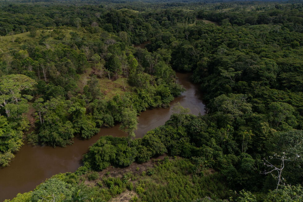
Colombia’s deforestation rises slightly as Amazon forest loss holds steady
BOGOTA, COLOMBIA — As the administration of Colombian President Gustavo Petro prepares to hand over power to a new government next week, the country’s top environmental and climate agencies have released long-awaited 2025 nationwide deforestation data that paints a mixed picture of progress on the president’s signature Amazon conservation agenda.
Data released late Friday by the Colombian Environment Ministry and the Institute of Hydrology, Meteorology and Environmental Studies (IDEAM) shows the country lost 119,483 hectares (roughly 295,000 acres) of forest cover in 2025 — an area roughly equal to the entire land area of the city of Los Angeles. This marks a 5% uptick in deforestation compared to 2024 levels.
Despite the small annual increase, the outgoing administration has highlighted that it still far outpaced its four-year national deforestation reduction goal. Compared to the 2021 baseline year when Petro took office, total annual forest loss is down 31% — exceeding the administration’s target of cutting deforestation by at least 20% from 2021 levels.
The new numbers, however, also underline a persistent challenge: after achieving dramatic, record-breaking reductions in deforestation in 2023, the country has struggled to maintain those gains. Forest loss rose 43% in 2024, erasing much of the prior year’s progress, and while the pace of growth slowed sharply in 2025, total deforestation remains well above the historic low recorded two years ago.
Pressure on the Colombian Amazon, which holds more than 60% of the country’s total forest cover, has stayed largely unchanged. More than 65% of all 2025 forest loss occurred in the Amazon biome, with 77,805 hectares cleared this year — only a marginal 681-hectare increase from 2024. Government monitors identified 10 active deforestation hot spots concentrated in the northwestern Amazon, clustered in the country’s long-troubled “arc of deforestation” — a swathe of remote rainforest that saw a surge in illegal activity after the 2016 peace deal with the FARC guerrilla group left a power vacuum in isolated border regions. The municipalities with the highest deforestation rates in 2025 were Cartagena del Chaira in Caquetá, Mapiripán in Meta, San Vicente del Caguán in Caquetá, and Calamar in Guaviare — all located within this high-risk zone, where illegal land grabbing, unregulated cattle ranching, and informal infrastructure expansion have remained the primary drivers of forest clearing.
On a more positive note, the data shows deforestation inside Colombia’s protected national parks fell nearly 19% year-over-year, dropping to 9,388 hectares. Officials credited this progress to community-focused conservation programs that pay local residents to protect forest cover, large-scale landscape restoration projects, and the country’s first forestry concession, which grants rural communities long-term legal rights to sustainably manage public forest lands.
Outgoing Environment Minister Irene Vélez framed the 2025 results as a product of shifted policy approaches, including closer collaboration with rural communities, expanded financial incentives for conservation, and a move away from past policies that criminalized small-scale farmers. She also highlighted a recent high-impact investigation in Mapiripán that led to the arrest of 17 people linked to a criminal network engaged in illegal land grabbing, deforestation, and unregulated cattle ranching. Officials reiterated that the core drivers of national deforestation remain illegal land seizure, expansion of extensive cattle ranching, and unplanned road construction — not coca cultivation, which has long been the focus of Colombia’s national anti-drug strategies.
Petro made protecting the Amazon a central pillar of his presidential environmental agenda, and his administration passed a landmark cattle traceability law designed to block beef produced on illegally cleared forest land from entering domestic and global supply chains.
The release of the 2025 data followed weeks of public criticism from incoming Environment Minister Fabio Arjona, who accused the outgoing Petro administration of deliberately delaying publication on the social platform X, claiming the government hid the numbers because it knew the “scenario is tragic.”
The newly released figures set a clear benchmark for the incoming administration of President-elect Abelardo de la Espriella, who has already announced plans to expand oil and mining development across the country and review many of Petro’s signature environmental policies.
-
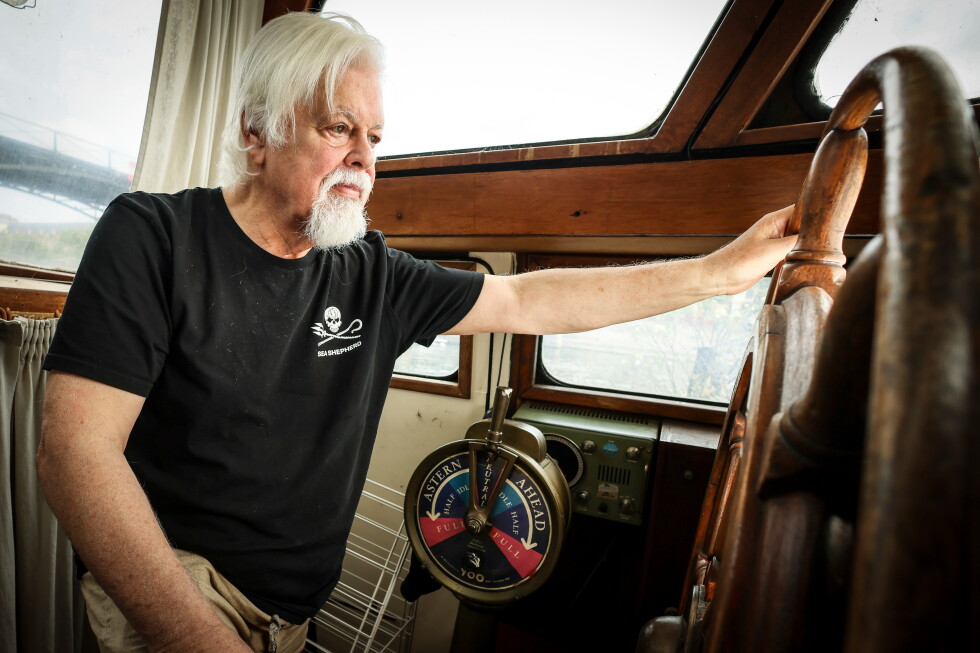
Iceland seizes Paul Watson Foundation’s anti-whaling ship and detains its crew
In a high-stakes confrontation between Icelandic law enforcement and anti-whaling campaigners, Icelandic coast guard units and police special forces have seized a protest vessel operated by an organization founded by veteran anti-whaling activist Paul Watson, detaining all 21 members of its crew, Icelandic officials confirmed Saturday.
The incident traces back to Thursday evening, when the crew of the Icelandic commercial whaling ship Hvalur 9 placed an emergency distress call, reporting that their safety was threatened by the protest vessel Bandero, which is owned and operated by the Captain Paul Watson Foundation. According to the Icelandic Coast Guard’s official account, the Bandero repeatedly defied direct orders from coast guard officials: first to exit Icelandic territorial waters, and later to cut its engines.
Around midnight on Thursday, armed joint units of the Icelandic Coast Guard and the elite Viking Squad police special force boarded the Bandero and took the entire crew into custody. Notably, Paul Watson, the 75-year-old founder of the foundation that owns the vessel, was not on board during the operation. In an official statement released after the seizure, the Captain Paul Watson Foundation confirmed the action and reported that detained crew members are being held aboard the vessel with all their personal communication devices confiscated.
By Friday, the Bandero had been escorted into Reykjavik, Iceland’s capital port, and Icelandic police have assumed lead responsibility for the ongoing investigation. Iceland’s national public broadcaster RÚV has reported that law enforcement intends to request deportation for all 21 detained crew members, alongside a permanent ban on their re-entry to Iceland.
Iceland stands as one of only three nations alongside Norway and Japan that continue to permit large-scale commercial whaling, setting annual hunting quotas for fin and minke whales within its exclusive economic zone. While the country exports the vast majority of its whale meat to Japan, demand for the product has dropped sharply since 2019, when Japan withdrew from the International Whaling Commission and restarted its own commercial whaling operations. Domestically, commercial whaling has grown increasingly divisive in Iceland, as local consumption of whale meat has fallen to near-negligible levels in recent years.
This latest encounter adds another chapter to Paul Watson’s decades-long, high-profile campaign against commercial whaling. A Canada-born activist, Watson stepped down as head of the Sea Shepherd Conservation Society, the pioneering anti-whaling group he co-founded, in 2022 to launch the Captain Paul Watson Foundation. Watson’s confrontational direct-action tactics, which have included high-seas standoffs with whaling vessels, earned him global celebrity support and a starring role in the popular reality television series *Whale Wars*, but have also repeatedly landed him in legal custody.
Earlier this year, Watson spent five months imprisoned in Greenland following his arrest on a Japanese extradition warrant stemming from a 2010 incident where he was accused of obstructing a Japanese whaling vessel. Upon his release in December 2024, Watson publicly stated he would avoid travel to nations where he faced arrest risk, telling reporters: “I have to make sure that I don’t land in Iceland or another country where Interpol might try to have me arrested again.”
Watson was first placed on Interpol’s “red notice” most-wanted list in 2012, and was only removed from the roster earlier this year in 2025. Watson’s uncompromising, direct-action approach has long created divisions within the global conservation movement, and fishing and marine shipping firms have repeatedly accused his activists of endangering crew lives and vessel safety. Earlier this year, the Bandero was involved in a collision with a Norwegian-owned industrial krill trawler operating in Antarctica; the trawler’s owner called the incident a deliberate attack that put their crew at risk and could have triggered a major environmental catastrophe in the sensitive Antarctic ecosystem.
-
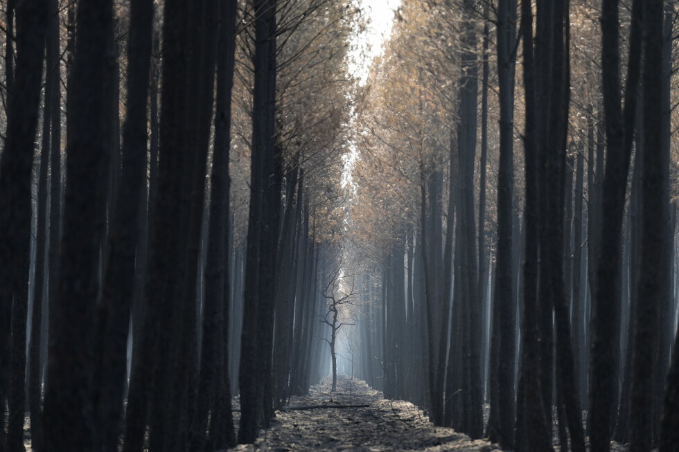
Europe’s wildfire crisis shifts as some 200,000 French return but new blazes force thousands to flee
As climate change continues to push Europe’s temperatures well above global averages, a patchwork of progress and crisis has emerged across the continent’s wildfire response: while firefighters successfully corralled a massive blaze in southwestern France’s Gironde region that triggered France’s largest ever peacetime evacuation, fast-flaring new fires have displaced thousands more in southern France and coastal Greece.
After days of intense containment work, firefighters announced Saturday that the Gironde wildfire, which has already consumed 420 square kilometers of pine forest west of Bordeaux — an area four times the size of Paris — had been held within its existing perimeter, allowing roughly 198,000 evacuated residents and tourists to return to their properties. The blaze is not yet fully extinguished, however: active burning sectors and deep-buried hot spots remain across 240 kilometers of fire edge, and crews have spent nights conducting controlled tactical burns to clear remaining fuel and prevent the fire from spreading beyond containment lines.
The popular, upscale Cap Ferret peninsula remains under full evacuation order, a precautionary measure driven by its limited road infrastructure. Officials warn that a flare-up of a nearby hot spot could quickly cut off escape routes, trapping anyone who returns. “Today, the fire is still not fixed. It is contained,” Lieutenant Colonel Eric Pitault explained to reporters on Saturday. The ecological toll of the blaze has already extended far beyond human settlements: Allain Bougrain-Dubourg, president of France’s League for the Protection of Birds, estimates millions of wild animals have been displaced or killed by the fire.
Just hundreds of kilometers away in France’s Mediterranean Var department, a blaze that officials had already declared fully extinguished earlier this week roared back to life on Friday, spreading across 10 square kilometers of dry brush in just six hours — a pace Var’s prefecture described as “faster than a horse at full gallop.” The sudden resurgence, which Var Prefect Simon Babre called “defies understanding,” consumed an additional 1,250 hectares of land in a matter of hours, erasing days of hard-won progress in a single afternoon. As of Saturday, defensive lines protecting at-risk communities held and no additional land had burned, but the fire remains active. Some 2,500 people are still displaced, and 1,300 firefighters remain deployed to the site. Across France Saturday, 20 departments were under orange heat warnings, most concentrated in the east and southeast, with temperatures forecast to hit 35 to 39 Celsius near the Mediterranean, and eight departments categorized as facing high wildfire risk.
Across the Ionian Sea in Greece, strong gale-force winds have driven a fast-moving wildfire through the popular coastal resort of Porto Germeno, located on the Gulf of Corinth between Athens and Thebes. The blaze ignited Friday near the village of Agios Vasileios, and winds reaching speeds of 55 miles per hour pushed flames through dry vegetation quickly, forcing around 300 people to be evacuated by sea, with additional evacuation orders issued Saturday. Wildfire meteorologist Theodore Giannaros of the National Observatory of Athens called the level of damage “inconceivable,” and estimated 40 to 50 square kilometers of land has already burned, though official figures have not yet been released by Greek authorities.
Officials have reinforced response efforts, bringing total deployment to 420 firefighters, 20 specialized forest fire teams, 19 fixed-wing aircraft and 11 helicopters. Multiple homes have been confirmed destroyed, but full damage assessments are still underway. Strong winds continue to complicate response efforts, making it too dangerous for aircraft to conduct water drops in high-risk areas. Greece’s fire service reported crews battled 73 separate blazes across the country on Friday alone, and the Athens region and parts of Evia island were placed under the highest possible wildfire alert level Saturday.
Across the Iberian peninsula, the scale of displacement is even larger: at the peak of this summer’s fire season, wildfires in France and Spain combined have forced more than 330,000 people to flee their homes and vacation sites, stretching firefighting, aerial and emergency response resources thin across multiple simultaneous crises. Climate scientists have repeatedly warned that this season’s extreme wildfire activity is directly tied to human-caused climate change: data from the European Union’s Copernicus Climate Change Service confirms Europe is warming faster than any other continent on Earth, with temperatures rising more than twice the global average since the 1980s. Rising regional temperatures and prolonged multi-year drought have left vegetation parched across the Mediterranean, creating ideal conditions for fires to spread faster and burn with far greater intensity than historical averages.
-

Strengthening El Nino ‘adding fuel to a planet already on fire’: UN chief
United Nations Secretary-General António Guterres issued a stark new warning Friday, saying a rapidly strengthening El Niño weather event, supercharged by human-caused climate change, is “adding fuel to a planet already on fire” and pushing the global climate system into unprecedented, dangerous uncharted territory.
Two months prior, Guterres had cautioned the world that El Niño was approaching. Now, he told the UN body, the phenomenon has fully arrived—and is rapidly cranking up global temperatures beyond what communities have ever prepared for.
El Niño, a naturally occurring climate pattern marked by elevated sea surface temperatures across the central and eastern equatorial Pacific, triggers cascading shifts in global wind patterns, atmospheric pressure, and rainfall distributions that push overall global average temperatures higher. But decades of human greenhouse gas emissions have amplified these impacts dramatically: a warmer ocean and atmosphere already hold far more excess energy and moisture, creating ideal conditions for more frequent and more intense extreme weather events ranging from deadly heatwaves to catastrophic heavy rainfall.
“This summer has already put us through a trial by fire: record-shattering heat domes trapping communities in lethal temperatures, apocalyptic wildfires raging across Spain, France and countless other regions, and thousands of lives lost to scorching conditions,” Guterres said. “But the latest science tells us this is only the opening act—worse is still to come.”
Data from the World Meteorological Organization (WMO) confirms the severity of the current event: Pacific sea surface temperatures driving this El Niño have never hit this level of warmth so early in the event’s cycle, with current average temperatures sitting 3 degrees Celsius (5.4 degrees Fahrenheit) above long-term normal levels. The WMO’s seasonal forecast projects that nearly every landmass on Earth will see above-average temperatures through the end of October.
“When you combine record-warm Pacific waters with a planet already heated by fossil fuel emissions, we face a very real risk that this event will shatter every existing global temperature record and bring even more devastating impacts to communities across every continent,” Guterres warned. “We are in uncharted territory.”
The risks stretch far beyond extreme heat alone. Guterres noted that India’s critical monsoon season has seen well below average rainfall so far, while prolonged hotter, drier conditions are forecast across a swathe of regions including Central America, the Caribbean, parts of South America, South Asia, the Southwest Pacific, Europe and Africa. Other regions face heightened risk of catastrophic flooding driven by the extra moisture in a warmed atmosphere.
Guterres concluded that the evidence is unambiguous: “the climate crisis is in overdrive.” To address the immediate threat and root causes, he laid out four urgent priorities for global action.
First, governments must implement national and city-wide heat action plans paired with expanded early warning systems, and guarantee widespread access to sustainable cooling solutions to protect vulnerable populations from lethal heat.
Second, nations must update labor regulations to enforce heat safety standards, ensuring that vulnerable outdoor and frontline workers—including those in the global garment industry, one of the most at-risk sectors—do not have to risk their lives to earn a living.
Third, extreme heat resilience must be integrated into the core design of critical public infrastructure, including cities, residential homes, schools, and hospitals, with dedicated funding and planning allocated to heat adaptation.
Fourth and most fundamentally, Guterres emphasized, the world must end its reliance on the fossil fuels that are driving planetary warming. Rather than treating each climate disaster as an isolated tragedy to be responded to after the fact, global leaders must address the root cause of the amplified El Niño and extreme weather crisis: ongoing fossil fuel extraction and use.
-
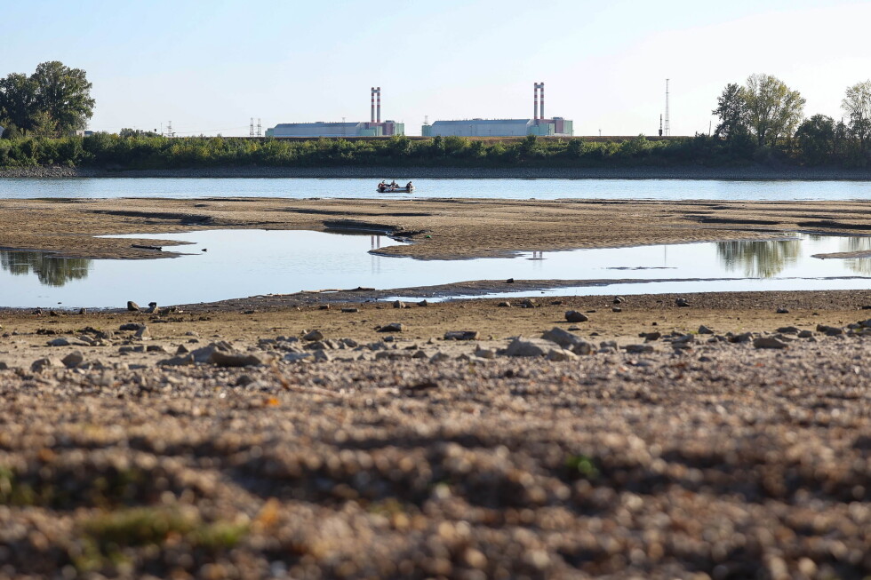
Hungary braces for a full shutdown of the Paks nuclear plant as the Danube River hits record lows
BUDAPEST, Hungary — A historic unprecedented event is set to unfold in Hungary’s energy sector this week, as the country’s sole nuclear power plant will power down completely for the first time in its 40-plus year operational history, driven by crippling drought that has pushed Danube River water levels to all-time lows. Prime Minister Péter Magyar confirmed the development during an on-site press conference at the Paks facility Friday, warning that the plant could remain offline for multiple weeks with no meaningful rainfall forecast to reverse the river’s steady decline.
Located roughly 90 kilometers south of Budapest, the Soviet-built, four-reactor Paks plant already operates at less than 50% of its standard generating capacity. Currently producing just 965 megawatts of electricity, far below its typical 2,000 megawatt output, the facility relies on Danube water to cool its active reactors. With the river dropping to unprecedented lows, the plant’s pumping infrastructure can no longer draw enough cooling water to maintain safe operations.
Magyar outlined that further gradual output cuts would begin later Friday, with a full shutdown of the entire facility expected to be completed by either Tuesday or Wednesday. The prime minister emphasized that the controlled shutdown will follow all strict safety protocols, stressing there is no elevated risk to public safety or surrounding ecosystems from the planned outage.
For context, Paks supplies nearly half of Hungary’s total annual electricity generation, making its impending 44-year first shutdown a major test of the country’s energy stability. The crisis is just the latest symptom of a months-long prolonged drought that has gripped Hungary and much of Central Europe, hammering tourism, agriculture, and industrial operations while forcing communities to confront the tangible impacts of accelerating climate change. Current meteorological projections offer no immediate relief: no significant precipitation is forecast in the region for the coming days, and even weeks, meaning Danube water levels are not expected to rebound anytime soon.
Magyar noted that over the past two decades, Danube water levels have only risen during the month of August three times. Current projections indicate the water level at Paks could drop as low as negative 144 centimeters, a measurement that sits far below the 2018 previous record low of negative 98 centimeters. It is important to clarify that negative readings do not mean the river is dry; rather, they indicate the water level has fallen below the gauge’s standard zero reference point. Per Magyar, a full plant shutdown is triggered when levels drop to negative 134 centimeters.
To mitigate potential energy shortages, the Hungarian government has issued a formal request to large energy-intensive companies to voluntarily cut their electricity consumption, particularly during peak demand hours between 5 p.m. and 10 p.m. So far, the country’s leading energy conglomerate MOL has already pledged to slash its power usage by 65 megawatt-hours, representing a 40% reduction from its typical consumption levels.
Beyond asking private firms for cooperation, Magyar announced additional energy conservation measures from the government: his political bloc has recommended suspending upcoming parliamentary sessions scheduled for Monday and Tuesday to cut unnecessary energy use, and he has issued an order requiring all state institutions to shut off all decorative outdoor and indoor lighting by Monday at the latest.