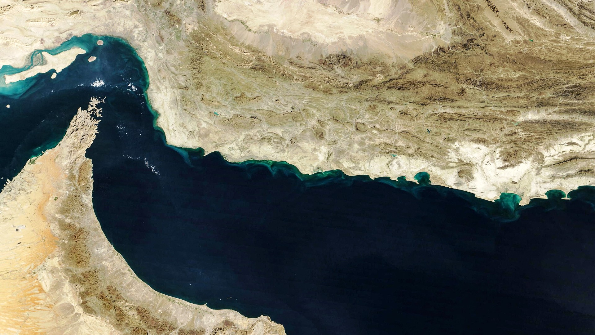
In the wake of the February 28 joint US-Israeli strikes on Iran and Tehran’s subsequent retaliatory attacks across the Persian Gulf, a largely unseen battle has emerged over public access to high-resolution commercial satellite imagery of the region, raising profound questions about transparency, press freedom, and accountability during wartime.
Weeks after the initial strikes, leading US commercial satellite provider Planet Labs first implemented a four-day delay for releasing imagery of the Gulf. That delay was quickly expanded to 14 days and extended to cover most of the Middle East, before the company enacted an indefinite restriction on high-resolution imagery of the region in early April, following a formal request from the US government. Today, the most recent publicly available commercial imagery of the Gulf dates back to March 9, with the company stating its decision was made in coordination with US officials and outside experts. But independent open-source journalists and analysts warn the new controls amount to a growing pattern of censorship that undermines public understanding of conflict.
The official rationale for the restrictions is that unregulated release of high-resolution imagery could fall into hostile hands and be used to target US troops or allied infrastructure in the region. Industry experts acknowledge that a limited two-week delay addresses this hypothetical risk, but note there is no comparable justification for a permanent freeze. While Planet Labs rolled back some restrictions, specifically for imagery of Iran, on July 1, most limits covering the Gulf remain in place.
Critics also point out that the core national security argument falls apart on closer inspection: many major powers that the US classifies as adversaries already maintain their own independent satellite surveillance networks. Iran, for example, operates its own domestic Earth observation satellites launched via Russian Soyuz rockets, and leaked documents from the Islamic Revolutionary Guard Corps indicate Tehran already supplements its capabilities with Chinese commercial satellite imagery. A 2026 investigation by the *Columbia Journalism Review* found no evidence that Iranian forces have ever used imagery from US satellite vendors, noting it is unclear why Iran would need to rely on US sources when it already has independent access to satellite data.
“The restrictions on US satellites are more about avoiding embarrassment or accountability than anything else,” explained Tom Brown, an independent open-source investigative reporter. Jake Godin, senior researcher at prominent open-source investigation collective Bellingcat, echoes this concern, saying the restrictions primarily make it more difficult for independent news outlets and non-governmental organizations to assess and verify damage from military strikes. This gap in reliable information undermines the global information environment as a whole and creates fertile ground for misinformation to spread, Godin added.
Bill Greer, co-founder of non-profit satellite initiative Common Space, argues the end result is a sharp reduction in transparency for events that impact populations on a global scale. “As satellite imagery is restricted, it is also becoming more politicized,” Greer noted, warning that even imagery that remains publicly available is often selectively released, which means images may remain technically accurate but fail to show the full context of events. Greer added this trend is being accelerated by both regulatory and financial pressures: the US government is not only able to directly order restrictions on commercial providers, it is also the largest customer for these companies, creating a powerful commercial incentive to comply with requests even without formal regulatory pressure. Many satellite firms are also publicly traded, facing constant pressure to prioritize revenue growth over public access, with Planet Labs seeing its stock drop 15 percent over the past six months amid ongoing regional volatility.
A striking paradox defines the current landscape: the total volume of Earth observation imagery collected globally is growing rapidly, even as public access to that data shrinks. Around 60 countries now operate or are building their own Earth observation satellites, ranging from Argentina and Canada to Turkey and India, alongside commercial providers based in China and Europe. But expanded data collection does not translate to expanded public access, Greer explained.
Satellite imagery has long been an irreplaceable tool for journalists, humanitarian groups, and independent analysts monitoring conflicts in hard-to-reach or dangerous regions, and it is often the most reliable way to contradict misleading or incomplete official government narratives. In one high-profile recent example, satellite imagery played a key role in confirming US responsibility for the bombing of a primary school in Minab, Iran, that killed 156 civilians including 120 children – an attack UNESCO labeled a grave violation of international humanitarian law. The US initially denied involvement, but the *New York Times* used satellite imagery to corroborate independent reporting that a US Tomahawk missile caused the blast, with the Pentagon still yet to conclude its official investigation months later.
Elsewhere, satellite imagery has been central to documenting the scale of destruction in Gaza during Israel’s ongoing war. A 2026 study from Oregon State University, using data from the European Space Agency’s Sentinel-1 network, found that more than 60 percent of all buildings in Gaza had been damaged or destroyed in the first year of the war – a proportion comparable to the 54 percent of buildings destroyed in the Allied bombing of Dresden during World War II. Satellite imagery has also been used to confirm other key details that governments attempted to hide: CNN used commercial imagery to identify the location where six US personnel were killed in an Iranian strike on Kuwait in March, days before the US government officially released any details, while the *New York Times* used satellite data to assess damage to US military sites across the Gulf, and open-source investigators used it to confirm Israel’s responsibility for the 2023 killing of Reuters journalist Issam Abdallah in southern Lebanon.
Without reliable, timely access to this imagery, independent investigators warn it will become far harder to gather evidence to challenge misleading official accounts. “Without safeguards, warzones risk going dark,” warned open-source intelligence analyst Alex Shaw.
To work around the new US restrictions, many journalists and analysts have begun turning to European and Chinese commercial providers as alternatives. Babak Taghvaee, a defense and open-source intelligence journalist, told Middle East Eye he repeatedly encountered restrictions when attempting to purchase imagery of locations inside Iran, and ultimately switched to commercially available Chinese satellite imagery. While this option works, it is significantly more expensive than comparable products from US providers, he noted.
The European Space Agency’s Sentinel program has also become a go-to alternative for many analysts, with Sentinel-1 emerging as the primary tool for conflict damage mapping in the Middle East in recent years, according to Shaw. But even ESA’s publicly funded scientific mission is not immune to US pressure: since July 13, the ESA has implemented a 24-hour delay for releasing imagery of key parts of the Middle East including the Strait of Hormuz, following a formal request from US officials to EU foreign policy chief Kaja Kallas. Greer said he was “a little confused, and highly concerned” by the move, noting “a public scientific mission, funded by the EU, is delaying imagery release due to US pressures.”
While Sentinel-2 remains a valuable workaround for many investigators, Godin noted its lower resolution is often insufficient to identify specific damaged or destroyed buildings, making it harder to verify damage to critical infrastructure like water systems in southern Lebanon when no on-the-ground photos or videos are available. Brown added that while the restrictions do not stop investigative work entirely, they make it far more difficult, forcing journalists to rely more heavily on user-generated content shared directly to social media, which often lacks the reliability and geographic scope of satellite imagery.
For dangerous or closed-off conflict zones, satellite imagery is often one of the only independent sources of information available to outside observers. “Conflict visibility depends not only on events on the ground but also on who controls access to satellite imagery,” Shaw said, noting that high-resolution satellite imagery is commonly shared for free after natural disasters, but restricted during conflicts, limiting scientific and humanitarian access. In Gaza, for example, Israel has banned all foreign journalists from entering the enclave since 2023, leaving international news outlets entirely dependent on satellite imagery and reporting from local on-the-ground journalists. The new restrictions have made continued monitoring of damage and destruction far more difficult, Godin said. “Where ground access is dangerous or impossible, journalists and researchers depend on satellite ‘eyes from above’, and there’s a very real danger they will be blindfolded,” Shaw added.
Longstanding US policy already creates structural inequities in satellite imagery access. Since 1997, US law has required American satellite providers to limit the resolution of publicly available imagery of Israel, making Israel the only country granted this special legal protection. The effect of this rule is visible even on popular public tools like Google Earth, where Israeli imagery is deliberately blurred: crosswalk stripes are unidentifiable and car edges are indistinct in Tel Aviv, while the same features are sharp and clear in comparable cities like Ankara, Turkey. This longstanding policy has raised concerns among journalists and human rights groups for decades, as it complicates both monitoring of civilian harm in Gaza and the expansion of illegal Israeli settlements in the West Bank, where high-resolution imagery would easily reveal new construction activity.
US policy has long granted the government “shutter control” over commercial satellite imagery: since 1992, US-based providers have required a government license to operate, giving officials the power to restrict public releases of imagery. While this power was rarely formally invoked in the past, the Pentagon bought up all available commercial imagery of Afghanistan in 2001 to prevent it from entering public circulation. Today, commercial incentives and regulatory pressure are increasingly pushing providers away from serving civilian customers including journalists and humanitarian groups. Greer noted this trend is not new, but “the shift towards defense contracts has dramatically increased in the past 18 months.”
In response to this growing gap, Greer and his team launched Common Space, a non-profit alternative to commercial satellite providers that aims to increase independent access to imagery as a transparency tool, built specifically to serve humanitarian groups, journalists, and academic researchers.
Greer emphasized the root of the problem is fundamentally political: “The public’s access to the information to make informed decisions is being limited for political reasons, in support of an unpopular war.”
Independent experts who rely on satellite imagery for their work remain deeply concerned about the long-term trajectory of access. Greer argued: “My biggest concern right now is that we will see further restrictions, and those restrictions will be codified into law and regulatory frameworks taking imagery access permanently out of the hands of the people that need it most to improve the lives of others.” Shaw agreed, warning that the recent wave of restrictions sets a dangerous precedent for future access to imagery, noting more blind spots are likely to emerge in US commercial satellite data. He pointed to the proposed 2027 Intelligence Authorisation Act, which would bar US government-contracted providers from publicly releasing “sensitive imagery that could harm national security” – a definition so broad it leaves significant room for political misuse.