Against a backdrop of escalating wildfire risk driven by climate change, artificial intelligence is rapidly becoming a critical new tool for early wildfire detection across fire-prone regions of the western United States, already proving its ability to stop blazes before they turn into catastrophic infernos.
The technology delivered a convincing proof of concept on a March afternoon in Arizona’s Coconino National Forest, when an AI-enabled monitoring camera picked up a faint plume of smoke that did not match the signature of cloud cover or wind-blown dust. After human analysts confirmed the anomaly, alerts were immediately dispatched to Arizona’s state forest service and Arizona Public Service (APS), the state’s largest electric utility. First responders arrived on scene quickly and contained the resulting Diamond Fire to just 7 acres (2.8 hectares), a fraction of the size it could have reached if detected hours later.
The Diamond Fire interception is far from an isolated success. As record-breaking high temperatures and record-low winter snowpack stoke fears of an extreme wildfire season, state agencies, power utilities and private tech firms have been rolling out AI monitoring systems across remote, high-risk regions where human spotters or casual 911 reports often fail to catch blazes in their earliest, most controllable stages.
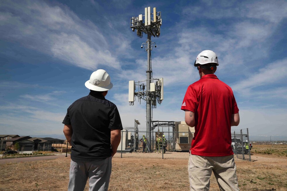
To date, APS already operates roughly 40 active AI smoke-detection cameras across Arizona, with expansion plans to bring the total to 71 by the end of the current summer. The Arizona Department of Forestry and Fire Management has also deployed seven of its own AI units, while Colorado-based utility Xcel Energy has installed 126 AI cameras, with goals to bring the system to all but one of the eight states it serves by the end of the year. In California, the ALERTCalifornia network operates more than 1,200 AI-integrated cameras that follow a detection model similar to Arizona’s system.
“Earlier detection means we can launch aircraft and personnel to it and keep those fires as small as we can,” explained John Truett, fire management officer for the Arizona Department of Forestry and Fire Management.
Unlike populated areas where residents often spot and report fires quickly, most high-risk unpopulated rural and remote zones lack consistent human observation. It is exactly these gap areas that AI monitoring fills, providing 24/7 surveillance that frequently outpaces 911 reports by a significant margin. According to Neal Driscoll, a geology and geophysics professor at the University of California, San Diego and founder of ALERTCalifornia, human oversight paired with ongoing AI training has kept false positive rates very low, and the technology consistently outperforms traditional 911-based detection timelines.
“It’s just the ones where we won’t get a 911 call for a long time, it is extremely helpful to have that AI always monitoring that camera,” said Brent Pascua, a battalion chief for the California Department of Forestry and Fire Protection (Cal Fire). “In many cases, we’ve started a response before 911 was even called, and in a few cases, we’ve actually started a response, went there, put the fire out, and never received a 911 call.”
Pano AI, one of the leading providers of this technology, integrates high-definition camera feeds, satellite data and artificial intelligence to scan for early smoke signs. Since launching in 2020, the company has seen surging demand for its systems, which are now deployed across 17 U.S. states plus Canada and Australia, serving forestry operators, public agencies and utilities including APS. In 2025 alone, the company’s technology detected 725 wildfires across the U.S.
“In many of these situations, we hear from stakeholders that the visual intelligence, the time, really, really gives them a head start and some of these could have taken off into hundreds if not thousands of acres,” said Arvind Satyam, Pano AI co-founder and chief commercial officer. APS meteorologist Cindy Kobold confirms the technology delivers an average 45-minute head start over the first incoming 911 call, a gap that can make the difference between a contained small blaze and a destructive megafire.
Satyam notes that the development of this technology was directly driven by the growing wildfire crisis fueled by climate change. Rising global temperatures from fossil fuel emissions have created drier, more fire-prone conditions that increase the frequency, intensity and speed of wildfire spread, and existing management tools have not kept pace. AI detection fills this gap, helping first responders act more effectively while protecting communities and critical infrastructure.
Despite its clear benefits, the technology still faces notable limitations and challenges. The most significant barrier for many agencies is upfront and ongoing cost: Pano AI charges approximately $50,000 per camera annually, a price that includes 24/7 monitoring support and fire risk analysis. False alarms remain a persistent issue, wasting valuable first responder time and resources even as training reduces their frequency. Even when the AI correctly identifies a fire, it cannot guide decision-making on response strategy – questions of when to deploy crews, whether to order evacuations, or how to prioritize resources still require human judgment and decision support systems.
In dense urban areas, where residents already report fires quickly, the technology offers less benefit, and it cannot keep pace with rapidly shifting fire behavior during extreme weather events such as the 2025 Los Angeles wildfires, when hurricane-force winds reshaped fire lines hourly. Proponents emphasize that AI is designed to complement, not replace, human firefighting teams.
“As the fire moves and shifts around, that’s where the human factor comes in and decides which tactics are best in fighting the fire. AI can only do so much,” Pascua said. “It just provides that real time information where we can make better decisions on the fire ground.”
AI’s role in wildfire management extends far beyond early detection, researchers note. The technology can already map optimal zones for controlled burns and vegetation thinning, and monitor air quality for early smoke signatures with far greater sensitivity than traditional consumer detectors. At George Mason University, professor Chaowei “Phil” Yang is leading a collaboration with California State University Los Angeles, the city of Los Angeles and NASA’s Jet Propulsion Laboratory to develop an AI system that forecasts wildfire spread and predicts which communities will face the worst smoke pollution impacts. The system will generate real-time maps to help agencies make faster, more effective decisions around evacuations, road and school closures, and public health warnings, with a target operational launch within three years.
Experts agree that AI integration in wildfire management is no longer a future concept – it is already deployed in active response, and its use will only expand in coming years. “AI in wildfires, it’s no longer just speculative. It’s really being used,” said Patrick Roberts, a senior RAND Corporation researcher who recently completed a study on innovation in wildfire management. “The future is AI everywhere, and the lines will blur between AI wildfire detection and just wildfire detection as the lines will blur in other areas of our life.”