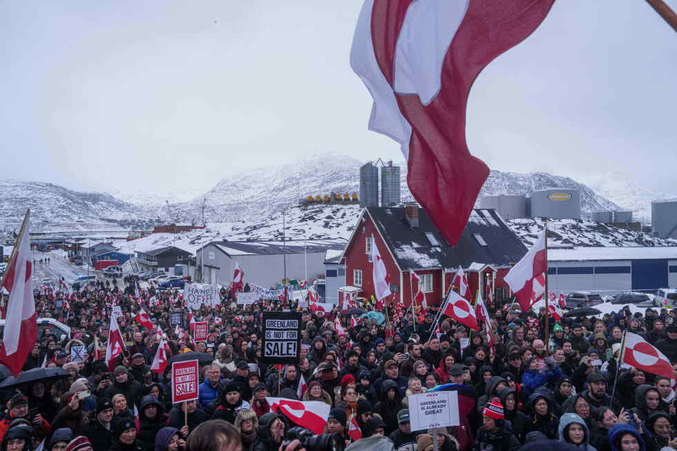
Diplomatic tensions are roiling the North Atlantic after former U.S. President Donald Trump shared a provocative, expansionist map on his Truth Social platform over the U.S. Labor Day holiday weekend, reigniting long-simmering concerns over his territorial ambitions for the region.
The map posted by Trump reimagines the entire North American continent as U.S. territory, extending the nation’s borders outward to include both Greenland, the self-governing Danish territory in the Arctic, and the North Atlantic island nation of Iceland. The map itself was shaded in the red, white, and blue of the U.S. flag, and Trump offered no accompanying explanation for the post.
The unprompted share was not out of character for the former president: it comes after years of repeated public musings from Trump about absorbing Canada as the 51st U.S. state, and consistent speculation about seeking U.S. control over Greenland. Tensions over his Arctic territorial rhetoric had already been rising through 2024, with Arctic nations on heightened alert after Trump ramped up his public comments on U.S. claims to Greenland earlier this year.
Danish Foreign Minister Lars Løkke Rasmussen called the post deeply concerning in comments to Denmark’s national public broadcaster DR on Tuesday. “It’s disturbing and, in many ways, completely inappropriate,” Rasmussen said. “It’s obviously a sign that the U.S. president still harbors some kind of maximalist vision in his own mind. We need to rein that in.”
The European Union moved quickly to shore up ties with Greenland just as Trump’s post circulated, offering the territory a new enhanced partnership and hundreds of millions of euros in targeted investment to counter growing uncertainty sparked by Trump’s repeated threats.
For Iceland, the map post amplified already elevated tensions that have roiled the island nation’s geopolitical landscape this year. Iceland’s Foreign Secretary Thorgerdur Katrín Gunnarsdóttir formally summoned U.S. Ambassador Billy Long to an official meeting, where she made clear that Trump’s Truth Social post was unacceptable, Iceland’s national broadcaster RÚV confirmed.
Relations between Iceland and Trump-aligned U.S. diplomatic leadership have been fraught for months. Earlier this year, Ambassador Long made a joke about Iceland becoming the 52nd U.S. state and himself as the territory’s governor, prompting thousands of Icelanders to sign a petition urging the prime minister to reject Long’s appointment. Long ultimately issued a public apology and took up his post in Reykjavik last month. Tensions rose again when Trump mistakenly name-checked Iceland four times during a speech discussing his plans for Greenland, despite the island sitting 180 miles off Greenland’s southern coast.
That incident pushed Iceland’s left-leaning coalition government to move up a planned national referendum on restarting long-stalled EU accession negotiations. The vote, held Aug. 30, was framed in part by supporters as a way to strengthen Iceland’s European ties and shield the nation from growing regional geopolitical instability. Ultimately, Icelandic voters rejected the measure, leaving accession talks stalled for the foreseeable future. Iceland is already a member of NATO, but has remained outside the European Union for decades.
Canada, which is prominently included as U.S. territory on Trump’s map, has also been a repeated target of the former president’s expansionist rhetoric. Trump has openly discussed making Canada the 51st state on multiple occasions, launched a trade war with the U.S. neighbor, and recently drew backlash for unilaterally renaming Lake Ontario — the Great Lake shared by Canada and the U.S. state of New York — as “Lake America.”
Over the same Labor Day weekend that the map was posted, Trump also added another provocative proposal to his list of naming changes: he suggested renaming the southwestern U.S. state of New Mexico to “New America.”
This report includes contributions from Associated Press correspondents Claudia Ciobanu in Warsaw and Darlene Superville in Washington.