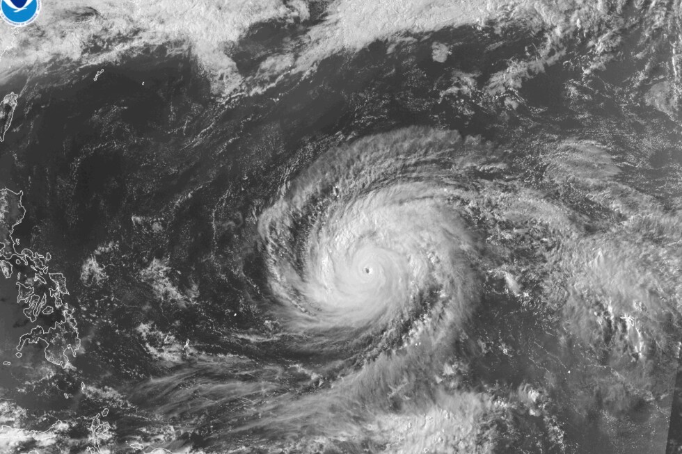
The strongest tropical cyclone recorded on Earth so far this year, Super Typhoon Sinlaku, is advancing rapidly toward remote U.S. island territories in the Western Pacific, with emergency officials bracing for catastrophic wind damage, widespread flooding, and destructive rainfall as the storm nears landfall. As of Monday, the storm had maintained sustained maximum winds of 173 miles per hour (278 kilometers per hour), placing it well within the super typhoon classification—an intensity category equivalent to a Category 4 or 5 Atlantic hurricane, reserved for the North Pacific’s most powerful systems. The Joint Typhoon Warning Center, which has tracked super typhoons in the region since 1947, projects Sinlaku will make landfall on the Northern Mariana Islands Tuesday, and will retain Category 4 or 5 strength even as it weakens slightly over the coming 48 hours. The storm’s projected path places the islands of Rota, Tinian, and Saipan directly at risk, while Guam, a major U.S. territory that hosts key American military installations, has already been placed under a tropical storm warning, with damaging winds expected to begin impacting the island as early as Monday. U.S. Coast Guard officials first issued high wind and flood warnings for Guam over the weekend, and military leaders have ordered service members to prepare for the storm and shelter in place—an urgent step that comes just two years after Typhoon Mawar knocked out power across Guam for days, causing widespread disruption. Over the weekend, President Donald Trump approved emergency disaster declarations for both Guam and the Northern Mariana Islands, unlocking federal resources to support local emergency response efforts and speed assistance to affected communities after the storm passes. Super typhoons are the highest classification for tropical cyclones that form in the northwestern Pacific, the ocean basin that consistently produces Earth’s most intense storm systems. To qualify as a super typhoon, a cyclone must produce sustained winds of at least 150 mph (240 kph), and more than 300 such storms have been recorded by the Joint Typhoon Warning Center since the naming convention was adopted in 1947. The approaching storm aligns with recent research finding that rising ocean temperatures driven by climate change are supercharging tropical cyclone intensity, increasing the risk of extreme damage when powerful storms make landfall.