分类: science

  • Diving robot explores mystery of France’s deepest shipwreck

    Diving robot explores mystery of France’s deepest shipwreck

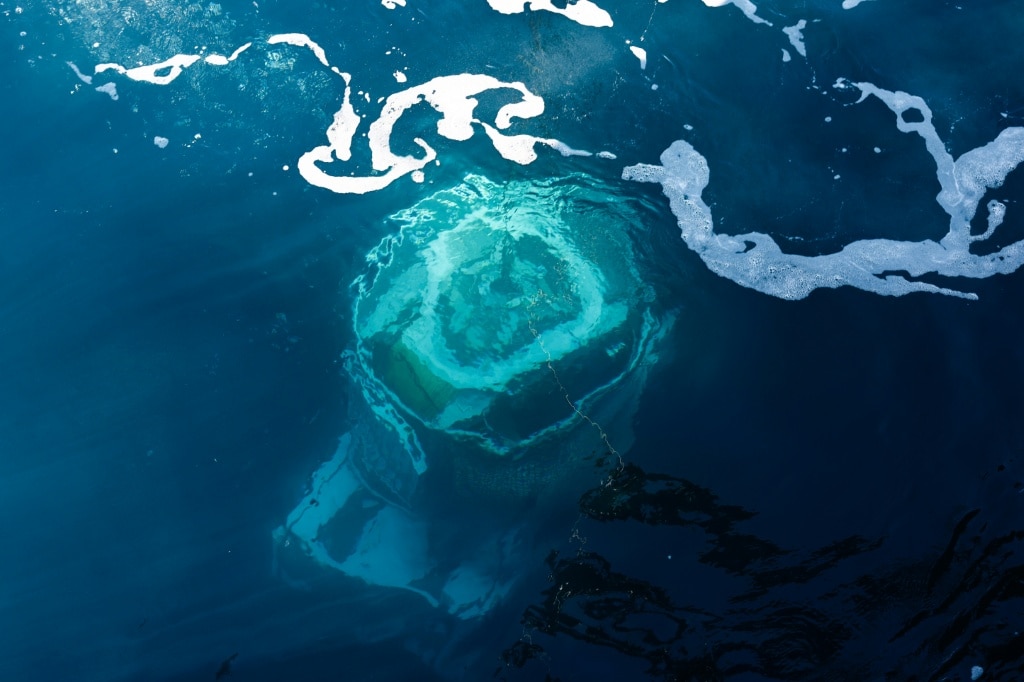
    Nearly 1.5 miles beneath the Mediterranean surface off the French Riviera, a remotely operated diving robot has begun the first archaeological investigation of France’s deepest recorded shipwreck, revealing a remarkably preserved 16th-century merchant vessel that could rewrite key details of early modern Mediterranean trade. The wreck, dubbed “Camarat 4”, was discovered entirely by accident last year during a routine French navy seabed survey off the coast of Ramatuelle, a short distance from the iconic resort town of Saint-Tropez. Though the deep location makes unauthorized access virtually impossible, navy officials have kept the exact coordinates of the site classified to protect the fragile archaeological remains from looting and disturbance.

    Before dawn on the first day of the mission, the expedition’s navy tugboat anchored above the wreck, carrying the specialized diving robot, a team of marine archaeologists from the French culture ministry’s underwater archaeology department, and two converted shipping containers that serve as mobile on-deck workspaces. Operated via a long fiber-optic cable linking the robot to the surface vessel, the craft — rated for dives as deep as 4,000 meters, well beyond the wreck’s 2,500-meter depth — began its slow descent, with every movement tracked in real time by a team of experts watching live monitoring screens. Navy officer Sebastien, who withheld his last name for security protocols, emphasized the extreme care required for the operation: every movement of the robot’s pincers must be deliberate and precise to avoid damaging fragile artifacts or stirring up clouds of sediment that would obscure visibility and disrupt the intact site.

    After a one-hour descent, the robot glided over the dark seabed, revealing a trove of well-preserved artifacts that have rested undisturbed for more than 400 years. High-resolution cameras captured clear footage of a cast-iron cannon, hundreds of intact ceramic pitchers and decorative plates, many adorned with hand-painted floral motifs, crosses and fish symbols. Over three hours of continuous scanning, the robot captured 86,000 individual images at a rate of eight frames per second; these images will later be stitched together to create a full, high-fidelity 3D model of the entire wreck site that researchers can study without disturbing the remains.

    Lead archaeologist Franca Cibecchini expressed surprise at the excellent condition of the site, noting that exceptional water clarity has made the survey far more productive than initial projections: “The visibility is excellent. You almost can’t tell it’s so deep.” Cibecchini and her team have concluded the vessel was almost certainly a merchant trading ship hailing from the Liguria region of northwest Italy, likely loaded with ceramic goods in the major trading ports of Genoa or nearby Savona before it sank en route to its destination. The team believes the ship was carrying a bulk cargo of glazed ceramics and raw metal bars when it went down.

    On the first day of excavation, the robot carefully maneuvered a small intact pitcher into a protective recovery cradle, moving with extreme slowness to avoid the cracks and breaks that ruin roughly one-third of all ceramics recovered from deep-sea shipwrecks, according to lead field archaeologist Marine Sadania. By the end of the first mission phase, the team successfully brought several jugs and plates to the surface, where they were transported to a dedicated marine archaeology laboratory in the southern French port city of Marseille for cleaning and analysis. Examining one recovered pitcher in the lab, Sadania pointed out the distinctive decorative work: dark blue outlines form rectangular panels across the rounded vessel, with some panels filled in turquoise and marked with saffron-yellow geometric symbols.

    Sadania emphasized the enormous historical significance of the find, noting that it fills a major gap in scholarly understanding of 16th-century Mediterranean maritime trade: “We don’t have very detailed texts about merchant ships in the 16th century, so this is a valuable source of information on maritime history.” As the first full-scale investigation of a shipwreck at this depth in French territorial waters, the mission also sets a new benchmark for deep-sea archaeological exploration, demonstrating how remotely operated robots can unlock historical secrets that were once permanently out of reach for researchers.
  • ‘Historic homecoming’ as endangered antelopes flown to Kenya from Czech Republic zoo

    ‘Historic homecoming’ as endangered antelopes flown to Kenya from Czech Republic zoo

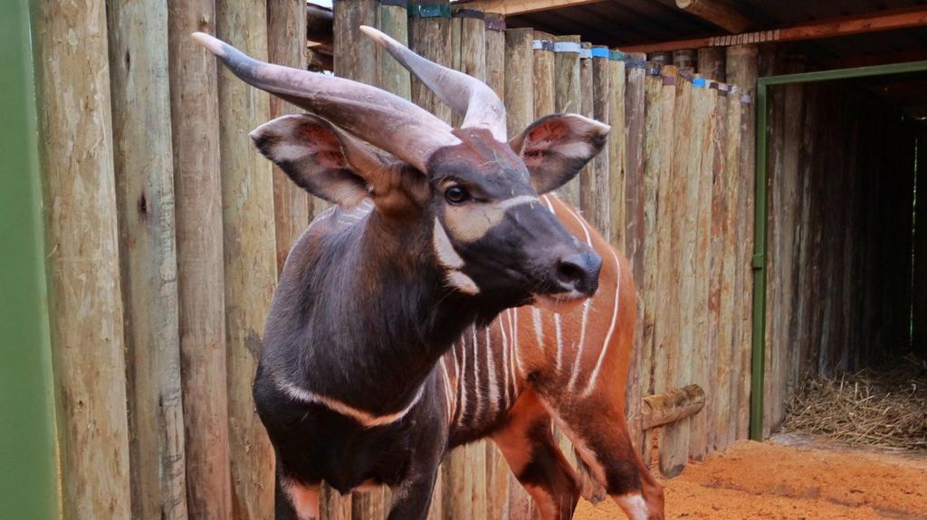
    In a landmark step toward reversing the decline of one of the world’s most endangered large mammals, four male mountain bongos – a rare antelope species endemic to Kenya’s central highland forests – have touched down in Nairobi after being transported from a Czech zoo, kicking off a new phase of a decades-long species recovery initiative.

    The rare arrivals were formally welcomed at Nairobi’s main international airport on Tuesday night by Kenya’s Cabinet Secretaries for Foreign Affairs and Tourism, alongside senior wildlife conservation officials. Following their entry, the antelopes were immediately transferred to the Mount Kenya Wildlife Conservancy (MKWC), a private protected reserve located at the base of Mount Kenya in central Kenya, where they will undergo a carefully structured acclimatization process before eventual release into the wild.

    Kenya Wildlife Service (KWS), the government agency leading the national recovery effort, framed the translocation as a historic homecoming that represents a meaningful milestone for the species’ long-term survival in its native habitat. Once numbering around 500 wild individuals in the 1970s, current estimates place the total remaining wild mountain bongo population at fewer than 100 – a lower count than the global population held in zoos and captive breeding facilities around the world, per KWS data.

    “This is a moment of hope, responsibility, and renewed commitment to securing the future of one of the world’s rarest large mammals,” said KWS Director-General Erustus Kanga in remarks following the arrival.

    Native exclusively to Kenya’s isolated highland forest ecosystems, the mountain bongo is a visually distinct large antelope defined by its rich chestnut-red coat, narrow vertical white stripes along its flanks, and striking long spiral horns. For decades, KWS and global conservation partners have collaborated on a coordinated program of captive breeding and repatriation to reverse steep population declines driven by habitat loss, poaching, and disease.

    The latest translocation builds on two prior large-scale repatriation efforts: an initial group of 18 antelopes was flown to Kenya in 2004 to launch the program, followed by 17 more repatriated from the Rare Species Conservation Foundation in Florida last year. Currently, around 400 mountain bongos are held in captive breeding facilities across North America, with additional populations housed in European zoos such as Prague Zoo, which supplied the four new arrivals.

    Before captive-bred bongos can be released into the wild, they must complete a multi-stage adaptation process designed to help them build the natural immunity required to withstand wild pathogens and environmental conditions. Ahead of their departure from the Czech Republic, Prague Zoo confirmed that each bongo would undergo acclimatization and continuous health monitoring as part of MKWC’s established breeding program, with the new individuals expected to boost the genetic diversity of Kenya’s growing founder population.

    By Wednesday morning, KWS confirmed via a social media post accompanied by photos of the new arrivals that the antelopes had reached their destination safely, and are “now settling in under close care.” The agency added that the translocation marks “a quiet but vital step in strengthening their population and securing their future.”

    The recovery effort has already shown promising early results: in 2022, MKWC told local media that previously repatriated bongos have successfully integrated into wild habitats and begun breeding naturally. That said, the program has faced setbacks, with some repatriated individuals succumbing to tick-borne diseases, a key risk for captive-bred animals new to wild ecosystems.

    Kenya’s national mountain bongo recovery plan, led by KWS, sets an ambitious target of growing the wild population to approximately 700 individuals by 2050, a goal that will require continued translocations of captive-bred bongos from global conservation institutions and expanded protection of the species’ native highland forest habitat.

  • Plans to clone over 100 yaks by 2028

    Plans to clone over 100 yaks by 2028

    A groundbreaking advancement in large mammal cloning for high-altitude livestock has set China on a path to expand its population of elite cloned yaks to more than 100 by 2028, marking a key step toward the industrial application of the new breeding technology, according to lead researchers on the project.

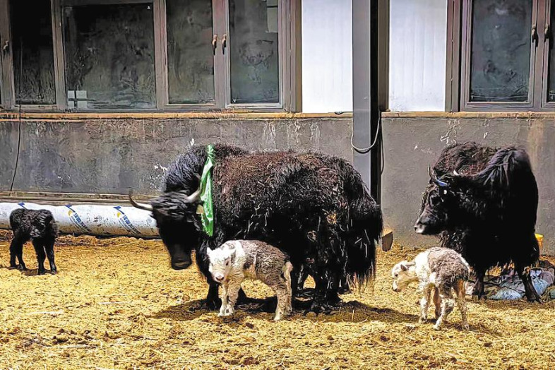
    The ambitious roadmap was unveiled by Fang Shengguo, a professor in the College of Life Sciences at Zhejiang University who heads the research initiative, coming shortly after China achieved its first successful batch cloning and natural delivery of 10 cloned yak calves in Damxung (Damshung) County, located in Lhasa, Tibet Autonomous Region. All 10 calves were carried to full term and born naturally between March 25 and April 15, a milestone that signals the technology has moved from isolated experimental success to small-scale, replicable commercial-ready production.

    Fang explained that the project will progress from its current “1-to-10” experimental phase to the “10-to-100+” scaling phase by 2028. By the end of the target period, the team aims to establish a core population of more than 100 superior cloned yaks, selected through whole-genome sequencing analysis, develop the first stabilized improved yak strain optimized for high-altitude plateau conditions, and formalize standardized commercial cloning and breeding protocols for the industry.

    This latest breakthrough builds on the 2025 birth of the world’s first cloned yak, named “Nam Co No 1”, which delivered the first proof that somatic cell cloning technology can be successfully applied to plateau-adapted livestock. “Nam Co No 1” has already demonstrated exceptional growth performance: it weighed 16.75 kilograms at birth, and reached 183.25 kilograms just nine months later, confirming the viability of the cloned breeding approach. To date, the research program has produced 11 healthy cloned yak calves and successfully established a stable somatic cell bank to support long-term breeding work.

    The technology developed by the team integrates two cutting-edge genomic and reproductive techniques: whole genome selection and somatic cell cloning. To identify the most desirable starting genetics, researchers sequenced the genomes of nearly 9,000 yaks across Tibet to pinpoint top-tier “seed yaks” that carry highly desirable traits, including faster growth rates, stronger reproductive performance, natural disease resistance, and exceptional adaptation to the extreme low-oxygen high-altitude environment. These elite genetic profiles are then replicated exactly through cloning, allowing for precise and rapid propagation of superior livestock that cannot be achieved through conventional breeding.

    Compared to traditional selective yak breeding, which typically takes 20 to 30 years to produce a stable improved strain, this new cloning-assisted method cuts the entire breeding cycle to just five years while enabling far faster expansion of high-quality breeding populations, Fang noted.

    Local industry leaders say this technological breakthrough solves decades-long challenges that have held back Tibet’s yak industry. According to Hu Ke, head of Damxung County, unregulated cross-breeding and environmental shifts have led to gradual degradation of native yak genetic resources over the past 30 years, resulting in widespread declines in average body size, adult weight, fertility, and disease resistance across regional herds. At the same time, conventional selective breeding methods have proven too slow and inefficient to reverse these declines at a pace that matches industry needs.

    “This breakthrough opens an entirely new technological pathway for rescuing and conserving native yak genetic resources, and for accelerating the expansion of improved breeds across the plateau,” Hu stated. He added that the achievement also fills a long-empty gap in cloning technology for large mammals at high altitudes, with broader implications beyond the yak industry: it supports plateau biodiversity conservation, creates new opportunities to boost the income of local herding communities, and aligns with regional ecological conservation goals for the Qinghai-Tibet Plateau.

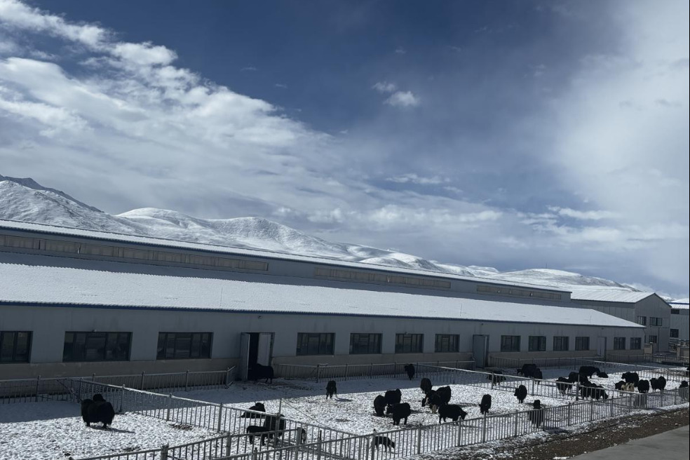
    To support the scaling of the technology, Fang’s team has laid out clear next steps: ramping up in vitro embryo production, expanding the pool of healthy surrogate cows, and developing customized forage systems tailored to the needs of the new improved yak strain. On April 27, a dedicated Yak Breeding and Germplasm Conservation Innovation Center was officially inaugurated at the project’s base in Damxung, which sits 4,300 meters above sea level and is currently home to all cloned yak calves.

    Moving forward, Damxung County will deepen industry-academia-research collaboration to accelerate the development of large-scale high-quality yak breeding bases and build a national-level innovation hub for high-altitude livestock breeding, Hu confirmed.

    As a species endemic exclusively to the Qinghai-Tibet Plateau, yaks are far more than livestock for the region: they are the primary source of livelihood for millions of local herding households, and play a critical role in maintaining the ecological balance of the plateau’s fragile high-altitude ecosystems.

  • New study finds ‘brake’ gene for Alzheimer’s

    New study finds ‘brake’ gene for Alzheimer’s

    A groundbreaking collaborative study led by scientists based in Shanghai has identified a key gene that acts as a natural brake on Alzheimer’s disease progression, a discovery made possible by the creation of the world’s first in vivo functional map of regulatory molecular switches in brain astrocytes. The findings, published April 25, 2026 on the official website of the top peer-reviewed journal *Science*, mark a major new direction for Alzheimer’s treatment and open new doors for research into a wide range of other devastating neurological conditions.

    The research brought together experts from three institutions: the Center for Excellence in Brain Science and Intelligence Technology under the Chinese Academy of Sciences, Shanghai Sixth People’s Hospital, and the Shanghai-based biotechnology firm Genemagic. Astrocytes, the most abundant non-neuronal cells in the human brain, play a critical role in supporting and protecting healthy neurons. When Alzheimer’s develops, however, these supportive cells undergo harmful dysfunction that speeds up neuronal death, a process that has been poorly understood by the scientific community until now.

    To unpack how astrocyte function is regulated, the research team developed an innovative in vivo high-throughput sequencing platform called iGOFPerturb-seq, which enables large-scale, simultaneous analysis of transcription factor function — the molecular ‘switches’ that control how cells behave. The team used engineered adeno-associated viruses targeted specifically to astrocytes to deliver nearly 1,000 different transcription factors into the brains of laboratory mice, with each transcription factor tagged with a unique genetic barcode to track its effect. Using single-cell sequencing technology, the researchers analyzed nearly 400,000 individual astrocytes in parallel, linking each cell’s functional state to the specific transcription factor it had received. This method allowed them to assemble the first ever complete functional map of astrocyte regulatory switches in a living organism.

    “This map is like a treasure map, helping scientists quickly identify candidate master regulators that can prevent astrocytes from becoming dysfunctional,” explained Zhou Haibo, the lead scientist of the study. From an initial pool of 39 promising regulatory molecules, the team identified Ferd3l, a transcription factor, as the most potent modifier capable of reversing astrocyte dysfunction in Alzheimer’s. To test the gene’s effectiveness, researchers activated Ferd3l in astrocytes of mouse models genetically engineered to develop human-like Alzheimer’s disease via intravenous injection. The treated mice saw dramatic improvements to their cognitive function, with performance on object recognition and maze tests nearly matching that of healthy control mice.

    Zhang Liansheng, the first author of the published study, noted that further analysis revealed how Ferd3l works: it helps dysfunctional astrocytes re-establish healthy, cooperative interactions with both neurons and microglia — the brain’s primary resident immune cells — restoring functional order to the inflamed, disrupted brain environment characteristic of Alzheimer’s.

    Unlike the majority of existing Alzheimer’s therapies, which focus exclusively on clearing beta-amyloid plaques from the brain, this new research targets astrocyte function, offering a complementary treatment strategy that could significantly improve long-term patient outcomes. In 2025, China launched an innovative beta-amyloid targeting therapy that has since been added to supplemental public health insurance coverage in major Chinese cities including Beijing, with clinical data showing sustained patient benefits even after treatment is stopped following successful plaque clearance.

    Beyond Alzheimer’s, the study’s biggest impact may lie in its open-access resource: the full functional map of astrocyte regulators will be made available to research institutions and pharmaceutical companies across the globe, enabling scientists to search for similar ‘brake’ genes for other incurable neurological disorders including Parkinson’s disease and amyotrophic lateral sclerosis (ALS). The research also establishes a large library of potential new drug targets for a wide range of neurological conditions, accelerating the development of next-generation therapies for currently untreatable brain diseases.

  • China clones 10 healthy yaks in livestock breeding breakthrough

    China clones 10 healthy yaks in livestock breeding breakthrough

    In a major milestone for agricultural science and high-altitude livestock improvement, Chinese researchers have successfully produced 10 fully healthy cloned yaks, a first-of-its-kind breakthrough that promises to reshape traditional yak breeding practices across the Qinghai-Tibet Plateau. The successful births of all 10 cloned calves took place between March 25 and April 2026 at a specialized breeding base located in Damshung county, Lhasa, in the Xizang Autonomous Region. According to official announcements from the county, every cloned yak was carried to full term and delivered through natural birth, with no reported health complications for the new calves.

    The cloning project was led by a research team from Zhejiang University, headed by lead researcher Fang Shengguo. The work relies on an indigenous, self-developed somatic cell cloning technology that creates exact 1:1 genetic replications of high-performing parent yaks. Prior to this breakthrough, conventional selective breeding for desired yak traits took approximately 20 years to produce a stable, improved breed. This new cloning technology cuts that waiting period dramatically, reducing the breeding cycle to less than five years.

    Beyond accelerating the development of improved yak breeds, the breakthrough also addresses a longstanding challenge facing local yak herds: gradual genetic decline that has reduced productivity and hardiness in regional populations over generations. By replicating the genetics of the strongest, most productive native yaks, the technology provides an effective tool to reverse this decline and preserve valuable native yak genetic resources.

    Yaks are a foundational livestock species for communities across the Qinghai-Tibet Plateau, providing meat, milk, fuel, and transportation for local herder populations, and supporting the livelihoods of millions of people living in high-altitude regions. This scientific advance is expected to deliver widespread economic and livelihood benefits to Xizang and other high-altitude pastoral areas, boosting the sustainability of local livestock industries while supporting conservation of the unique plateau ecosystem.

  • China builds integrated space-air-ground-sea environmental monitoring network with 150 satellites: ministry

    China builds integrated space-air-ground-sea environmental monitoring network with 150 satellites: ministry

    China has established a groundbreaking, fully integrated space-air-ground-sea ecological and environmental monitoring network that draws on data from approximately 150 satellites, the country’s Ministry of Ecology and Environment has announced. The development was revealed during a press conference held on Monday by Zhang Dawei, director of the ministry’s ecological and environmental monitoring department, who centered remarks on a new high-precision greenhouse gas detection satellite launched into orbit on April 17.

    This newly launched satellite carries five cutting-edge scientific instruments, including a lidar system and a hyperspectral greenhouse gas monitor. With this technology on board, Zhang explained, China has become the first country in the world to achieve integrated active and passive greenhouse gas detection from space. The satellite is capable of carrying out large-scale, high-accuracy monitoring of major greenhouse gases and key gaseous pollutants across the entire globe, marking a major milestone in the evolution of China’s modern ecological and environmental monitoring infrastructure, Zhang emphasized.

    Currently, the Ministry of Ecology and Environment serves as the lead operational user for eight dedicated environmental and atmospheric satellites, and maintains coordination agreements to access data from more than 140 additional commercial and civilian satellites across the country. Zhang noted that together, this fleet of satellites is equipped with multispectral sensors featuring a broad range of wavebands and short orbital revisit cycles, enabling the ministry to complete a full-coverage ecological “health check” every two months across 3.3 million square kilometers of national nature reserves and protected areas falling within China’s ecological conservation red lines.

    Beyond inland protected areas, the integrated monitoring system also conducts quarterly systematic scans of 21,000 kilometers of China’s mainland coastline and 100,000 square kilometers of its adjacent coastal waters. These scans allow authorities to rapidly identify human-caused ecological damage and illegal encroachment on protected coastal ecosystems.

    In addition to broad-area regional scanning, the satellite fleet also carries hyperspectral sensors designed for targeted, high-precision detection. These sensors can accurately resolve atmospheric chemical components and provide quantitative measurements of trace harmful gases including ozone, nitrogen dioxide and formaldehyde, delivering critical data that supports evidence-based air pollution control efforts.

    On a global scale, the network’s sensors can pinpoint the exact location of methane leaks from oil and gas extraction sites, coal mines and municipal landfills, tracing pollutant emissions directly to individual responsible facilities. Completing the system’s robust capabilities, many satellites in the fleet are equipped with radar instruments that enable all-weather, 24/7 monitoring operations that do not depend on natural light and are unaffected by cloudy or severe weather conditions.

  • Archaeologists at Pompeii use artificial intelligence to reveal the face of one of the victims

    Archaeologists at Pompeii use artificial intelligence to reveal the face of one of the victims

    Nearly 2,000 years after Mount Vesuvius’ catastrophic eruption smothered the ancient Roman city of Pompeii in ash and pumice, archaeologists have achieved a groundbreaking first: leveraging artificial intelligence to digitally reconstruct the face of one of the disaster’s victims. The project marks a transformative intersection of cutting-edge technology and classical archaeology, offering fresh, human-centered insight into one of the most iconic natural disasters in recorded history.

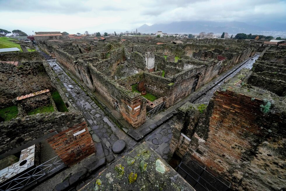
    The reconstructed portrait belongs to an elderly man, one of two fleeing victims unearthed during excavations near Pompeii’s Porta Stabia necropolis, located just outside the ancient city’s defensive walls. Archaeologists determined the man died in the early stages of the AD 79 eruption, when heavy volcanic debris first began raining down on Pompeii as residents scrambled to escape toward the nearby Italian coast.

    Archaeologists found the man’s remains alongside a collection of personal belongings that paint a vivid picture of his final minutes. He clutched a terracotta mortar, which researchers interpret as an improvised shield against falling lapilli — small, sharp volcanic stones that bombarded the city in the eruption’s opening phase. This detail aligns with ancient historical accounts, including the firsthand writings of Roman chronicler Pliny the Younger, who recorded that Pompeii’s residents used everyday objects to protect themselves as ash and debris blanketed the settlement. The victim also carried a small oil lamp, a tiny iron ring, and 10 bronze coins, artifacts that add tangible context to both his final flight and daily life in Pompeii before catastrophe struck.

    The collaborative project was led by the Pompeii Archaeological Park in partnership with researchers from the University of Padua, built on detailed archaeological survey data collected during recent excavations. To build the realistic portrait, the team combined AI-powered analysis with specialized photo-editing techniques, which translated structural data from the victim’s skeleton and surrounding archaeological context into an accurate, lifelike human likeness.

    Pompeii, a UNESCO World Heritage Site located near modern-day Naples, has captivated archaeologists and the public for centuries since its rediscovery. The volcanic ash that buried the city preserved entire buildings, art, and even the remains of inhabitants in extraordinary detail, creating an unparalleled snapshot of Roman life in the first century AD. Now, researchers say AI is unlocking new ways to engage with that vast archive of historical material.

    “The vastness of archaeological data is now such that only with the help of artificial intelligence will we be able to adequately protect and enhance them. If used well, AI can contribute to a renewal of classical studies,” Gabriel Zuchtriegel, director of the Pompeii Archaeological Park, explained in an official statement. Beyond advancing academic research, the project’s core goal is to make archaeological work more accessible and emotionally resonant for the general public, all while upholding rigorous scientific standards, the team confirmed.

  • Camera trap shows Sumatra orangutan using a canopy bridge to cross a public road in Indonesia

    Camera trap shows Sumatra orangutan using a canopy bridge to cross a public road in Indonesia

    For the first time ever, a wild Sumatran orangutan has been recorded crossing a busy public road via a purpose-built artificial canopy bridge, a landmark breakthrough for conservation efforts protecting this critically endangered species, Indonesian environmental leaders announced Monday.

    Decades of rapid economic and infrastructure development across Sumatra have gnawed away at the ancient jungle habitats that orangutans depend on, splitting once-contiguous wild populations into isolated, vulnerable groups and raising the frequency of deadly human-orangutan conflicts as hungry or displaced primates enter settled areas. This latest milestone comes from conservation work focused on a high-stakes stretch of infrastructure in North Sumatra’s Pakpak Bharat district, where the Lagan–Pagindar road serves as a critical lifeline connecting remote local communities to schools, medical care and government services. When the road was upgraded in 2024, the expansion widened the gap in the forest canopy, completely eliminating the natural tree-to-tree crossings that arboreal orangutans rely on to move between forest patches. The road now cuts the region’s estimated 350 wild orangutans into two completely disconnected groups, separated between the Siranggas Wildlife Reserve and the Sikulaping Protection Forest.

    “Development was necessary for people,” explained Erwin Alamsyah Siregar, executive director of Indonesian conservation non-profit Tangguh Hutan Khatulistiwa (TaHuKah). “But without intervention, it would have left orangutans trapped on either side.”

    Working in partnership with the Sumatran Orangutan Society (SOS) and local and national government agencies, TaHuKah rolled out a low-cost, targeted solution: five rope canopy bridges suspended between mature trees on opposite sides of the road, designed to let tree-dwelling wildlife cross safely above moving vehicle traffic. Each bridge was sized and reinforced to support the weight of orangutans— the world’s largest tree-dwelling mammal—and motion-activated camera traps were installed at every site, placed after extensive surveys mapping orangutan nesting sites, forest cover and local wildlife movement patterns. A long-term monitoring program, including regular anti-encroachment patrols, was also put in place to protect the corridor.

    Conservationists waited two full years for the first orangutan to use the crossing. In the months after installation, smaller arboreal species were the first to test the structures: squirrels, langur monkeys and macaques were followed by gibbons, a encouraging sign that the bridges were viewed as safe. Over time, the young male orangutan that would eventually make the crossing gradually acclimated to the structure: building sleeping nests near the bridge edge, lingering to observe the crossing and testing the rope’s stability repeatedly before committing to the full traverse.

    “They observe,” Siregar said. “They don’t rush. They watch, they try, they retreat. Only when they’re certain it’s safe do they move.”

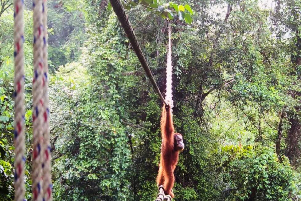
    The brief, historic crossing was captured by the motion-activated camera, which recorded the young orangutan pausing at the forest edge, gripping the bridge rope with deliberate care before stepping out over the open road. Halfway across, it paused to glance down at the traffic below before completing the crossing to the opposite forest. Conservationists emphasize this is the first documented case of any Sumatran orangutan using an artificial canopy bridge to cross a public road. While orangutans have used similar structures to cross rivers and private industrial forest roads elsewhere, busy public roads—with their constant noise, vehicle movement and unpredictability—present a far larger barrier and greater risk to the shy primates.

    For the long-term survival of Sumatran orangutans, reestablishing habitat connectivity is a critical priority. Isolated populations face extreme risks of inbreeding, genetic decline and eventual population collapse, while restored connectivity allows orangutans to access new food sources, find mates and maintain genetically healthy, resilient populations. Once widespread across much of southern Asia, orangutans now survive only on the Indonesian islands of Sumatra and Borneo. Current conservation data puts the total wild Sumatran orangutan population at fewer than 14,000 individuals, alongside just 800 Tapanuli orangutans and roughly 104,700 Bornean orangutans, all three species classified as critically endangered by the International Union for Conservation of Nature.

    “This was the moment we had been waiting for,” Siregar told the Associated Press. “We are very grateful that the canopy here provides benefits for orangutan conservation efforts.” Conservation teams now hope this pioneering crossing will encourage more orangutans to use the bridges, and that the successful model can be replicated in other fragmented orangutan habitats across Sumatra and Borneo to reduce extinction risk for the species. “These bridges allow orangutans to move, to mix, to maintain healthy populations,” Siregar said. “It reduces the risk of extinction.”

  • The threat of light pollution puts the world’s darkest skies in the Atacama Desert at risk

    The threat of light pollution puts the world’s darkest skies in the Atacama Desert at risk

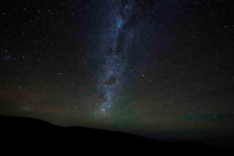
    Tucked into northern Chile, the Atacama Desert — widely recognized as the driest terrestrial landscape on the planet — offers one of the clearest unobstructed views of the cosmos available anywhere on Earth. For first-time visitors, the experience of gazing up at its night sky is transformative: eyes adjust slowly to the profound darkness, first picking out faint pinpricks of light, then brighter stars, until entire galaxies stretch out in full view, visible to the naked human eye.

    This extraordinary stargazing environment is the product of a rare confluence of natural conditions: extreme aridity, high elevation, and, most critically, geographic isolation far from the glow of urban light pollution. This combination has turned Atacama into the global gold standard for ground-based astronomy, hosting more of the world’s largest and most advanced astronomical observatories than any other region on Earth.

    “The conditions in the Atacama Desert are unique in the world,” explained Chiara Mazzucchelli, president of the Chilean Astronomical Society. “There are more than 300 clear nights per year, meaning no clouds and no rain.”

    Today, the desert’s nearly 41,000 square miles of open, high-altitude terrain are home to nearly 30 separate astronomical research sites, most run by international scientific collaborations. Dubbed “Photon Valley,” this concentrated corridor of cutting-edge observation facilities draws thousands of scientists from across the globe annually, all pursuing answers to fundamental questions about the origins of the universe. Even with the region’s popularity, access is highly competitive: Julia Bodensteiner, an assistant professor at the University of Amsterdam and a visiting researcher at the European Southern Observatory’s (ESO) Paranal Observatory, the flagship facility in Atacama, notes that only 20 to 30 percent of competing research proposals win observation time.

    While the harsh desert terrain — with altitudes pushing past 10,000 feet, where oxygen is scarce, scorching daytime heat gives way to freezing nighttime temperatures, and rocky ground makes travel difficult — poses challenges for human researchers, it is perfectly suited for astronomical observation. The region is currently host to the most ambitious ground-based telescope project in history: ESO’s $1.5 billion Extremely Large Telescope (ELT), scheduled for completion in 2028 at Paranal. With 798 individual mirrors and a total light-collecting area of nearly 1,000 square meters, the ELT will be 20 times more powerful than any existing leading optical telescope, and capable of producing images 15 times sharper than NASA’s iconic Hubble Space Telescope.

    For astronomers, the ELT promises to unlock breakthroughs that were previously unthinkable. “We should be able to see Earth-like planets in what we call the habitable zone, so basically the planets which are candidates towards life,” explained ESO astronomer Lucas Bordone. Data collected from Atacama’s observatories does not only advance our understanding of deep space; it also delivers critical insights for life on Earth, and research into the future of human exploration beyond our home planet. That makes protecting these sites a global scientific priority.

    But the world’s most valuable window into space is under growing threat. Last year, a proposed green energy complex just 6 miles from Paranal Observatory ignited a global dispute between the energy company developing the project and the international astronomical community. The proposal exposed a critical gap: Chile’s existing regulations designed to protect dark skies for astronomical research are lax, outdated, and unclear, leaving the region’s unique scientific assets vulnerable to unregulated industrial development.

    After widespread outcry from astronomers, physicists, and even Nobel laureates, the energy company canceled the project in January. But the risk of future development remains. The incident sparked a review of Chile’s environmental regulations governing protected astronomical zones, but scientists warn that no meaningful regulatory update has been enacted to prevent similar proposals from moving forward in the future.

    “We are working to ensure the new criteria are strict enough to guarantee that there will be no impact on astronomical areas,” said Daniela González, director of the Cielos de Chile Foundation, a non-profit founded in 2019 dedicated to preserving the quality of Chile’s night skies for research.

    Eduardo Unda-Sanzana, director of the Astronomy Center at the University of Antofagasta and a member of the ministerial advisory commission that delivered regulatory recommendations to the Chilean government after the energy project controversy, recalled how dramatically the Atacama has changed over the past two decades. “Twenty years ago, the Atacama Desert was ‘an ocean of darkness,’” he said. “It was just you and the universe.”

    Today, urban expansion, industrial growth, mining operations, and renewable energy development have turned the remote desert into a highly coveted territory, and balancing competing interests has grown increasingly difficult. Even small amounts of human activity can derail cutting-edge astronomical observation: at Paranal, researchers live in an underground residential facility designed to minimize their impact, with all windows covered, hallways kept dark, and outside movement limited to red-filtered flashlights to avoid even the faintest light pollution interfering with telescope data.

    The proposed energy project near Paranal posed multiple threats beyond light pollution: project construction and operation would have generated constant micro-vibrations, increased dust pollution, and disrupted atmospheric stability, all of which would have rendered high-precision astronomical observation impossible. As Itziar de Gregorio-Monsalvo, ESO’s Chile representative, put it: “If you place the ELT next to a city, it doesn’t matter that its diameter is 40 meters long. It’s just the same as having a tiny telescope.”

    History offers a stark warning of what is at stake. In the early 20th century, the first international heliophysics observatory in Chile — a major solar research station operated by the U.S. Smithsonian Institution — was forced to permanently close in 1955 after expanding mining operations in the area created irreversible pollution that made research impossible.

    “We’ve had 70 years to learn from history and avoid repeating those same mistakes,” Unda-Sanzana said. Despite the high-profile cancellation of last year’s energy project, he warned that without updated, enforceable protections, the Atacama’s irreplaceable astronomical resource remains at risk: “Despite all the media hype in 2025, we find ourselves exactly where we were last year.”

  • More minerals found in lunar samples

    More minerals found in lunar samples

    On China’s 11th National Space Day, marked on April 24 2026, the China National Space Administration announced a groundbreaking scientific breakthrough at a celebratory event in Chengdu, Sichuan province. Chinese researchers have confirmed the discovery of two previously unknown minerals from lunar soil and rock samples retrieved by the country’s Chang’e 5 mission more than five years ago, marking a major milestone in humanity’s exploration of the moon.

    Both new minerals, officially named magnesiochangesite-(Y) and changesite-(Ce), have received formal approval from the Commission on New Minerals, Nomenclature and Classification of the International Mineralogical Association, the global authoritative body for mineral classification and registration. This discovery brings the total number of new lunar minerals identified by Chinese scientists to three, following the first Chinese-discovered lunar mineral, changesite-(Y), which was documented in 2022. Globally, these two new entries are the seventh and eighth lunar minerals ever confirmed from samples physically brought back to Earth from the moon.

    Magnesiochangesite-(Y) was isolated and characterized by a research team headed by Li Ziying, a senior geoscientist at the Beijing Research Institute of Uranium Geology of the China National Nuclear Corp. The tiny mineral grain was found embedded within basalt clasts from Chang’e 5’s drill-collected lunar samples, with particle sizes ranging between just 2 and 30 micrometers — small enough to be invisible to the naked human eye.

    The second new mineral, changesite-(Ce), was discovered by a team led by Hou Zengqian, an academician of the Chinese Academy of Geological Sciences. Notably, researchers have identified this mineral not only in the Chang’e 5 collected samples, but also in a lunar meteorite that naturally fell within China’s national territory. Changesite-(Ce) forms along the margins of other lunar crystals including anorthite, ferrosilite, fluorapatite and ilmenite, with grain sizes measuring approximately 3 to 15 micrometers.

    Per the China National Space Administration’s official statement, both newly identified minerals are rare earth phosphate minerals trapped within the fine particulate fraction of lunar soil. Both possess delicate, unique crystalline structures that have no matching analog among naturally occurring minerals found on Earth. Along with the previously discovered changesite-(Y), the two new minerals belong to the merrillite group — a category of phosphate minerals commonly detected in extraterrestrial samples from the moon, Mars and asteroids, but one that displays wide compositional variation and uneven distribution across different planetary bodies.

    The Chang’e 5 robotic mission, launched in late 2020, stands as one of the most significant deep-space exploration endeavors of the 21st century. The 23-day mission successfully returned 1,731 grams of lunar rock and soil to Earth, marking the first time any nation had collected fresh lunar samples in 44 years, following the Soviet Union’s final lunar sample return mission in 1976. With this achievement, China became the third country in history to successfully retrieve geological materials from the moon, after the United States and the former Soviet Union.

    Li Ziying, the lead researcher for the magnesiochangesite-(Y) discovery, noted that the Chang’e 5 landing site differs significantly from the sites visited by U.S. Apollo missions and Soviet Luna missions, with a much younger geological formation timeline. This difference means the Chang’e 5 samples hold unique chemical and geological characteristics not seen in previously collected lunar materials.

    “The discovery of magnesiochangesite-(Y) expands the global catalog of confirmed lunar minerals, and offers a new mineralogical reference point for research into the moon’s formation and evolutionary history, ancient lunar magmatic activity, and lunar chemical differentiation processes,” Li explained.

    Officials from the China National Space Administration emphasized that the new discoveries will provide critical empirical evidence for advancing deep research into the moon’s bulk material composition, long-term geological evolution, and early origins. These findings represent a landmark achievement in integrating large-scale deep-space exploration infrastructure with cutting-edge basic scientific research, and carry major significance for advancing humanity’s collective understanding of the moon and the broader solar system.