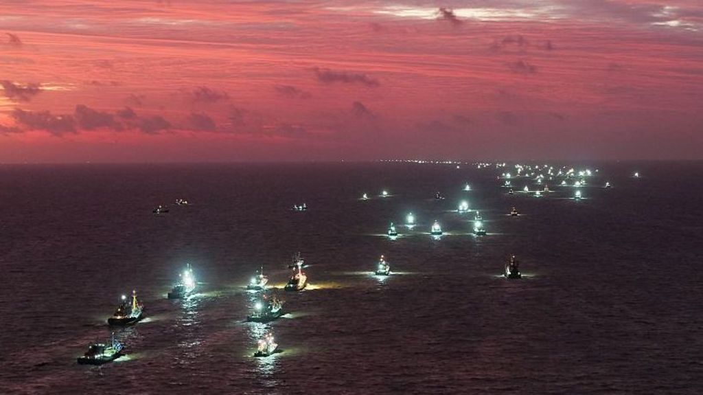
For coastal communities stretching across the Philippines, Taiwan (China), mainland China, and Japan, navigating seasonal severe weather has long been an embedded part of daily life. Yet the past several months have brought a historically unusual stretch of catastrophic, often erratic storm events, supercharged by one of the most powerful El Niño events on record, leaving dozens dead, major international airports temporarily shuttered, and vast swathes of agricultural land and critical public infrastructure destroyed across the region. In October, Taiwan (China) prepared for a near-direct hit from Typhoon Champi, a Category 5-equivalent storm large enough to cover the entire 23-million resident island, packing sustained wind speeds of up to 295km/h (193mph) strong enough to level residential structures and generate life-threatening storm surges. Though the system ultimately skirted the island without making formal landfall, deluging local communities with heavy rainfall, its ripple effects extended across the broader region: hundreds of cross-border flights were cancelled across Hong Kong, Taiwan (China), and Japan, coastal highways in the Philippines’ Batanes archipelago were closed due to towering waves crashing over sea walls, and 15,000 households in Japan’s southern Okinawa Prefecture lost full electrical power. El Niño is a naturally recurring climatic phenomenon driven by pooled warm surface waters in the eastern Pacific and shifting global wind patterns that trigger cascading extreme weather events worldwide, typically occurring every 2 to 7 years and persisting for roughly 12 months. The UK Met Office has classified the 2025-2026 El Niño event as the strongest in living memory, with projections indicating it will continue through at least February or March of the coming year. The months leading up to the current period of peak activity saw a relentless string of unusual storm events across the region: in June, Japan faced two simultaneous approaching systems, Typhoon Mekkhala and Severe Tropical Storm Higos, that forced nearly 1 million residents on its eastern coast to evacuate. In July, Tropical Storm Narra swept across southern China’s Guangxi Zhuang Autonomous Region, submerging entire rural villages and displacing tens of thousands of local residents. August brought Super Typhoon Dolphin, which churned across the Pacific Ocean for 16 consecutive days before making landfall in eastern China, triggering widespread destructive flooding and resulting in dozens of recorded casualties. Just weeks later, Typhoon Saudel made landfall in three separate southeastern Chinese cities over a seven-day window, paralyzing regional transport networks and prompting mass evacuation orders for thousands of at-risk residents. Official data from the Accumulated Cyclone Energy (ACE) index, a standardized metric that tracks the total combined intensity of all tropical cyclones in a given season, shows that the El Niño-heated Pacific Ocean is currently holding record levels of storm-generating energy, with the 2025 ACE reading for East and Southeast Asia projected to reach nearly double the 30-year historical average. The current El Niño’s alteration of global wind patterns is pushing storm formation hundreds of kilometers further east than usual, meaning developing typhoons spend far longer traveling over unusually warm open water, gaining far greater strength before reaching populated coastal zones. Ana Liza Solis, chief of the climatology division at the Philippines’ national weather service, described the current state of the Pacific Ocean at a September Manila press briefing as akin to a human body “burning with fever. It can go into convulsions soon.” Recent monitoring data underscores the severity of her warning: last month, equatorial Pacific sea surface temperatures tracked by the Japan Meteorological Agency hit 4°C above the long-term historical average, the highest anomaly recorded since formal record-keeping began in 1949, surpassing the previous 3.6°C record set in December 1997. China’s national climate agency has warned that these record ocean temperatures will continue to climb over the next three months, even as the region is already reeling from months of consecutive storm impacts. Adding to the unusual nature of this season, August’s Typhoon Chan-Hom defied decades of observed regional storm patterns by traversing Japan from east to west, rather than the typical south-to-north trajectory that local disaster response systems are calibrated to address. While Japan’s well-funded, highly prepared emergency management authorities were able to coordinate swift evacuations to minimize casualties, experts note such unanticipated storm paths would create far more dangerous, high-stakes scenarios for less resourced neighboring nations. A team of climate researchers led by Manila-based climatologist Rafaela Jane Delfino recently ran simulation models to measure how elevated ocean and atmospheric temperatures would amplify the impacts of historic catastrophic Philippine storms, including 2013’s Super Typhoon Haiyan (locally named Yolanda), which killed more than 6,000 people nationwide. Delfino described the study’s outcomes as “very, very scary findings”: the warmer atmospheric conditions driven by the current El Niño would increase total accumulated rainfall during such a storm by 26%, a devastating projection for a nation that already faces chronic annual flooding from monsoon rains and roughly 20 tropical cyclones per year. In recent years, widespread multi-day city-paralyzing flood events have pushed frustrated Filipino residents to stage public protests, calling out systemic corruption that they say has siphoned millions of dollars in public funding away from long-delayed flood control infrastructure projects. In a public post published via the University of the Philippines’ official website, Delfino emphasized that national and local government leaders must prioritize improved, granular understanding of evolving climate hazards to build more resilient frontline community defenses. Across the region, national authorities have rolled out immediate emergency preparedness measures: Japan’s government has advised all residents in typhoon-prone zones to stockpile at least several days of food and critical emergency supplies, and to secure all outdoor furniture and loose household items that could become deadly wind-borne projectiles during high-intensity storms. Chinese authorities have ordered local disaster management teams to complete full surveys of all high-vulnerability residential zones, and are rolling out system-wide upgrades to national typhoon early warning and real-time monitoring networks. The Philippines and neighboring Southeast Asian nations have rolled out targeted support for smallholder farmers, including subsidized fertilizer distributions, to mitigate projected sharp disruptions to staple food production, particularly rice harvests. However, long-term systemic adaptation planning remains uneven across the region. The United Nations Development Programme (UNDP) Asia-Pacific regional office recently issued a public warning that the window of opportunity for governments to implement proactive, long-term El Niño resilience measures is rapidly closing. “The severity of impact a community faces during an El Niño event is determined years in advance, by the choices made about where roads and residential settlements are zoned, how freshwater resources are managed, which populations are covered by formal social protection schemes, and whether public budgets are structured to absorb sudden climate shocks,” the agency noted in its official statement, adding: “Every El Niño tests the resilience infrastructure we have already built; this historic event must serve as the catalyst to build far more.”