The 2025 El Niño event is on track to become the most intense tropical Pacific warming event ever recorded, climate experts warn, bringing amplified extreme weather across every continent and accelerating the planet toward unprecedented temperature milestones that were not forecast to arrive for another 12 years. As the climate event stacks its warming effect on top of decades of human-caused greenhouse gas emissions, it is offering the world a shocking early preview of what average global conditions will look like by the end of the 2030s.
To understand the scope of the current event, it is first necessary to break down what El Niño actually is. The phenomenon is the warm phase of the El Niño-Southern Oscillation (ENSO), a natural recurring climate cycle that drives shifts in ocean temperatures and atmospheric patterns across the tropical Pacific. El Niño develops when the east-to-west blowing trade winds that normally push warm surface water toward Asia and Australia weaken temporarily. This allows the accumulated warm water to slump back eastward across the Pacific, rising to the surface off the western coast of the Americas.
When these above-average surface ocean temperatures persist for multiple months, they trigger increased storm activity and cloud formation over the central and eastern Pacific. These changes send ripple effects through global atmospheric circulation that reshape weather patterns on every continent, creating hotter, drier conditions in some regions and cooler, wetter conditions in others. “Stronger events mean that we can expect to see more of these expected El Niño impacts,” Michelle L’Heureux, head of the ENSO analysis team at the U.S. National Oceanic and Atmospheric Administration (NOAA) Climate Prediction Center, told Agence France-Presse, noting that while extreme impacts are likely, they are not guaranteed.
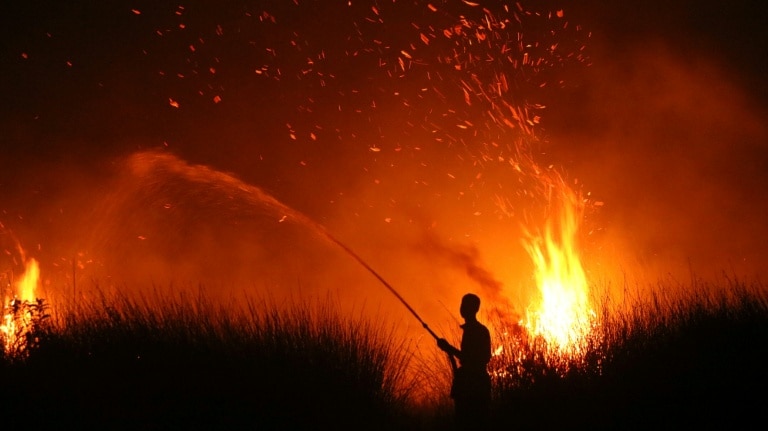
Some of these extreme impacts are already unfolding. In Indonesia, an extended, unusually intense dry season amplified by El Niño has created tinder-dry conditions that have allowed wildfires to consume hundreds of thousands of hectares of land, filling the region with toxic smoke and disrupting daily life.
Current data shows just how far outside historical norms this year’s event already is. According to the widely cited Climate Brink dashboard, which pulls data from NOAA’s network of satellite and buoy sea surface temperature readings, daily average temperatures in the key Niño 3.4 monitoring region of the tropical Pacific are already running 2.6 degrees Celsius above the 30-year historical average. Forecast data aggregated by the dashboard projects the event will peak this November with a 3.9 degree Celsius temperature anomaly — a full 0.9 degrees above the peak anomaly recorded during the 2015 El Niño event, the previous record holder.
This unprecedented warming has major implications for global average temperatures. The bulk of El Niño’s heat impact on global annual temperatures is usually felt in the year after it peaks, meaning 2025 will be a strong contender for the hottest year on record (currently held by 2024), while 2027 is all but certain to claim that title. Climate scientists Zeke Hausfather and Andrew Dessler calculate that this El Niño will add a temporary 0.3 degrees Celsius of warming on top of the long-term human-caused global warming trend. That will push 2027’s global average temperature to 1.76 degrees Celsius above pre-industrial levels — a level of warming that was not expected to become the annual average until 2037. “It’s kind of a preview of the future,” explained Dessler, a climate professor at Texas A&M University, noting that much of the extreme warming will be concentrated in the equatorial Pacific.
NOAA Senior Scientist Mike McPhaden, of the agency’s Pacific Marine Environmental Laboratory, shares a similar projection. “It’s not inconceivable that 2027 may top out at 1.7C above preindustrial levels” if current model forecasts hold true, he told AFP.
There is no single universal standard for measuring the strength of El Niño events, which has created some variation in how intensity is reported. In February 2025, NOAA adopted a new measurement standard called the Relative Oceanic Niño Index (RONI), which compares warming in the Niño 3.4 region to broader warming across the entire tropical belt to better capture the full ocean-atmosphere dynamics that drive ENSO impacts. While the absolute numbers from this new scale are lower, the overall ranking does not change: NOAA calculates there is a 69 percent chance this event will be the strongest recorded in data going back to 1950.
Climate scientists universally agree that long-term human-caused climate change is amplifying the harmful impacts of El Niño events. A warmer atmosphere holds more moisture, meaning rainfall events linked to El Niño are far more likely to turn into extreme, destructive flooding. At the same time, higher temperatures dry out soil in regions affected by El Niño-driven drought, deepening water scarcity and increasing wildfire risk.
While the link between climate change and amplified El Niño impacts is well established, there is less consensus on whether climate change is actually causing El Niño events themselves to grow stronger, though emerging evidence points to that conclusion. “Climate change may be amplifying the El Niño cycle itself,” NOAA’s McPhaden said.
McPhaden explained that warmer tropical Pacific seas make the trade winds that drive El Niño more sensitive to changes in ocean temperature, creating a tighter feedback loop that allows strong El Niño events to develop more quickly and reach higher intensities. He pointed to multiple lines of evidence supporting this conclusion: paleoclimate records from sources like coral skeletons, 19th-century instrumental temperature records, and modern climate modeling all show that the intensity of El Niño events has increased by roughly 10 percent over the past century.