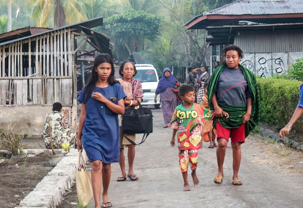
In the early hours of Saturday, a powerful 7.7-magnitude earthquake rattled the waters off Indonesia’s Flores Island, forcing thousands of residents to flee their homes in panic after national disaster authorities issued an urgent tsunami warning.
Witnesses with Agence France-Presse (AFP) reported that residents in Nagekeo Regency, the region closest to the quake’s epicenter, rushed toward higher elevation immediately after the sea pulled back from the shore — a well-documented natural precursor that often signals an incoming tsunami. Roughly an hour after the initial warning, authorities announced it had been lifted, though they maintained ongoing monitoring of sea conditions.
According to geological data from both United States and Indonesian seismic agencies, the shallow quake originated off Flores’ north coast, approximately 68 kilometers northwest of the coastal town of Ende. In the hours after the main tremor, the region was hit by a series of strong aftershocks, including one that registered a magnitude of 6.1.
Lukas Lotar, a 31-year-old hospital administrative employee based in the coastal town of Maumere, described the sudden chaos of the quake. “Suddenly it started to shake and I panicked,” he told AFP. “Patients also fled the hospital, the jolt was big. I saw some walls were cracked.”
Yohanes Babo, a 56-year-old Nagekeo resident, was at a local open-air market when the ground began to move. “The shaking was strong. Thankfully, we were already outside the house,” he said. “People were panicking, running here and there. We’re evacuating for the time being… and trying to get to the hills. My family is safe. No one was harmed.”
Indonesia’s national disaster management agency (BNPB) and the country’s Meteorology, Climatology, and Geophysics Agency (BMKG) quickly issued evacuation orders for at-risk coastal regions immediately after the quake. “We strongly urge our communities along the northern coast of Flores and in the southern parts, on the southern islands and across the southern region, to carry out self-evacuation immediately,” BNPB official Abdul Muhari told local broadcaster Kompas TV. He added that residents should move at least two kilometers inland or to elevated terrain that sits more than 10 meters above sea level to avoid potential flood risk.
BMKG earthquake and tsunami director Wijayanto — who, like many Indonesians, uses a single name — noted that early tsunami modeling showed potential for wave activity across East Nusa Tenggara, South Sulawesi, and West Nusa Tenggara provinces. The initial alert warned of waves ranging from 0.5 meters to 3 meters, but no large dangerous waves materialized. Authorities ultimately detected minor swells between 19 and 30 centimeters, and the warning was canceled. “We have ended (the tsunami warning) but we will keep monitoring the sea level,” Wijayanto confirmed.
On-the-ground reporting from AFP saw Maumere residents streaming toward higher ground, while local television footage showed hundreds of people in Nagekeo Regency gathering outside amid the rubble of damaged structures. As of the latest update, officials have not reported any fatalities or serious injuries from the event.
Indonesia sits along the Pacific Ring of Fire, a geologically active zone that circles the Pacific basin and produces frequent seismic activity, making the country no stranger to devastating quakes and tsunamis. In 2004, a 9.1-magnitude quake off the coast of Sumatra triggered a massive Indian Ocean tsunami that killed more than 220,000 people across the region, 170,000 of whom were in Indonesia. The Boxing Day disaster remains one of the deadliest natural disasters in recorded modern history. In 2018, a series of powerful quakes on the holiday island of Lombok and neighboring Sumbawa killed more than 550 people over the course of several weeks. Later that same year, a 7.5-magnitude quake and subsequent tsunami hit the Sulawesi city of Palu, leaving more than 4,300 people dead or unaccounted for.