In a landmark vote that addresses centuries of geographic bias in global mapping, the United Nations General Assembly has backed a plan to replace the ubiquitous but deeply flawed Mercator projection with a more geographically accurate map that properly reflects Africa’s true scale. The initiative, dubbed the “Correct the Map” resolution, was introduced by the West African nation of Togo and earned unified support from the 55-member African Union ahead of the vote. When the final tally was counted, 164 member states had thrown their support behind the measure, with major European powers France and the United Kingdom among the backers. The United States stood alone as the only country to vote against the resolution, while six other nations abstained from the vote.
For more than 450 years, the Mercator projection has dominated classroom walls, atlases, and popular world maps across the globe. Created in 1569 by Flemish cartographer Gerardus Mercator, the projection was originally designed to aid European mariners in navigating transoceanic trade routes and exploration voyages. Its enduring popularity stems from its unique ability to preserve straight lines of constant compass bearing, a feature that made it invaluable for 16th-century navigation. However, the projection carries a well-documented flaw: an unavoidable distortion inherent to flattening a three-dimensional spherical globe onto a two-dimensional plane. To preserve the straight-line navigation property, Mercator’s design systematically inflates the size of landmasses near the poles while drastically shrinking the apparent area of continents and countries near the equator.
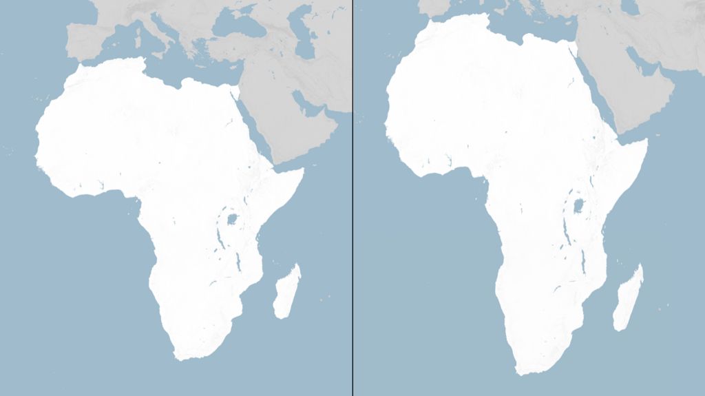
The most striking distortion of the projection shrinks Africa to such an extent that it appears roughly the same size as Greenland on most Mercator maps, even though Africa’s actual land area is 14 times larger than the Arctic island. Proponents of the change have long argued that this persistent misrepresentation is not just a trivial geographic error, but a distortion of global perceptions that undermines recognition of Africa’s geopolitical importance, economic potential, and development needs. By systematically minimizing the continent’s size on maps, critics argue, the Mercator projection has contributed to a longstanding underappreciation of Africa’s role in global affairs and the scale of challenges and opportunities it faces.
The solution adopted by the UN and African Union is the Equal Earth projection, a modern equal-area map created by a team of independent cartographers in 2018. Unlike the Mercator projection, which prioritizes navigation shape over area accuracy, the Equal Earth projection preserves the proportional size of all landmasses across the globe, ensuring that Africa, South America, and other equatorial regions appear at their true size relative to northern landmasses such as Europe and North America. In February of this year, all 54 African Union member states formally adopted the Equal Earth projection, citing its ability to fairly represent all continents while retaining the visual clarity needed for general use.
Speaking ahead of Friday’s General Assembly vote, Togolese Foreign Minister Robert Dussey framed the initiative as a matter of global equity. “A fair world begins with a fair map,” Dussey told Reuters news agency. In an earlier briefing to UN delegates, he expanded on this reasoning, noting that maps are never neutral political or cultural objects. “A map is never neutral. It shapes perceptions, influences how the place of peoples and continents in the world is understood,” Dussey explained.
While the non-binding resolution does not legally require all UN member states to alter their official maps, policy analysts and cartographers expect it to drive widespread changes to mapping standards across international institutions, educational systems, and global publications in the coming years. The vote marks a historic step toward addressing long-standing geographic bias that has shaped popular understanding of the world for centuries.