分类: environment

  • Sarawak town chokes as haze pushes air pollution past Malaysia’s emergency threshold

    Sarawak town chokes as haze pushes air pollution past Malaysia’s emergency threshold

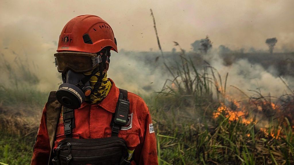
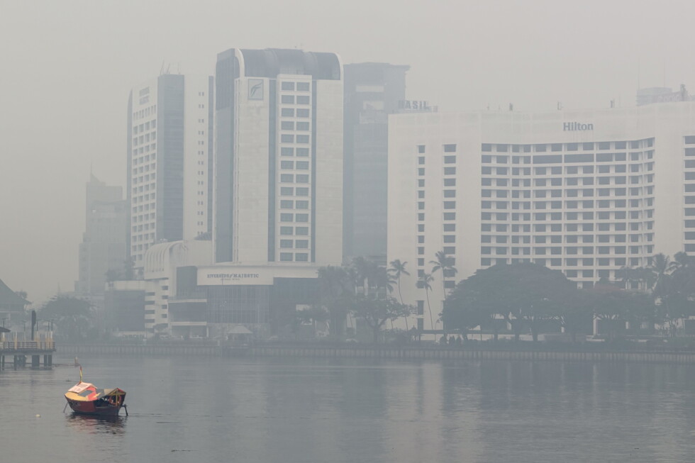
    A small agricultural town on Malaysia’s Borneo Island has recorded hazardous haze levels that cross the country’s emergency threshold, amplifying concerns over the annual regional air quality crisis driven by Indonesian forest fires. On Friday, Sarawak state’s Serian, a border community of roughly 89,000 people adjacent to Indonesia’s Kalimantan province, saw its Air Pollutant Index (API) spike to 521, according to official data from Malaysia’s environment department. Not far away, Kuching, Sarawak’s capital and largest urban center, also posted a dangerous reading of 311, placing it firmly in the hazardous category of Malaysia’s air quality scale.

    Transboundary haze is a chronic seasonal challenge for Southeast Asia. Every dry season, smoke from slash-and-burn land clearing and forest fires in Indonesia drifts across national borders, degrading air quality in neighboring countries including Malaysia, Brunei and Singapore. Under Malaysia’s regulatory framework, any API reading above 500 triggers an emergency protocol that requires halting non-essential work and outdoor activities; schools have already been ordered closed in areas with readings exceeding 200. As of Friday evening, Malaysian officials had not yet issued a formal emergency declaration for Serian.

    This year’s haze outbreak is far more severe than average, experts note, fueled by a combination of increased fire activity across multiple Indonesian provinces and extended dry weather conditions that have allowed blazes to spread rapidly across Borneo. Sarawak has emerged as the hardest-hit region in Malaysia, with multiple localities recording hazardous air pollution levels for consecutive days.

    Indonesian authorities have ramped up response efforts to contain the blazes. Latest satellite data from Indonesia’s Forestry Ministry, released Friday, shows 717 confirmed hot spots — areas of elevated temperature linked to active fires — detected across the country since August 1, with 103 new hot spots recorded in just the 24-hour period leading up to the report. To slow fire growth, Indonesian authorities have deployed large-scale ground and aerial firefighting teams, and have carried out cloud seeding operations to induce much-needed rain.

    Law enforcement action has also been stepped up, particularly in Kalimantan, the Indonesian portion of Borneo that is the source of much of this year’s smoke. Five companies operating in the province have already had their business licenses suspended over allegations that illegal fires burned within their concession areas. Forestry Minister Raja Juli Antoni announced that penalties could extend far beyond temporary suspensions: companies that fail to meet mandatory land restoration requirements, or that are found to have intentionally set fires, will face full criminal prosecution.

    The ongoing crisis highlights the persistent challenge of addressing transboundary air pollution in Southeast Asia, where dry seasonal conditions and lax land management enforcement have created a recurring public health threat that crosses national borders.

  • Data centres are booming in Australia – but at what cost?

    Data centres are booming in Australia – but at what cost?

    Nestled in Sydney’s desirable lower north shore, the quiet suburb of Lane Cove has become the frontline of a growing national debate: can Australia deliver on its ambition to become a global data centre hub, while protecting the quality of life for local residents and meeting its environmental targets?

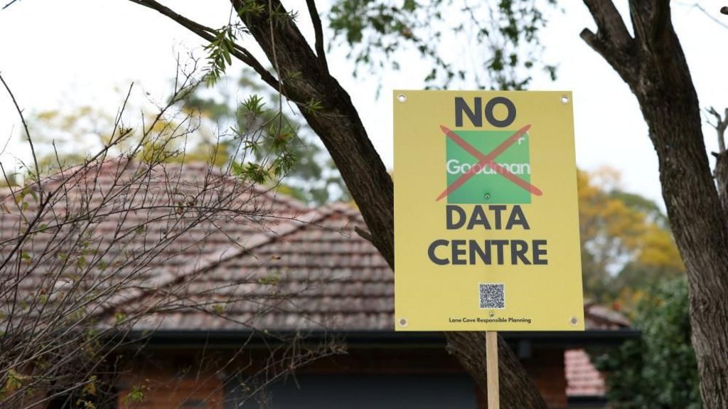
    For local mother Lucy, the reality of living near a data centre is already an unavoidable part of daily life. Just 350 meters from her front door, an existing facility emits a constant, low humming that seeps into her home every night as she tucks her child into bed. “I’ll hear it and think, ‘What is that? What is going on?’” she says. What Lucy and hundreds of her neighbors are now bracing for is far more disruptive: plans to build four additional large-scale data centres in Lane Cove’s local industrial park, which would turn the already affected suburb into one of Australia’s densest data centre clusters.

    Australia’s rapid rise as a top global destination for data centre investment did not happen by accident. Global investors are drawn to the country’s abundant available land, political stability, skilled workforce, established Five Eyes security framework, and untapped renewable energy potential. The AI boom that followed ChatGPT’s 2022 launch supercharged this trend: OpenAI CEO Sam Altman noted earlier this year that Australia has all the ingredients to become the world’s data centre capital if it chooses to pursue that goal.

    Right now, the country is moving full speed ahead to meet that demand. There are already 162 operational data centres across Australia, with 90 more in active planning stages, and more than AU$155 billion (£80 billion) in committed investment waiting to be deployed. If approved, a 1-gigawatt facility in western Sydney would become Australia’s largest single energy user and one of the biggest data centres on the planet. Just 100 meters from another western Sydney community in Marsden Park, the Southern Hemisphere’s largest data centre is already under construction.

    Industry leaders argue this growth is non-negotiable for Australia’s future digital and economic prosperity. Belinda Dennett, CEO of Data Centres Australia, points out that modern digital services from robotic surgery to air traffic control to streaming platforms demand minimal latency, requiring local data storage and processing to avoid dangerous or frustrating delays. With 13.6 million Australian AI users every month – ranking the country sixth globally for AI activity – local data infrastructure will lower barriers for homegrown Australian AI companies to emerge and compete. “If we don’t build infrastructure here, we get none of the value chain,” Dennett says. “We are just importing tools from someone else and we become just a user.”

    Leading business analysts add that the data centre boom has already been a critical economic buffer for Australia. Jon Whittle, a former digital research director at Australia’s national science agency CSIRO and a leading AI business advisor, notes that without the surge in data centre investment over the past two years, Australia would likely have slipped into recession. “There’s some very serious considerations around this, but my main message would be we need to lean into it,” he says. New South Wales Treasurer Daniel Mookhey echoes this view, arguing that data centre investment is driving a parallel boom in renewable energy development, helping the country phase out aging coal-fired power plants without passing the full cost on to households. “We don’t see the two as unrelated,” Mookhey says. “We see data centres allowing us to replace a lot of our old coal-fired power with clean, green renewable energy with the private sector picking up a large amount of the tab.” The investment, he adds, will create new industries that employ future generations.

    But critics and local communities are pushing back hard, raising urgent alarms about the massive environmental, infrastructure and social costs of the current unregulated growth. The most pressing concerns center on energy: the Australian Energy Market Operator projects that national data centre energy demand will triple by 2030. The independent Climate Council warns that without massive new renewable generation and storage capacity, data centre demand could push electricity prices up by 26% in New South Wales by 2035. Because data centres require uninterrupted, consistent power that variable wind and solar cannot yet deliver at scale, many operators are turning to fossil fuels: a recent Greenpeace Australia Pacific report found no major data centre operator has adequately proven its claims of driving renewable growth. In the U.S., many operators have opted to build new gas-fired power plants rather than wait for renewable capacity to expand, and Australian firm Cloud Carrier is already planning three gas-fired stations to power its existing and future data centres 90 minutes outside Sydney. If the grid fails, most data centres, including the existing one in Lane Cove, rely on polluting diesel backup generators.

    Water scarcity is an equally urgent concern in drought-prone Australia. Data centres require massive volumes of water to cool overheating servers, with some large facilities consuming up to 40 million liters per day – enough to supply 80,000 households. The Water Services Association of Australia already projects Sydney will need to expand drinking water supplies over the next decade to meet population growth, but Sydney Water estimates data centres could consume 25% of the city’s drinking water by 2035. If that happens, households will be forced to bear the cost of more expensive alternative water sources like desalination.

    For Lane Cove’s local leaders and residents, these national concerns have become a local crisis. Deputy Mayor Rochelle Flood says the four proposed data centres would force 50% of existing businesses in the industrial park to relocate, taking thousands of local jobs with them. Felipe Tanaka, a local business manager who has already been told he must relocate to make way for a new data centre, says the disruption will have long-term impacts on local workers. “We never knew that something like this would happen,” Tanaka says. “Thousands of jobs are going to be gone from this area in the next few years. Most of our 300 to 400 workers here are locals. Having to move will probably see half of my employees gone.” While data centres create hundreds of construction jobs, they only employ around 100 full-time workers once operational, far fewer than the existing businesses they displace. One proposed facility sits just 16 meters from the nearest residential home and 160 meters from a local primary school, and residents say they were never consulted about the plan to turn their suburb into a data centre hub. Locals also fear the development will threaten nearby Lane Cove National Park and the Parramatta River, core natural assets for the community.

    In July, Prime Minister Anthony Albanese announced new regulations that will require large-scale data centres to guarantee sufficient power supplies, cap water use, and cover the cost of any required new water infrastructure. But the legislation will not take effect until 2027, and will only apply to new proposals – leaving all currently planned and under-construction projects exempt. Community and environmental groups are now calling for a full moratorium on all new data centre development until stronger safeguards are in place.

    “We’ve got the government rolling out the red carpet saying we want to be the data centre capital of the world,” Flood says. “But can we actually do that sustainably or is it going to set us back in terms of net zero and our water storage targets?” Critics add that beyond environmental costs, the public has little clarity on what the data centres will actually be used for, with much of the capacity powering low-value AI activity that delivers little benefit to Australian communities. “They’re telling us this is essential… that we need to have these centres in our neighbourhood but they’re not saying what it’s for,” Flood says. “When our drinking water, energy and land is being used for generative AI slop, that is not giving any value back.”

  • France records its hottest summer since measurements began over a century ago

    France records its hottest summer since measurements began over a century ago

    PARIS – In a stark confirmation of advancing climate change, France has officially marked the summer of 2026 as the hottest ever recorded since national temperature tracking began in 1900, French Environment Minister Monique Barbut announced Thursday at a public unveiling of the national seasonal climate report. The unprecedented heat came paired with extreme drought, destructive wildfires that displaced tens of thousands of residents, and further underscored Europe’s status as the fastest-warming continent on the planet.

    Meteo France, the country’s national weather service, reported that the average daily and nighttime temperature across June, July and August hit 24 degrees Celsius (75.2 degrees Fahrenheit). This is a full 3.6 degrees Celsius (6.5 degrees Fahrenheit) above the pre-industrial baseline average for the season, surpassing the previous record set during the deadly 2003 European heatwave, when temperatures were 2.7 degrees Celsius (4.9 degrees Fahrenheit) above normal.

    The season was defined by a cascade of extreme weather events. Total rainfall across the country was nearly 40% lower than the seasonal average, making 2026 the second driest summer since record-keeping began. An unprecedented 5 days of heatwave conditions were recorded across three distinct heatwave events, far outstripping the 33 heatwave days recorded in the 2022 summer, previously one of the most extreme in recent decades.

    Unusually hot conditions extended beyond the traditional summer months too: record-high ocean temperatures were measured along all of mainland France’s coastlines and the coast of Corsica, and unseasonal heatwaves were recorded as early as May and as late as early September — patterns that Meteo France called clear indicators of long-term human-caused climate change.

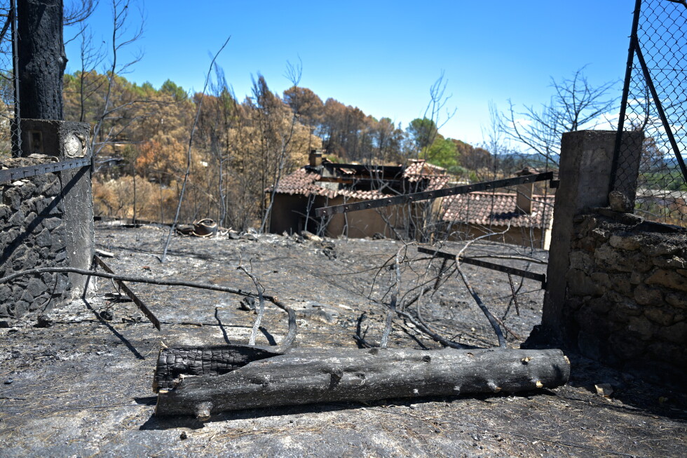
    The dry, hot conditions created tinderbox conditions across the country, forcing firefighters to work around the clock to contain widespread wildfires even in regions unaccustomed to such blazes. Northern France and Brittany, normally known for cool, wet climates, saw active fire activity this summer. A single historic wildfire near the southwestern city of Bordeaux burned through thousands of hectares of forest and forced 250,000 people to evacuate their homes to escape the flames.

    France’s record-breaking summer is part of a broader pattern of extreme heat across the European continent this year. Millions of people across France, Italy, Spain, the United Kingdom and other European nations faced prolonged extreme temperatures this summer. Data from the European Union’s Copernicus Climate Change Service confirms that Europe has warmed at twice the global average rate since the 1980s, making it the most rapidly warming continent on Earth.

  • Toxic wildfire haze spreads across South East Asia as ‘super’ El Niño intensifies

    Toxic wildfire haze spreads across South East Asia as ‘super’ El Niño intensifies

    A growing public health and environmental emergency is unfolding across Southeast Asia, as months of uncontrolled wildfires in Indonesia have spawned a thick blanket of toxic haze that has drifted across national borders, endangering millions of people and threatening massive carbon emissions from vulnerable ecosystems.

    Weeks after the first blazes ignited across Sumatra and Indonesian Borneo in mid-July, the smog now covers large swathes of Indonesia and has spread to neighboring Malaysia, Singapore, and the Philippines. In the hardest-hit areas, pollution levels have surpassed 15 times the maximum safe limit set by the World Health Organization, pushing air quality into the “acutely unhealthy” range that threatens even healthy adults, not just vulnerable groups.

    For local residents, the daily reality of living under the haze is grim. Nineteen-year-old teaching assistant Rizma Nur Fatimah, who works at a school in Banjarbaru, South Kalimantan, described visibility so poor that “you couldn’t even see your own feet” inside her classroom. Even sealed indoor spaces offer little protection: “Even inside the house, with everything closed, the haze still got in,” she said. Having grown up with annual haze events, Fatimah noted that this year’s crisis is far worse than previous seasons, leaving local communities resigned to chronic poor air quality. Twenty-three-year-old mother Misbah, from nearby Pengayuan village, said her three-year-old daughter has already developed persistent cough, sore throat, and runny nose from prolonged exposure to the smog.

    The health impacts are being felt hundreds of kilometers away, too. On the Philippine island province of Palawan, residents and medical workers report widespread respiratory and allergic symptoms linked to the drifting smoke. “We are now experiencing mild headaches,” said local physician Dr Precious Bañas-Melad. “My cousin who isn’t allergic to anything started developing allergies. My husband is the first one who had itchy eyes and throat.” Across the border in Malaysia, national health authorities have recorded sharp increases in asthma and conjunctivitis cases as air quality declines across the country.

    Between July and August alone, Indonesia’s Ministry of Health confirmed more than 50,000 cases of respiratory infections directly linked to the land and forest fires, with children under five accounting for over 12,000 of those cases.

    While this year’s extreme severity is being driven by a Super El Niño event that has worsened drought conditions across the region, experts emphasize that the recurring crisis is deeply rooted in decades of human-caused land use change. The pattern dates back to the Suharto era, when vast areas of ancient rainforest and carbon-rich peatland in Kalimantan were cleared for logging, industrial agriculture, and large-scale infrastructure projects. Today, environmental groups, researchers, and official government investigations have repeatedly documented that many commercial operators use fire as a low-cost method to clear large tracts of land for industrial plantations.

    Unlike small-scale, community-managed traditional burning practices that are tightly controlled, large-scale clearing fires are far harder to contain and create far greater harm to both public health and the environment. Drained peatlands, industrial timber estates, and oil palm plantations create landscapes that are far more vulnerable to burning, and blazes often reoccur in the same degraded areas year after year.

    What makes this year’s fires on Indonesian Borneo particularly alarming is that they are tearing through one of the world’s largest tropical peatland ecosystems. These unique landscapes act as massive natural carbon sinks: under normal waterlogged conditions, decomposition is slowed, allowing carbon to accumulate underground for thousands of years. But when drained and burned, these same carbon stores turn into what researchers call carbon “bombs,” releasing thousands of years of stored carbon into the atmosphere in just weeks or months, worsening the climate change that drives extreme drought and El Niño events in a dangerous feedback loop.

    “Peatlands are incredibly effective carbon stores because their waterlogged conditions slow decomposition, allowing carbon to accumulate underground for thousands of years,” explained Dr Nisa Novita, a peatland researcher at Indonesian conservation NGO Yayasan Konservasi Alam Nusantara. “But this also means they can become a ‘carbon bomb’ when they are drained or burned, because that carbon can be rapidly released into the atmosphere.”

    As the Super El Niño event continues to intensify through the coming months, experts warn the worst may still be ahead. Forest fire forensics expert Professor Bambang Hero Saharjo, from Institut Pertanian Bogor University, noted that in 2025, without an El Niño event, Indonesian wildfires burned roughly 359,000 hectares of land. This year, he projects the burned area could reach 11 million hectares, putting the 2026 season on par with the devastating 1997-1998 wildfires, one of the worst on record for Indonesia.

    Indonesia’s Forestry Minister Raja Juli Antoni confirmed this week that the fight to contain the blazes is now entering its most critical phase. “Our problems are not over. September is the peak of El Niño,” he said. “September is the main fight for us.”

  • Algerians battle deadly wildfires as Tebboune seeks death penalty for arson

    Algerians battle deadly wildfires as Tebboune seeks death penalty for arson

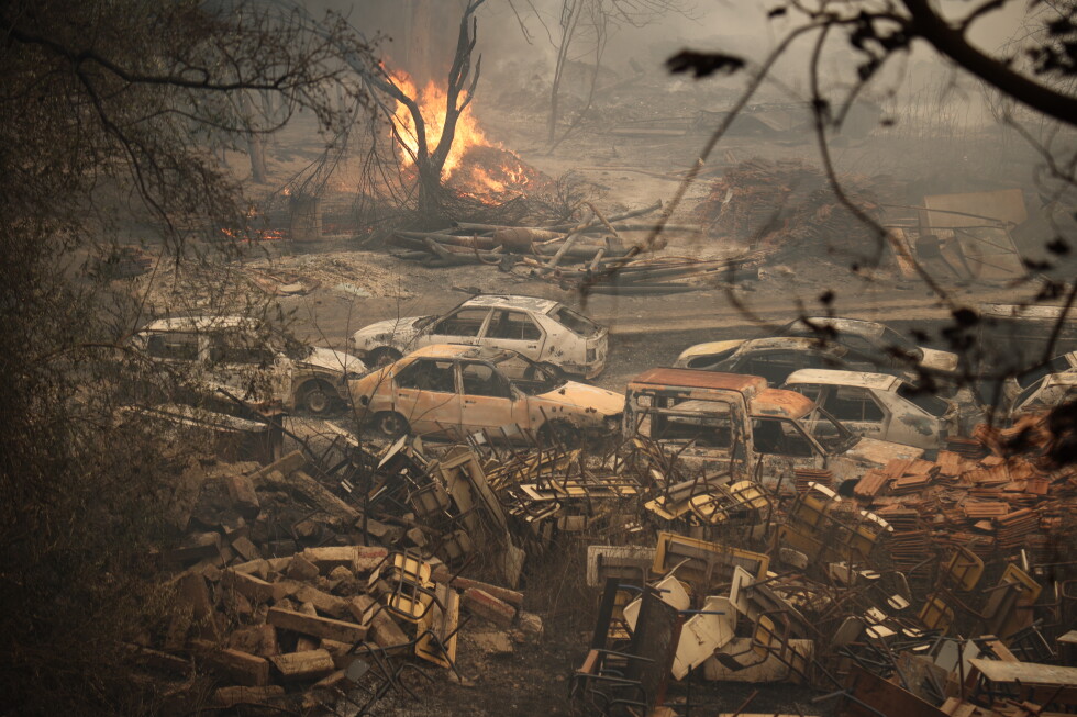
    A devastating and historically unmatched outbreak of wildfires has swept across northern Algeria, leaving widespread death, ecological destruction, and political upheaval in its wake. The inferno has carved a continuous line of flames from central Algeria all the way to the country’s far eastern border, forcing emergency responders to mount a desperate, resource-stretched battle to contain the blaze.

    This week, Civil Protection teams backed by army units continued to fight reignited flare-ups in the eastern provinces of Sétif and Guelma, where thousands of hectares of old-growth forest have already turned to ash. The worst-hit region is Jijel, a popular coastal province located 120 miles east of the capital Algiers, once celebrated for its pristine sandy shorelines, clear turquoise waters, and rolling hills covered in olive groves, fruit orchards, and ancient cedar forests. Today, the entire 1,200-square-kilometer expanse of Jijel’s forests is reduced to smoldering cinders and blackened stumps.

    Discrepancies over the official death toll have emerged as a major point of tension following the disaster. The Algerian Interior Ministry initially reported a national death toll of 12, all from Jijel, when the crisis escalated in late August. But on-the-ground accounts and social media footage suggest the actual number of fatalities is far higher. Videos posted online show dozens of coffins lined up alongside open mass graves, awaiting burial as high temperatures accelerate decomposition of remains.

    “After 40 years in Civil Protection fighting wildfires, I have never seen a catastrophe on this scale — human, environmental, and material. There are hundreds of dead,” Lieutenant Djabri Said told the Associated Press in an on-site interview. One high-profile case underscores the scale of the tragedy: Abdelwahab Boukrouh, a journalist with the Algerian presidency’s communications department, announced via Facebook that 12 members of his own family were killed when the fire swept through their mountain village of Ouled Riyah on the night of August 22–23, with three more relatives still unaccounted for. The victims included women, children, and elderly residents trapped in their small rural homes before they could escape. Thousands of livestock — cattle, sheep, goats, mules and donkeys — also perished in the flames, their charred remains scattered along the steep mountain paths leading to destroyed villages, where little remains of residential structures except smoking piles of rubble.

    All private and public media in Algeria operate under state oversight, and most have stuck to the official 12-death toll in their coverage, while focusing heavily on ministerial visits and state-led relief efforts. President Abdelmadjid Tebboune cut short his summer vacation to oversee the response, visiting burn victims in specialized Algiers hospitals, declaring a three-day national period of mourning, and calling an emergency Cabinet meeting. The meeting designated the Jijel region a disaster zone and unlocked emergency funding for response and recovery operations.

    A spontaneous grassroots movement of national solidarity has emerged across the country, with convoys of private and volunteer trucks carrying emergency food, medication, bottled water, and clothing streaming into fire-ravaged mountain villages. Tebboune has also announced state-funded compensation for all affected families and pledged that the government will cover the full cost of rebuilding destroyed homes. Priority has been given to repairing damaged schools to ensure they are ready for the new academic year scheduled to begin September 21.

    The disaster has sparked a heated national political debate over the president’s proposal to reinstate capital punishment for anyone found guilty of arson connected to the wildfires. Tebboune has dismissed unsubstantiated claims of organized intentional sabotage, known locally as conspiracy theories, and instead aligned his explanation with global scientific consensus: he noted that numerous Mediterranean countries, including France, Spain, Portugal and Italy, all faced extreme wildfire outbreaks this summer, driven by rising temperatures and arid conditions linked to climate change. Climate researchers have repeatedly warned that human-caused global warming is increasing both the frequency and intensity of heatwaves and droughts across the Mediterranean basin, creating ideal conditions for destructive wildfires.

    Even so, Tebboune acknowledged that “criminal hands” may have played a role in starting some blazes, and announced that all investigations are ongoing. He went on to announce that anyone convicted of arson in connection with the fires will face the death penalty, confirming that the country will end a moratorium on executions that has been in place since 1993. That year marked Algeria’s last confirmed executions, when three Islamist militants were put to death for a deadly attack at Algiers International Airport.

    Reaction to the announcement has split sharply along political lines. Parties that support Tebboune’s administration, including major Islamist political groups, have backed the proposal. However, opposition parties linked to Algeria’s pro-democracy movement and multiple leading human rights organizations have condemned the move, describing it as a dangerous retreat into authoritarian practice and a deliberate distraction from perceived failures in government wildfire management and prevention.

  • Why did this Canadian ‘island’ seemingly vanish and reappear miles away?

    Why did this Canadian ‘island’ seemingly vanish and reappear miles away?

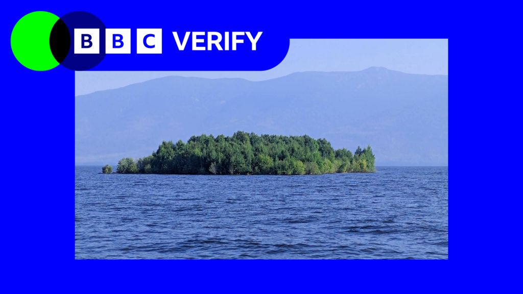
    A bizarre natural phenomenon off Canada’s Pacific coast has captured global attention after a landmass that looked like a small island abruptly vanished from its long-time location, only to reemerge miles away. To untangle this puzzling event, BBC Verify launched an investigation using time-lapse satellite imagery to trace the unusual movement of the feature off the coast of British Columbia.

    What many observers initially mistook for a stationary, permanent island turned out to be a massive floating mass of vegetation, sediment, and peat that broke free from its original mooring in shallow coastal waters. These rare floating landmasses, sometimes called “drifting islands,” form when accumulated organic matter and soil detach from shoreline wetlands or shallow bays due to a combination of erosion, shifting water levels, and storm activity.

    Satellite data analyzed by the verification team confirms that after separating from its original location, the large floating island drifted with coastal currents and wind patterns over several weeks, eventually coming to rest miles from where it was first mapped. The unexpected disappearance and reappearance of the feature sparked widespread curiosity and speculation on social media, with many users questioning whether the event was linked to climate change-driven coastal shifts or unusual geological activity.

    Climate researchers note that more frequent intense storm systems and rising sea levels along British Columbia’s coast are increasing the likelihood of such floating landmasses breaking free, as eroding shorelines weaken the anchors that hold accumulated organic sediment in place. While floating islands are not a new geological phenomenon, the high-profile tracking of this one through open-source satellite data has given scientists and the public a rare opportunity to observe how these mobile landforms move through coastal ecosystems.

  • UN warns of ‘supersized’ El Niño as countries prepare for impact

    UN warns of ‘supersized’ El Niño as countries prepare for impact

    United Nations Secretary-General António Guterres has issued a stark warning that the globe has entered a ‘danger zone of extreme weather’ as a historically powerful El Niño event begins to send disruptive impacts across every continent. New data from the World Meteorological Organization (WMO), a UN specialized agency, indicates this climate event could become the strongest El Niño recorded in more than 70 years, with its far-reaching effects expected to persist through at least February 2027.

    El Niño, a natural climate pattern originating in the tropical Pacific Ocean driven by shifting trade winds that push warm surface water eastward, triggers profound disruptions to global weather systems. It creates prolonged drought in some regions while supercharging typhoons and catastrophic flooding in others, and amplifies global surface temperatures on top of the long-term warming already driven by human-caused climate change.

    “El Niño is being supersized before our eyes. The science leaves no room for doubt: the planet is in uncharted waters, and those waters are heating up,” Guterres stated in his warning.

    Latest ocean temperature readings confirm the rapid strengthening of this event. In recent months, sea surface temperatures in the central and eastern tropical Pacific have spiked dramatically, with key monitoring regions recording readings more than 2°C above the long-term average. Forecasts project monthly anomalies could approach 4°C above average in the coming months, pushing this event past the ‘very strong’ threshold to become the most intense El Niño since at least 1950, potentially by a substantial margin. Even more striking anomalies have been recorded below the ocean surface, where some areas are more than 8°C warmer than average.

    Above-normal ocean temperatures are also projected across the Indian Ocean, tropical Atlantic, and sections of Australia’s coastline, bringing heightened risk to the country’s unique marine ecosystems. Australia has already seen a string of climate change-fueled marine heatwaves in recent years, and El Niño typically amplifies the extreme ocean heat that drives these events.

    Dr. Alistair Hobday, chief researcher at Australia’s national science agency, told the BBC that while forecasts predict the Great Barrier Reef will avoid the most severe heat stress this year – giving vulnerable coral populations valuable additional recovery time – southern parts of the country face extreme impacts. When the region last suffered a major marine heatwave, the event caused mass penguin starvation, large-scale fish die-offs, toxic algal blooms, and widespread jellyfish invasions. Australia has rolled out new early warning systems for marine crises that allow policymakers to activate financial support for fishing industries, relocate at-risk species, and step up coral monitoring, but Hobday acknowledged deep concern over the unprecedented intensity of the approaching event.

    The WMO projects major shifts to global rainfall patterns over the coming months, with impacts that will ripple through communities and global trade. Much of Southeast Asia, Central America, and northern South America are forecast to see far drier conditions than average, raising the risks of severe drought and destructive wildfires. In anticipation of low rainfall that will limit water levels along its key shipping route, the Panama Canal will cut daily vessel transits by more than 10% starting this week. The canal supports 14,000 annual ship passages, serves as a critical artery for global trade, and generates roughly $3 billion in annual revenue for Panama, making the cuts a significant economic concern.

    In Indonesia, authorities are already working to contain wildfires that have burned over 107,000 hectares of land across the country this extended dry season. A Central Kalimantan resident told BBC News Indonesia that blazes have burned for more than a month, leaving thick smoke that stings the eyes and lingers in the air. The government has deployed cloud-seeding aircraft to trigger rainfall, allocated emergency resources, and arrested dozens of people accused of intentionally setting fires to clear land for development.

    Across the globe, other regions face the opposite risk: above-average rainfall and devastating flooding. Eastern Africa, southern Brazil, and the southern United States all face elevated flood risk, while China has already seen a surge in typhoon activity linked to the super El Niño, with seven storms projected to make landfall this year. Three typhoons hit the country in July alone, leaving dozens dead, and more than one million people were evacuated as Typhoon Dolphin brought destructive winds and torrential rain in August.

    WMO Secretary-General Celeste Saulo warned that El Niño “has the potential to deliver a massive blow to communities and economies across the world. We are already seeing disruption and devastation from droughts and floods and we expect these impacts to increase as El Niño intensifies.”

    All these risks are compounded by long-term anthropogenic climate change, which amplifies the intensity of extreme weather events linked to El Niño. While some research suggests climate change may be making individual El Niño events stronger, this hypothesis has not yet been confirmed by consensus science.

    Peru, which borders the warming eastern Pacific, is among the most vulnerable nations to this event. Past strong El Niños have brought extreme rainfall, deadly flash floods, and destructive landslides to Peru, neighboring Ecuador, and parts of Brazil, particularly in densely populated urban areas with poor drainage.

    Miguel Aréstegui, climate resilience lead at the non-profit Practical Action which supports extreme weather preparedness in vulnerable nations, said that while the scale of the event warrants serious concern, that urgency should translate to preparedness rather than panic. Aréstegui noted that Practical Action and its partners have spent years expanding public access to early warning systems, including real-time data on river levels, flood risk, and weather forecasts. At the end of last month, the U.S. announced it would deploy the hospital ship USNS Comfort to the Peruvian coast to provide additional medical support and technical equipment ahead of the event’s peak intensity.

    Even with these preparedness measures, Aréstegui emphasized that El Niño’s impacts are worsened by long-standing structural vulnerabilities that take far longer to address. “El Niño does not arrive in a vacuum,” he said, pointing to unplanned housing in high-risk flood zones, fragile water and sanitation infrastructure, and under-resourced healthcare systems as persistent challenges that amplify harm from extreme weather.

    To respond to the event, the WMO has launched a major global mobilization effort to distribute El Niño-linked extreme weather forecasts to as many at-risk communities as possible. While many nations have strengthened early warning systems and pre-positioned emergency medical support, the unprecedented intensity of this event has raised sharp concerns about outcomes for the world’s most vulnerable populations.

  • Pacific island nations seek to turn geopolitics into funding to offset climate change harm

    Pacific island nations seek to turn geopolitics into funding to offset climate change harm

    In the low-lying coastal community of Melekeok, a 300-person chiefdom on Palau’s largest island, storm surges driven by rising sea levels now routinely flood residential properties, forcing residents to plead for government support to relocate inland. For 43-year-old Bol Sebalt, a lifelong Melekeok resident who works as a legislative clerk and trained disaster response volunteer, the need for relocation could not be clearer — but chronic underfunding has left the community trapped.

    Sebalt already moved to a newly platted inland subdivision designated for Melekeok’s displaced population, but she remains the only resident months after relocation preparations began. Funding for critical infrastructure including plumbing, sewage systems, and street lighting has trickled in in small, fragmented batches, moving far too slow to match the accelerating pace of climate change. “We cannot move faster than climate change,” Sebalt told the Associated Press, summing up the existential crisis shared by dozens of low-lying Pacific island nations facing encroaching oceans.

    This collective crisis took center stage this week at the annual Pacific Islands Forum summit hosted in Palau, where leaders from the region’s most climate-vulnerable nations issued renewed dire warnings just days after the United Nations released a groundbreaking report confirming that global temperatures will exceed the 1.5°C safe threshold set by the 2015 Paris Climate Agreement within the next decade, driven by fossil fuel emissions from the world’s largest economies.

    “Loss and damage is a reality that currently exists in my country,” said Vanuatu Climate Adaptation Minister Ralph Regenvanu Wednesday, speaking to reporters from the sweltering outdoor summit venue. “It will only accelerate with any overshoot, encompassing economic and non-economic losses that no finance can fully restore. This includes our ancestral lands, our heritage, our identity.”

    For decades, Pacific island leaders have pressured major global greenhouse gas emitters to cut emissions enough to keep warming below 1.5°C, the threshold scientists identify as the line that would avoid the most catastrophic, irreversible impacts of climate change projected to occur if warming hits 2°C. The UN’s latest confirmation that the world will cross the 1.5°C mark in the coming years, even with temporary overshoot and efforts to cool the planet afterward, comes as too little, too late for these at-risk nations.

    Beyond the immediate threat of submerged coastlines and displaced communities, regional scientific body the Secretariat of the Pacific Community (SPC) warns that warmer ocean temperatures will devastate the Pacific’s $multi-billion tuna fishing industry, which supplies 30% of the world’s global tuna catch, as well as the mangrove ecosystems that support juvenile fish populations. Already, the 2024 El Niño event has triggered extreme drought in some parts of the Pacific and catastrophic flooding in others, a pattern scientists project will only intensify as the planet warms.

    “There is no other way out,” said Maina Talia, Tuvalu’s Minister for Climate Change. “The only way out for us is to ensure that we continue to push for 1.5, to stay alive, to stay in our countries.”

    Palau’s President Surangel Whipps Jr., this year’s summit host, used his opening address to push back against the pattern of major global powers prioritizing geopolitical influence over climate action in the strategically vital Pacific region. Whipps argued that major powers seeking a foothold in the region should redirect their efforts toward funding climate adaptation and mitigation projects, backing his call with a goal to make Palau the world’s first nation powered entirely by renewable energy.

    Despite Whipps’ appeal, longstanding geopolitical tensions quickly overshadowed opening proceedings, when diplomatic envoys from Beijing and Taipei were seated in the same row during the opening ceremony, rekindling the cross-strait rivalry that frequently distracts from climate action at regional summits. Geopolitical jostling is far from the only obstacle, however: a region-managed climate fund, the Pacific Resilience Facility (PRF), designed to deliver fast, direct funding for grassroots adaptation projects across the Pacific, has failed to secure the pledged funding from major global donors.

    While some donors have cited governance concerns about the PRF, which will be headquartered in Tonga, regional leaders note the fund was intentionally designed to bypass the slow, rigid approval processes of traditional international financial institutions, which often delay critical aid for years while donors retain control over how funding is spent. For aid-dependent Pacific communities facing immediate climate threats, that delay is fatal. “International financial institutions have very lengthy, long processes to deliver the direct access funding that we require in the Pacific,” Tonga Prime Minister Fatafehi Fakafanua told the AP. “The PRF was purposefully designed to work immediately for the urgent needs of the Pacific Island people. That is something that differentiates the PRF from the existing financial models that we are using here in the Pacific.”

    Tensions have also flared between the forum’s small island member states and its two largest, most powerful donor nations: Australia and New Zealand. Australian Prime Minister Anthony Albanese told reporters in Palau Wednesday that his country’s transition away from fossil fuels could not happen overnight, and required expanded renewable energy capacity to be feasible. “Australia is highly regarded when it comes to climate change and the talking down of Australia doesn’t happen from outside Australia, I make that point,” Albanese said.

    Just an hour later, Regenvanu pushed back on that claim, noting that as one of the world’s top fossil fuel exporters, Australia is still approving new fossil fuel expansion — a step that directly contradicts the needs of climate-vulnerable Pacific nations. “Australia is a major producer of fossil fuels,” Regenvanu said. “The very least a country like Australia should be doing is stopping future expansion and it’s not doing that.”

  • Why Nepal floods should worry India

    Why Nepal floods should worry India

    The catastrophic flood disaster that has struck southern Nepal near the Tibet border has already claimed more than 1,000 lives, sending a urgent transboundary warning that stretches far beyond Nepal’s national boundaries. As hydrological and climate experts emphasize, Nepal and India share an interconnected network of Himalayan river systems, and the link between upstream flooding in Nepal and downstream disaster in India is far more complex than the simple narrative of water flowing south across the border.

    Nepal is home to more than 6,000 rivers and streams, the vast majority of which drain southward into India’s Ganges river basin. Four major transboundary systems dominate the region: the Kosi in eastern Nepal, the Gandaki (known as Gandak in India) in central Nepal, the Karnali (called Ghaghara in India) in western Nepal, and the Mahakali (Sharda) that runs along the two countries’ western border. Dozens of smaller rivers, including the Bagmati, Kamala, Rapti, and Babai that originate in Nepal’s Siwalik and Chure hill ranges, are far less well known but pose outsized risk: their small, steep catchment areas produce far faster, more unpredictable flash floods that can catch communities off guard.

    Manish Shrestha, a hydrologist at the International Centre for Integrated Mountain Development (ICIMOD), confirms that between 7 to 9 major river systems flow from Nepal into India’s northern plains, and these systems are the primary source of flood hazards across northern India. India’s Central Water Commission formally lists the Kosi, Gandak, Bagmati, and Ghaghara as the highest-risk transboundary watercourses.

    Among Indian states, Bihar is by far the most vulnerable to cross-border floods, with approximately 75% of northern Bihar officially designated as flood-prone territory. Nearly every major river that floods the state originates in Nepal, with the Kosi—long infamously known as the “sorrow of Bihar”—toping the list of high-risk systems, followed by the Gandak, Bagmati, and Kamala. But the hazard extends far beyond Bihar’s borders: eastern Uttar Pradesh is regularly impacted by flooding from the Ghaghara, Rapti, and Gandak rivers, with districts including Gorakhpur, Bahraich, Lakhimpur Kheri, and Shravasti facing repeated disaster. Uttarakhand shares the Mahakali-Sharda river system with Nepal, while North Bengal receives floodwaters from the Mechi and Mahananda. Pradeep Man Dangol, another ICIMOD hydrologist, notes that while Bihar bears the largest scale of flood risk, Uttar Pradesh is the second most affected and its vulnerability is chronically underreported.

    Hydrologists break down transboundary flood risk into a clear three-stage chain of causality. First, the rainfall: flood peaks that reach Indian territory are most often generated not in the high Himalayas, but in the lower elevation Siwalik, Chure, and Terai regions, where intense monsoon downpours fall on steep, small catchments that can channel massive volumes of water downstream very quickly. Second, the river itself: after rushing out of the mountains, Nepal’s rivers hit a sharp break in slope at the mountain front, drop their heavy sediment load, and spread across the plains as wide, braided, constantly shifting channels. Third, when the water crosses into India, the final severity of the disaster depends entirely on local conditions: how much rain has fallen on the Indian side, the existing water level of the Ganges, the condition of embankments and barrages, and how much natural drainage has been blocked by roads, railways, and expanding settlements on the floodplain.

    To put this simply: while the volume of flood flow arriving at the Indo-Nepal border is determined primarily by rainfall in Nepal, the ultimate severity of flooding depends at least as much on local conditions in India. The 2008 Kosi disaster offers a clear illustration of this dynamic. When the Kosi breached an embankment in Nepal and flooded large swathes of Bihar, killing nearly 400 people, the event was not caused by an unprecedented high-flow event. According to Rajiv Sinha, a professor of earth sciences at the Indian Institute of Technology (IIT) Kanpur, the actual river flow during the 2008 event was only around one-tenth of the channel’s designed carrying capacity. The catastrophe was triggered by a breach in decades-old embankments that had never been properly maintained. “The embankments constructed in the 1950s and 1960s had not been properly maintained. They had become eroded and eventually developed a weak point. The river breached its embankment through these vulnerable points and entered parts of India that had not seen flooding for perhaps 100 years,” Sinha explained. Saswata Sanyal, ICIMOD’s intervention manager for disaster risk reduction, summarizes this failure: “The failure was structural, not hydrological.”

    For routine monsoon floods, India typically receives between 12 hours and two days of advance warning before floodwaters arrive, depending on how quickly water travels downstream. It takes roughly one full day for floodwaters to travel from the Nepal mountain front to the Bihar plains along the Kosi and Gandak, and slightly longer for the Ghaghara. Flash floods from the steep Chure hill rivers can arrive in just a few hours, and surges from landslide dam bursts or debris flows move even faster: during the 2026 Nepal floods, the peak flood surge from Rasuwa reached the Indian border near Triveni in just seven and a half hours.

    Currently, India and Nepal do share real-time rainfall and river level data through a network of monitoring stations, with Nepal’s Department of Hydrology and Meteorology sharing data with India’s Central Water Commission to support flood forecasting. But experts warn that critical gaps remain in the existing cooperation framework. There are far too few real-time monitoring stations in the fast-flowing Chure catchments that produce the most dangerous flash floods. The two countries also do not have a single shared cross-border flood forecasting model, and there is limited routine information sharing on embankment conditions, shifting river channels, and sediment buildup. Even when forecasts are successful, gaps remain in the “last mile” of warning delivery: a notification reaching a district government office does not guarantee that at-risk families in rural floodplains receive the warning in time to evacuate.

    Scientists are also eager to correct a common public misconception: the idea that Nepal intentionally “releases” floodwater into India. Nepal has almost no large-scale reservoirs capable of storing and releasing large volumes of water; the country’s largest storage dam, the Kulekhani, holds less than one-tenth of a cubic kilometre of water, far too little to create a large-scale flood. “So there’s nothing to release,” Sanyal says. In fact, the Kosi and Gandak barrages that regulate flow along the border are operated by India, not Nepal. When floodwater crosses the border, it is almost entirely the result of heavy rainfall upstream, not deliberate gate openings by Nepal.

    That said, the basic fact remains: the majority of floodwater that hits northern Bihar and eastern Uttar Pradesh originates as rain in Nepal, so Nepal’s rainfall patterns set the timing and size of flood peaks that reach India. Overall, Nepal supplies roughly 40% of the Ganges’ average annual flow, and a far larger share during the dry season, making Nepal’s hydrology critical to India’s water security and flood risk. But experts emphasize that blaming Nepal for downstream floods is overly simplistic. “Rain is not a decision,” Sanyal points out. Whether a given flow becomes a disaster depends on conditions in India as much as Nepal: the Ganges’ baseline water level, local rainfall, embankment integrity, drainage infrastructure, and sediment buildup.

    Crucially, the impacts of water management on one side of the border also affect the other: infrastructure like embankments and barrages built for flood protection in India have raised upstream water levels and caused backwater flooding in Nepal’s Terai region, a longstanding concern for Nepali authorities. Since Nepal and India share a single integrated river system, with one country positioned upstream and the other downstream, the solution to growing flood risk is not blame, but expanded cross-border cooperation on data sharing, joint forecasting, and integrated river basin management.

    Experts note that the 2026 Nepal flood disaster carries a broader warning beyond transboundary management: it highlights the growing risk of extreme, debris-laden catastrophic flood events driven by climate change across the entire Himalayan region. Sinha points out that the 2026 Nepal disaster follows a pattern of similar catastrophic events that have struck India in recent years, including the 2021 Chamoli disaster and the 2025 Dharali disaster in Uttarakhand, and the 2026 Nepal event was between five to 10 times larger than those earlier disasters.

    “The fundamental point is that these are not normal hydrological floods,” Sinha explains. Conventional floods are composed almost entirely of water, but these new extreme events mix intense rainfall, melting glacial ice, or sudden glacial lake discharge with massive volumes of rock and sediment, creating a thick, high-energy debris slurry that can destroy almost every structure in its path. This was exactly what happened during the 2021 Chamoli disaster, when a large section of a Himalayan glacier collapsed, sending a debris and water cascade downstream that killed more than 200 people and destroyed major hydropower infrastructure. The same dynamic was seen in the 2025 Dharali disaster, where heavy rain triggered a flash flood that buried large parts of a village under meters of rock and sediment.

    Climate change is amplifying these risks across the board. Experts confirm that extreme rainfall events are intensifying across the Himalayan region, which is warming faster than the global average. A warmer atmosphere holds more moisture, leading the monsoon to deliver more total rain in fewer, more intense downpours. High mountain hazards are also growing: as permafrost degrades, glacial lake outburst events and rock-ice avalanches are projected to become more common, creating faster, debris-heavy floods that are far harder to forecast. More extreme events also trigger more landslides, adding larger volumes of sediment to rivers, which raises riverbeds and reduces channel capacity on both sides of the border. All these hazards are part of a single interconnected Himalayan risk system, and India’s exposure to these events is very significant.
  • In Chile, injured penguins sport copper vests to help them heal

    In Chile, injured penguins sport copper vests to help them heal

    SANTIAGO, Chile — As one of the world’s most vulnerable penguin species faces rapid population decline across Chile, local wildlife researchers and veterinarians have launched an innovative new trial to improve rescue outcomes: custom-fitted red vests woven with healing copper and zinc fibers designed to accelerate wound recovery for injured aquatic birds.

    The experimental treatment draws on a proven approach already used in veterinary care for domestic pets. For years, veterinarians have successfully leveraged microfiber garments embedded with copper and zinc to treat skin wounds in domestic dogs and cats. Now, researchers are adapting this technology for Humboldt penguins, a cold-water species that counts Chile as home to its largest global concentration, where it is currently listed as vulnerable by international conservation standards.

    The first round of custom vests was developed at Buin Zoo, a wildlife sanctuary located on the outskirts of Santiago, where research teams took precise body measurements of penguins to craft well-fitted garments. “For years, vests with microfibers containing elements like copper and zinc have been tested on pets, particularly dogs and cats, and have greatly helped in the recovery of skin wounds,” explained Ignacio Idalsoaga, director of Buin Zoo, in an interview with the Associated Press Wednesday. “We began to wonder — why can’t this be used on penguins?”

    The timing of the trial could not be more urgent. Recent surveys of major Humboldt penguin breeding colonies conducted by Chilean and international research teams between 2024 and 2025 reveal a devastating 63% drop in active nests compared to counts at the same sites just three years prior. The species is confronting a growing cascade of threats: widespread entanglement in commercial fishing nets, rampant plastic pollution, periodic disease outbreaks, and intensified competition with industrial fishing operations for the small fish that make up their core diet.

    Compounding these existing pressures, the species is now facing extreme disruption from El Niño, one of the most impactful global weather patterns. El Niño pushes unusually warm water into large swathes of the eastern Pacific Ocean, pushing the cold-water fish Humboldt penguins depend on further south or to deeper depths, making prey far harder to access. As hungry adult penguins are forced to travel longer distances in search of food, they often leave their chicks unprotected and abandoned at nesting sites.

    “Especially now, with all the problems caused by El Niño, we’re likely to see many abandoned chicks in the coming weeks, with injuries they suffer in the environment,” Idalsoaga noted.

    Wildlife rehabilitation clinics across Chile already treat dozens of distressed penguins stranded along the country’s extended coastline every year. Many arrive with deep gashes from fishing nets or boat propellers, while others are severely weakened by prolonged hunger, according to Tomás Pino, a veterinarian who leads Conservación Humboldt, a northern Chile-based nonprofit dedicated to rescuing and rehabilitating injured marine wildlife.

    Treating these wounds has long posed unique challenges for veterinarians. Penguins’ flexible long necks allow them to reach their own body wounds, and they frequently peck at gashes and pull out surgical stitches before injuries can fully heal, Pino explained. The custom vests solve this problem by creating a protective barrier that prevents pecking, while also putting Chile’s most abundant natural resource to work for conservation: Chile is the world’s top producer of copper, which acts as an natural antimicrobial agent when woven into the garment fabric.

    Both copper and zinc woven into the vest fabric actively inhibit the growth of harmful bacteria and fungi that can cause wound infections. Zinc also offers an extra healing benefit, stimulating the growth of new blood vessels that speed regeneration of damaged tissue and cut overall recovery time.

    Early results from the trial are promising. “We’ve seen that the penguins tolerate it quite well,” Pino said. “We noticed that from one day to the next, the wounds were in better condition with the vest.”