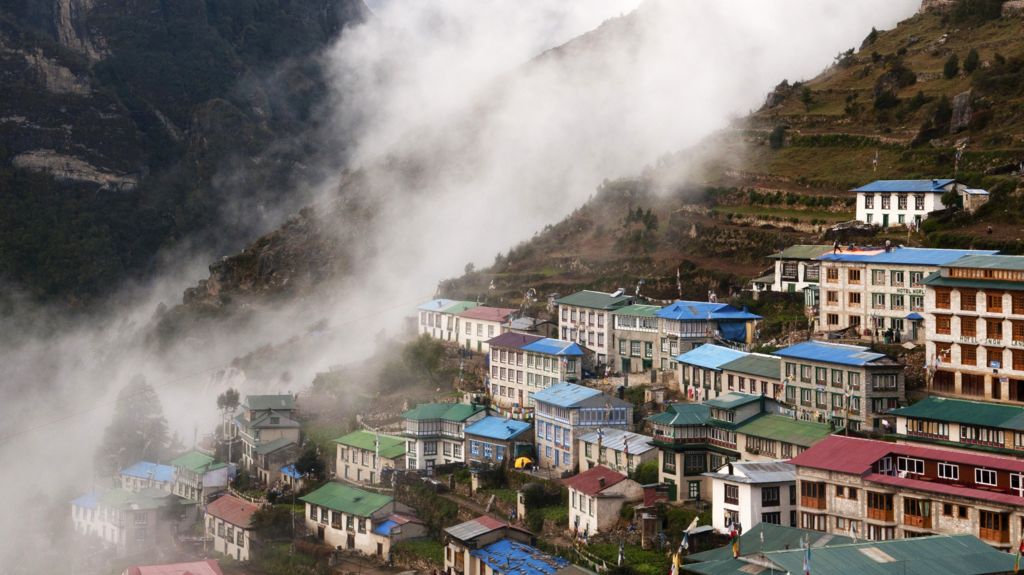
A landmark peer-reviewed study published in *Scientific Reports* has revealed that unplanned, rapid expansion of residential, tourism, and hydropower infrastructure across high-risk Himalayan zones spanning northern Nepal, southeastern Tibet, and India’s Uttarakhand state has exposed more than 300,000 people to life-threatening glacial flood and landslide hazards, with the actual at-risk population likely far higher than initial estimates. Conducted by a nine-member international research team from the UK, Nepal, and India, the analysis tracked built-up land expansion across a 50-kilometer downstream buffer from major Himalayan rivers and around 1,360 documented glacial lakes, finding that overall development in hazard-prone zones surged 45% between 2016 and 2023, while construction in areas directly vulnerable to glacial lake outburst floods skyrocketed nearly 78% over the same seven-year period. The research was finalized shortly before Nepal’s catastrophic August 2024 mass flooding that killed over 1,400 people and left thousands unaccounted for, and subsequent smaller but destructive incidents including the October 11 flash flood on the Budhi Gandaki River that destroyed 200 homes, washed away five bridges, and left five residents missing. Even the study’s conservative risk threshold, which categorized all structures within 50 vertical meters of river or glacial lake surfaces as exposed, understates actual danger: during the August Rasuwa district floods, local witnesses recorded river levels rising 70 meters at some points, burying buildings previously thought to be safely distanced from waterways under meters of debris. Rapid development has centered on iconic high-value Himalayan destinations including Pokhara, a world-famous tourism hub at the foot of the Annapurna range, where decades of unregulated growth to accommodate surging visitor numbers have left hundreds of heritage and residential buildings as close as 5 meters from the Seti Gandaki River banks, defying newer setback ordinances that mandate greater distance from waterways. Pokhara Mayor Dhana Raj Acharya noted that relocating these at-risk communities poses unprecedented logistical and financial challenges. The adjacent Annapurna trekking corridor, which draws hundreds of thousands of global hikers annually, has also seen unplanned homestay and hotel construction along riverbanks, with local business owners reporting plummeting bookings this peak trekking season as visitors avoid disaster-hit zones. Laxman Subedi, president of the Hotel Association Pokhara, openly acknowledged that the regional tourism sector expanded haphazardly with no formal risk planning for decades, and the industry group is now rushing to roll out risk awareness campaigns for local operators and investors. Beyond tourism, the valleys surrounding the Bhotekoshi and Trishuli rivers have seen a boom in hydropower plant construction, adding further strain to the fragile mountain ecosystem. Study lead author Dr. C Scott Watson, a glaciologist at the University of Leeds, emphasized that current short-sighted development decisions will lock in severe disaster risk for local communities for generations to come. The underlying driver of these escalating hazards is the Himalayan region’s accelerated warming, which is occurring at twice the global average, triggering rapid glacial melt, permafrost thaw, glacial lake expansion, and destabilization of steep mountain slopes that are already vulnerable to seismic activity. Nepal’s Prime Minister Balendra Shah highlighted this inequity during his recent UN General Assembly address, noting that his nation contributes almost nothing to global carbon emissions yet pays a colossal price for climate change, with every major disaster erasing years of hard-won development gains and forcing the low-income nation to take on crippling debt for post-disaster recovery. While independent mountain geographer Dr. Alton Byers of the University of Colorado described the new study as a critical springboard to push for life-saving early warning systems and targeted mitigation action, widespread enforcement failures of existing building and zoning regulations remain a core barrier. Urban planning expert Prof. Surya Raj Acharya of the University of Nepal noted that developers have long ignored mandatory river setback rules to build on the only accessible flat low-lying land along valley floors, even though the ecologically fragile Himalayan ecosystem demands far stricter construction safeguards than lowland regions. In response, Nepal’s national disaster management agency has announced an immediate full ban on new settlements within 15 meters of riverbanks along the devastated Rasuwa-Bhotekoshi corridor, with similar zoning restrictions rolling out across other high-risk river valleys in the coming months, though officials acknowledged that relocating long-established communities with deep sentimental ties to their ancestral land will be an enormous undertaking. Across the border in India’s Uttarakhand state, local environmental activists have decried rampant unregulated construction in pilgrimage and tourism zones, where formal floodplain zoning rules have been systematically bypassed in the name of economic growth. The Uttarakhand state cabinet approved long-delayed new floodplain land use regulations on October 12 to restrict unplanned construction, but disaster studies expert Prof. Basanta Raj Adhikari of Tribhuvan University warned that total elimination of Himalayan disaster risk is impossible, and proposed tiered risk mapping tied to differentiated insurance premium structures as a market-based incentive to push developers and residents to shift to safer higher-ground locations. For the moment, however, the pace of unplanned construction across the transboundary Himalayan high-risk zone shows no signs of slowing, leaving hundreds of thousands of residents facing persistent, growing exposure to catastrophic climate-driven disasters.
Building boom puts 300,000 people in the path of potential Himalayan disasters