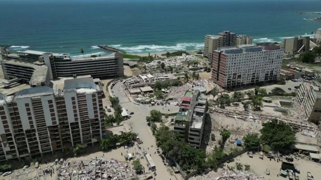
Newly released aerial footage has laid bare the catastrophic scale of destruction that has swept across Venezuela’s coastal La Guaira region in the wake of two powerful back-to-back earthquakes. The geologic events, registering magnitudes 7.2 and 7.5 respectively, have triggered one of the deadliest natural disasters the South American nation has faced in recent years.
As of the latest official updates from Venezuelan government authorities, the confirmed death toll from the seismic events has climbed to at least 1,430 people. The aerial perspective captured by drones and reconnaissance aircraft offers a sweeping, unflinching view of collapsed infrastructure, leveled residential neighborhoods and damaged public facilities that have left thousands of survivors displaced and in urgent need of aid.
La Guaira, a key coastal region that sits along Venezuela’s northern Caribbean coast, has long been recognized as an area at high risk for seismic activity, but the intensity of the two consecutive quakes has outpaced many local emergency preparedness expectations. Rescue and recovery teams are still working to clear rubble, reach isolated communities and account for hundreds of people who remain unaccounted for in the hardest-hit zones, even as emergency response efforts ramp up across the country.
International disaster relief organizations have already begun coordinating with local officials to deliver food, clean water, medical supplies and temporary shelter to affected populations, as the full scope of the tragedy continues to emerge in the days following the seismic shocks.