On Thursday, leading meteorological officials delivered a stark climate update: a new El Niño event has officially formed in the warming equatorial Pacific Ocean, and projections indicate it could grow to become one of the most powerful such events recorded since modern tracking began in 1950.
El Niño, a naturally occurring climate cycle defined by elevated sea surface temperatures across the central and eastern equatorial Pacific, is set to amplify the already accelerating planetary warming driven by decades of fossil fuel emissions, climate experts warn. The United States National Oceanic and Atmospheric Administration (NOAA) confirmed the event’s formation in an official announcement, noting there is a 63% probability that the event will intensify to a rank among the four strongest El Niños on record by late fall and early winter. Many forecasters even project it could match or outpace the devastating 1997 El Niño, which caused tens of billions of dollars in global damage via cascading extreme weather events including deadly heatwaves, catastrophic flooding, prolonged droughts, intense tornado outbreaks, and out-of-control wildfires.
“Warm deep water associated with El Niño reshapes global weather patterns by releasing a massive amount of excess heat into the atmosphere, which acts as a catalyst for extreme weather events across nearly every continent,” explained Abby Frazier, a climate scientist at Clark University. For many vulnerable Pacific communities, she added, conditions can deteriorate into life-threatening scenarios with alarming speed. United Nations Secretary-General António Guterres framed the confirmation of El Niño as an urgent wake-up call for global climate action, noting that the event would “pour fuel on the fire of a warming world.”
Unlike uniform weather events, El Niño creates divergent impacts across different regions, creating a mix of winners and losers. One notable silver lining is that El Niño typically suppresses (though does not eliminate) hurricane activity in the Atlantic Ocean, which could reduce storm risk for the U.S. East and Gulf Coasts. However, this reduction comes with a tradeoff: Pacific hurricane activity is expected to increase, putting Hawaii and other Pacific island nations at greater risk.
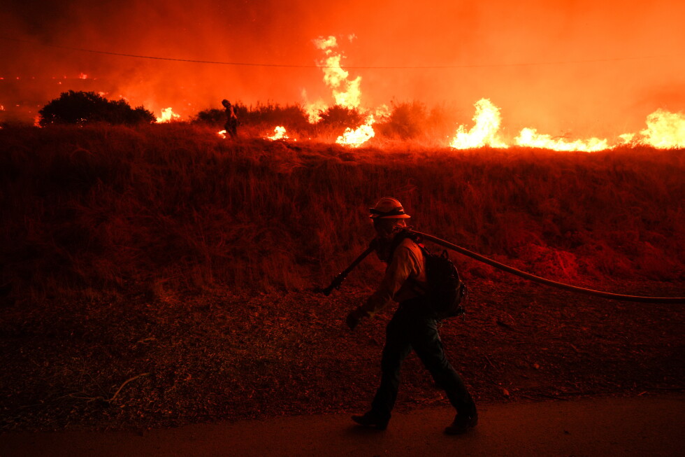
Other regional impacts follow well-documented patterns. The chronically drought-stricken Middle East could see much-needed precipitation that eases dry conditions, while western South America — the region where El Niño was first identified centuries ago by local fishermen — faces elevated risk of extreme rainfall and devastating flooding alongside a much hotter than average summer. India will likely face longer, more intense heatwaves, while Australia is threatened by worsening drought, more destructive wildfires, and prolonged high temperatures. Northeastern Africa, already reeling from persistent severe drought, could experience extreme whiplash with a sudden shift to dangerously heavy rainfall that causes flash flooding, according to Muhammad Azhar Ehsan, a Columbia University climate scientist and leading El Niño researcher.
In the United States, the event is projected to bring more intense, rain-heavy storms to the southern states, while the Pacific Northwest will likely see warmer than average temperatures and drier conditions. The northern Rockies and Southwest, currently facing record-breaking snow drought, could receive beneficial heavy summer rainfall. On the agricultural side, El Niño generally brings favorable conditions for U.S. crop production, particularly for soybeans in the country’s 18 major growing regions, though outcomes for dairy and cattle production are more mixed. Despite these agricultural benefits, Stanford climate economist Marshall Burke notes that the overall temperature increase driven by this El Niño will likely dampen U.S. economic growth, as research consistently shows national economic output slows when average temperatures climb above historical norms.
Most climate scientists project that 2027 will become the hottest year ever recorded globally, due to the lagging climate impacts of this El Niño, which is expected to reach its peak intensity between late 2024 and early 2025.
Unusually for this time of year, all forecasters are aligned in their projections of a very strong event, thanks to unusually clear early indicators. Typically, El Niño forecasts vary widely in the early stages of formation, but this year, warm water has already pushed steadily toward the Pacific surface, creating unambiguous signals that the event will intensify rapidly. Unlike most El Niños that peak in mid-winter, Ehsan’s research team projects this event will reach its peak one to two months earlier, and Princeton climate scientist Gabriel Vecchi adds that large El Niño events like this one typically persist longer than weaker events.
Climate researchers have observed that as planetary warming continues to accelerate due to fossil fuel combustion, El Niño events are becoming stronger and more frequent on average, though Frazier notes it is too soon to confirm whether this specific event fits that long-term trend. Even before its official confirmation, the event has earned dramatic nicknames ranging from “Super El Niño” to “Godzilla El Niño” among the climate community. While the event brings significant risk, Ehsan emphasizes that preparation can reduce harm: “Instead of giving in to fear, we can urge communities to prepare early for the changes ahead.”