Global weather authorities have sounded a clear alarm: the climate phenomenon El Nino is increasingly likely to develop in the coming months, bringing heightened risks of extreme weather that could compound decades of human-caused global warming. In its latest quarterly update on El Nino and its cooling counterpart La Nina, the United Nations’ World Meteorological Organization (WMO) announced Tuesday that there is an 80% probability of El Nino forming between June and August 2024, with that likelihood climbing to near or above 90% by November. Most climate models also project the event will be at least moderate, and possibly reach strong intensity.
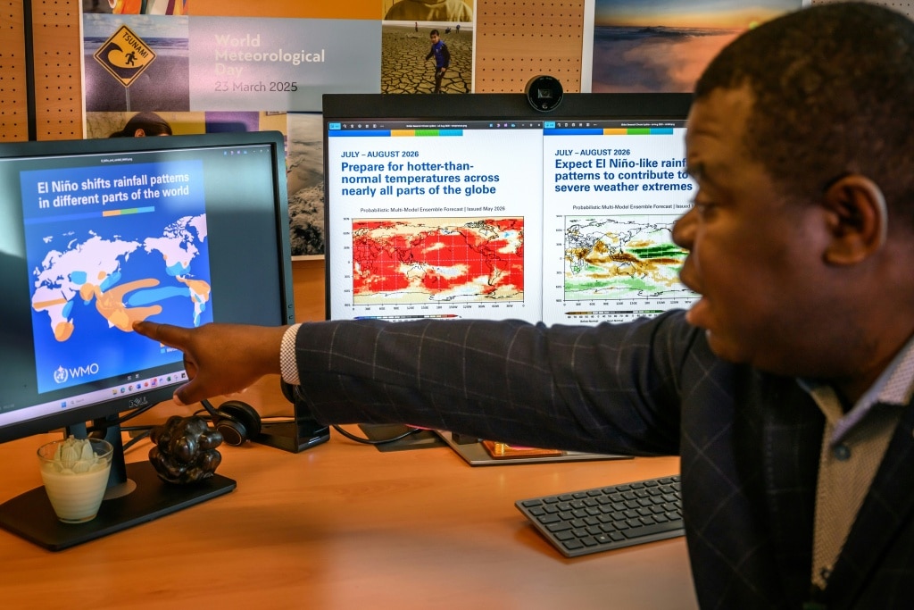
El Nino is a naturally occurring climate pattern defined by elevated surface ocean temperatures across the central and eastern equatorial Pacific. It reshapes global atmospheric circulation, wind patterns, and rainfall distribution, with effects that can last 9 to 12 months, occurring every two to seven years as conditions cycle between El Nino, La Nina, and neutral phases. As of late April to mid-May 2024, WMO data shows sea surface temperatures in the key monitoring region of the central-eastern equatorial Pacific are already approaching El Nino threshold levels, with sub-surface ocean temperatures measuring more than 6°C above the long-term average. The Southern Oscillation Index, the atmospheric metric that tracks El Nino development, also aligns with the pattern’s formation.
While WMO confirms there is no conclusive evidence that human-caused climate change increases the frequency or strength of El Nino events, the agency emphasizes that rising global temperatures amplify the phenomenon’s most dangerous impacts. A warmer baseline ocean and atmosphere already hold extra energy and moisture, creating conditions that make extreme weather events such as heatwaves and intense downpours far more likely during an El Nino event. The most recent major El Nino was a key driver pushing 2023 to become the second-hottest year on record, and 2024 to break all previous temperature records, hitting an average of 1.55°C above the pre-industrial baseline from 1850 to 1900.
WMO Secretary-General Celeste Saulo stressed that the time for global preparation is now, warning the upcoming El Nino could worsen existing droughts, amplify heavy rainfall, and boost the risk of dangerous heatwaves across both land and marine ecosystems. “It will have cascading impacts,” Saulo told reporters, noting that warming tropical oceans can ripple through global trade, national economies, and human security. “That’s why this early information is so relevant and so important.” Early preparation, she added, can help climate-sensitive sectors including agriculture, water management, energy, and public health adapt to coming changes. Currently, 128 countries operate multi-hazard early warning systems, and the UN has set a target of achieving universal coverage for all nations by the end of 2027.
UN Secretary-General Antonio Guterres framed the forecast as an urgent climate wake-up call in a video address. “El Nino is arriving on our doorstep,” Guterres said. “The world must treat it as the urgent climate warning it is. El Nino conditions will pour fuel on the fire of a warming world.” Guterres added that the only meaningful response to the growing risk is scaled climate action: ending global dependence on fossil fuels, accelerating the transition to renewable energy, protecting vulnerable communities, and rolling out universal early warning systems.
Though El Nino typically reaches its peak intensity between November and February, the associated temperature surge often emerges after the event’s peak. Forecasters expect more precise projections of the event’s timing and strength to be available next month. For the June to August period, WMO forecasts that nearly every region of the globe will see above-average temperatures, increasing the risk of overlapping extreme hazards and accelerating drought development in areas that receive reduced rainfall.
Regional climate projections already point to specific high-risk zones: the northern Greater Horn of Africa is forecast to see below-normal rainfall during its critical June-September wet season; South Asia is projected to have below-average monsoon rainfall; and Central America is likely to face a hotter, drier than average summer. In terms of hurricane activity, El Nino’s warm Pacific waters typically fuel more intense hurricane development in the central and eastern Pacific, while suppressing storm formation in the Atlantic Ocean during the Northern Hemisphere summer.