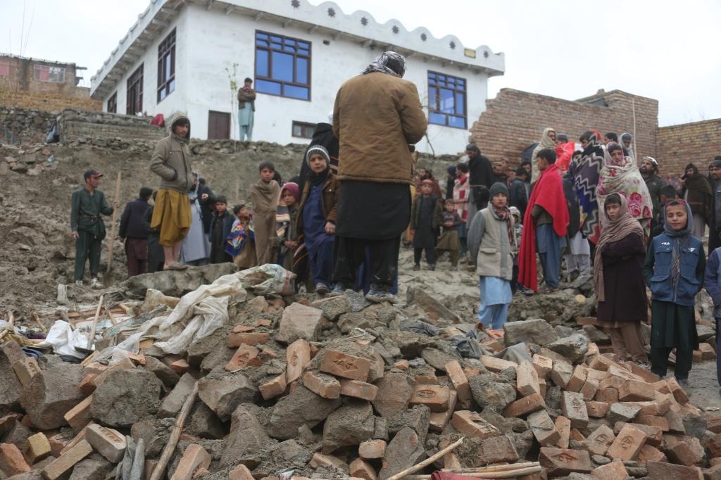
On the night of Friday, April 3, 2026, a magnitude 5.8 earthquake jolted multiple regions across Afghanistan, leaving a confirmed death toll of 12 and four additional people injured, Afghan deputy government spokesperson Hamdullah Fitrat announced in a public statement on Saturday.
The seismic event sent strong tremors rippling across a wide swathe of the country, impacting communities in the national capital Kabul as well as six eastern and northern provinces: Panjshir, Logar, Nangarhar, Laghman, Nuristan, and Badakhshan. Beyond the human cost of the disaster, Fitrat shared in a post to the social platform X that the quake also caused significant structural damage: 38 residential homes were damaged, and a total of 40 families have been displaced or otherwise affected by the disaster.
Initial geological surveys placed the earthquake’s epicenter roughly 35 kilometers south of Jurm district in Afghanistan’s northern Badakhshan Province, at coordinates 36.55 degrees north latitude and 70.85 degrees east longitude. The temblor originated at a depth of 186.4 kilometers below the Earth’s surface, a depth that allowed shaking to be felt across far-flung regions of the country, from the capital Kabul to all adjoining border provinces.
This latest seismic disaster is far from an isolated event for Afghanistan, a nation that sits atop geologically active fault lines and is frequently battered by destructive earthquakes, especially in and around the rugged Hindu Kush mountain range that stretches across the country’s northern and eastern regions. Just last November, a stronger 6.3-magnitude quake hit this same general region, killing more than two dozen people and injuring nearly 1,000 more across the northwestern provinces of Samangan and Balkh.