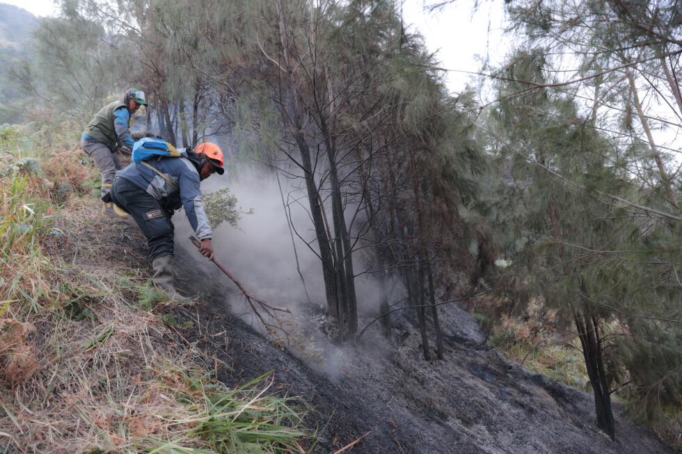
As Indonesia confronts its annual dry season wildfire crisis, authorities announced Wednesday that firefighting teams have mostly contained a large blaze that tore through one of Java’s most visited protected natural landmarks, Bromo Tengger Semeru National Park. Though several lingering hot spots continue to challenge crews, the progress comes as a much-needed reprieve for the iconic tourist destination, which has been closed to visitors since the fire ignited last week.
As of Tuesday, the fire had burned through nearly 900 hectares (2,224 acres) of park land, destroying vast swathes of dry grassland, native vegetation, and protected edelweiss flower populations, according to Rudijanta Tjahja Nugraha, head of the East Java-based national park. The world-famous volcanic terrain of Mount Bromo, a top draw for domestic and international tourists that draws hundreds of thousands of visitors annually, falls within the burned perimeter. The entire conservation zone remains closed while crews work to stop any further spread of the blaze.
Four active hot spots still persist across the park, located in the Watangan, Argowulan, Dingklik-Pakis, and Bincil-Mungal regions. Nugraha explained that combined ground teams and aerial firefighting units are working around the clock to prevent these hot spots from flaring back into full blazes. “We are not only trying to put out the visible fire, but also ensuring it is completely extinguished and does not reemerge later,” he said.
The Bromo blaze is just one small part of a far larger national wildfire emergency gripping Indonesia this dry season. As of Monday, Indonesia’s National Disaster Management Agency (BNPB) confirmed that nearly 48,900 hectares (121,000 acres) of vulnerable peatland has already burned across six fire-prone provinces, with the largest concentration of destruction recorded in West Kalimantan on the island of Borneo.
In Pontianak, the capital of West Kalimantan, the widespread fires have already upended daily life: officials suspended all in-person classes after local air quality plummeted to unsafe levels, and health authorities have documented a sharp spike in reported respiratory illnesses across the province.
In response to the growing crisis, the Indonesian government has ramped up national firefighting efforts across the high-risk islands of Sumatra and Borneo, deploying more than 35 aircraft to support ground operations, including water-bombing helicopters and surveillance patrol planes. BNPB chief Suharyanto, who like many Indonesians goes by a single name, emphasized the critical role of aerial support, particularly for peatland fires. “Aerial operations are supporting ground operations which are especially critical in peatland areas,” he explained. “Because peat fires can continue smoldering underground long after surface flames disappear and can reignite if not fully extinguished.”
Suharyanto added that peatland fires produce uniquely dangerous outcomes: the dense smoke they generate creates toxic, widespread haze that cripples regional air quality, elevates public health risks for local communities, and often drifts across international borders to impact neighboring countries. BNPB data confirms that satellite imagery has detected thick smoke haze drifting from West Kalimantan into neighboring Malaysia multiple times this month.
This annual cycle of forest and peatland fires is a long-running environmental and diplomatic challenge for Indonesia. Authorities confirm that most blazes are deliberately ignited illegally by commercial plantation operators or small-scale traditional farmers clearing land for new planting. These unchecked burns periodically blanket huge swathes of Southeast Asia in hazardous haze, repeatedly straining Indonesia’s diplomatic relations with neighboring countries.