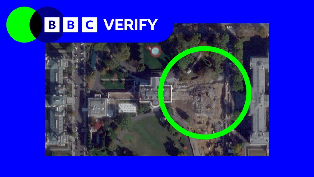
Recent high-resolution satellite images have unveiled the full-scale demolition of the White House East Wing, a historic section of the presidential residence. This significant structural overhaul is part of an ambitious renovation project aimed at constructing a grand ballroom for former President Donald Trump. The images, captured by advanced satellite technology, depict the site cleared of all previous structures, marking a pivotal moment in the ongoing transformation of the White House grounds. The decision to demolish the East Wing has sparked widespread debate, with critics questioning the preservation of historical architecture, while supporters argue it reflects modern presidential needs. The project underscores the intersection of political legacy and architectural evolution in one of the world’s most iconic buildings.