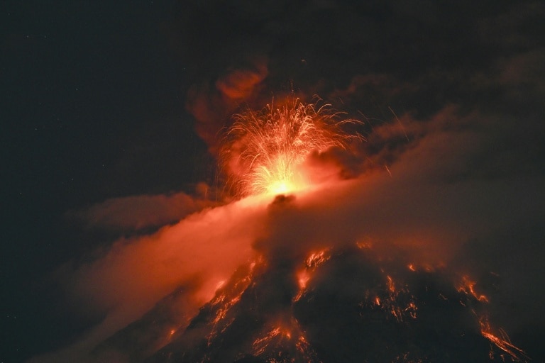
One of Central America’s most consistently active volcanoes, Fuego, has erupted, pushing Guatemalan national authorities to activate the country’s second-highest emergency alert level and order the evacuation of at-risk nearby communities. The volcano first began erupting early Monday, and activity grew significantly more intense as the day progressed, according to official updates. By nightfall, fast-moving lava flows had begun streaming down the volcano’s slopes, while massive plumes of toxic gas and volcanic ash surged more than six kilometers into the sky.
Guatemala’s national disaster coordination agency Conred confirmed the nationwide orange danger alert in an official post to social media platform X, noting that the orange designation sits one step below the country’s highest red alert level, which is reserved for the most severe catastrophic events. Located just 35 kilometers southwest of Guatemala City, the 3,763-meter-high volcano prompted immediate evacuation orders for two villages situated close to its crater by Monday afternoon.
Drone and on-the-ground footage released by Guatemalan emergency services captured the dramatic power of the eruption, with ash turning the sky a deep, fiery red and incandescent lava cutting distinct paths down the volcano’s forested slopes. In a public video address shared across social platforms, Conred spokesperson Valeria Urizar urged at-risk residents to prioritize personal safety: “If an official evacuation order is issued, or conditions on the ground start to put your life in danger, follow protocols for immediate self-evacuation.”
Guatemala’s Institute of Volcanology further warned in a formal bulletin that Fuego’s activity is trending toward a far more explosive phase, increasing risks for surrounding populations. The agency highlighted that fast-moving flows of superheated volcanic debris are a major ongoing hazard, with communities along the volcano’s western and southern slopes facing the greatest level of threat.
As a precautionary measure, the Guatemalan Ministry of Education has suspended all in-person classes for two municipalities located near the volcano. National traffic police have also closed a key circular highway that links Guatemala’s southern Pacific coast to Antigua, a top international tourist destination and UNESCO World Heritage Site, to prevent travelers from entering high-risk zones. The Institute of Volcanology confirmed that ash plumes have reached altitudes of more than 6,000 meters, with light to heavy ash fall already reported in multiple nearby communities.
Fuego’s latest major eruption marks one in a series of significant events from the volcano in recent years, as Guatemala sits atop the Pacific Ring of Fire, a geologically active region that experiences frequent seismic and volcanic activity. In 2018, a catastrophic eruption of Fuego sent fast-moving lava flows pouring into the nearby village of San Miguel Los Lotes, killing 215 people and leaving an equal number of residents unaccounted for. More recently, an eruption in 2023 prompted the evacuation of roughly 1,200 at-risk residents, and just last year, another outburst of gas and ash forced the evacuation of more than 500 people to emergency shelters. On both occasions, authorities suspended local school operations and closed the same key highway connecting the south coast to Antigua, mirroring the precautions being implemented this week.