In the early hours of Monday, a powerful 7.8-magnitude earthquake rocked parts of the southern Philippines, leaving infrastructure damaged, cutting power supplies, and prompting urgent tsunami warnings for coastal zones across multiple regional nations. The seismic event has put emergency response teams on high alert, though no confirmed fatalities or injuries have been released in the immediate aftermath.
According to data from the Philippine Institute of Volcanology and Seismology (PHIVOLCS), the earthquake’s epicenter was located 13 kilometers southwest of General Santos, a major coastal commercial hub on the island of Mindanao that is home to more than 700,000 residents and renowned for its large-scale tuna processing industry. The agency recorded the quake hitting at 7:37 a.m. local time at a depth of 10 kilometers. The U.S. Geological Survey offered a slightly different depth measurement of 55 kilometers, a common discrepancy between agencies in the immediate hours following large seismic events. In the wake of the initial quake, aftershocks reaching as high as magnitude 6.5 were recorded by the U.S. body.
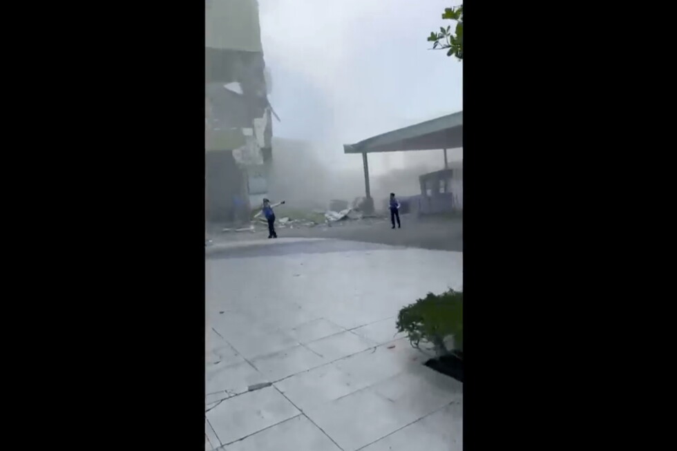
Widespread damage has already been reported in General Santos, including the partial collapse of a four-story small commercial building that housed a provincial branch of Manila-based DZRH radio station. Station representatives confirmed that all on-site staff fled to the ground floor safely and escaped without injury, but uncertainty remains over whether any other people were trapped in the rubble, as the quake struck before standard office hours when most workers had not yet arrived.
Immediately following the seismic event, the Pacific Tsunami Warning Center (PTWC) issued a series of regional alerts. The center warned that tsunami waves as high as 3 meters could impact sections of the Philippine coastline, while surges of up to 1 meter were possible for coastal areas of Indonesia and Malaysia. Smaller, non-destructive sea level changes were flagged for Taiwan, Japan, Guam, Papua New Guinea, and multiple small island nations and territories across the western Pacific. The PTWC explicitly confirmed that Hawaii faced no tsunami threat from the quake. As of Tuesday local time, Indonesia’s meteorological agencies have already recorded minor tsunami surges of up to 18 centimeters along coastlines in North Sulawesi and North Maluku provinces, where residents also reported feeling clear tremors from the main quake.
Teresito Bacolcol, head of PHIVOLCS, issued an urgent advisory for at-risk coastal populations, urging residents to evacuate immediately to elevated inland areas or higher ground to avoid potential tsunami inundation.
This seismic event underscores the constant natural hazard risk the Philippines faces as a nation positioned along the Pacific “Ring of Fire”, an extensive arc of active seismic faults that circles the Pacific Basin. The archipelagic nation counts among the world’s most disaster-prone countries, regularly experiencing major earthquakes and volcanic eruptions, and is hit by an average of 20 typhoons and tropical storms each year.