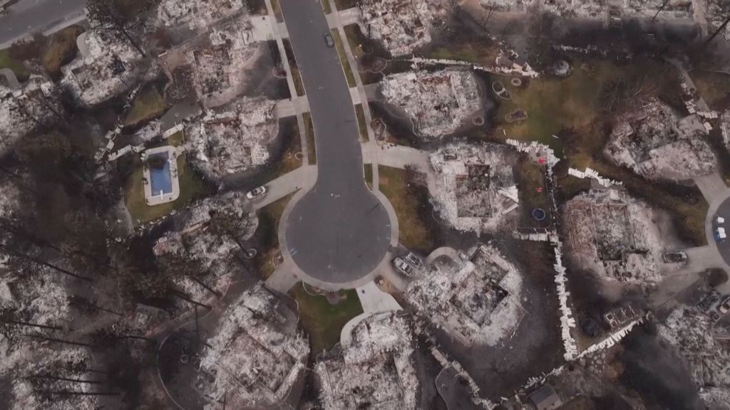
Newly released aerial footage captured by an unmanned drone has laid bare the full scale of destruction left behind by recent wildfires that swept through parts of Spokane. The sweeping, bird’s-eye view of the affected area offers a haunting perspective on the disaster, showing entire residential neighborhoods reduced to charred rubble. Where family homes once stood, only concrete foundations remain, blackened and empty. In a particularly striking detail that underscores how suddenly the blaze forced residents to flee, many burned-out, twisted shells of cars still sit in the driveways of the leveled properties, abandoned when owners evacuated ahead of the advancing fire line. The dramatic imagery has drawn renewed attention to the growing threat of destructive wildfires in the Pacific Northwest, a region that has seen a steady increase in large-scale fire events in recent years linked to rising temperatures and prolonged dry conditions. Local emergency management officials have confirmed that the damage captured in the footage matches preliminary on-ground assessments, as teams continue working to clear debris, support displaced residents, and investigate the cause of the blaze.