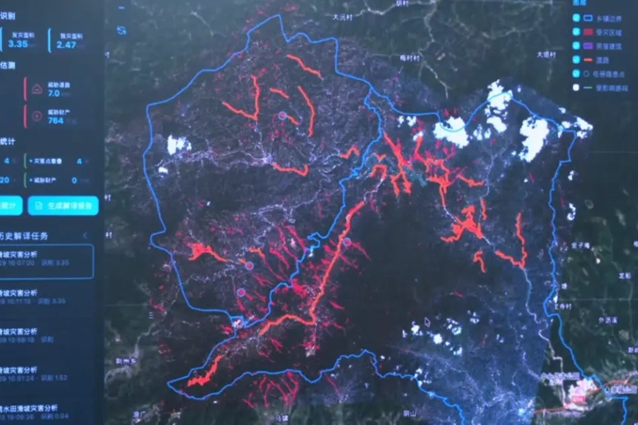
Against a backdrop of rising extreme weather events that have exposed critical gaps in legacy disaster mitigation frameworks, China’s Ministry of Natural Resources has launched an ambitious new five-year plan to reform the country’s geological disaster prevention system, shifting focus from monitoring individual hazard points to managing entire at-risk zones to cut disaster-related casualties and economic damage.
Releasing the 15th Five-Year Plan (2026–2030) for National Geological Disaster Prevention and Control in early August 2026, officials outlined that the policy update comes in response to a growing trend: more frequent extreme rainfall is triggering sudden, clustered and cascading geological disasters in regions previously classified as outside traditional high-risk zones. Point-based prevention strategies, which only target documented individual hazard sites, have proven ill-equipped to handle these emerging threats, according to the ministry.
As of the end of 2025, China has recorded nearly 280,000 registered geological disaster hazard points across the country. These sites collectively put more than 11.48 million people at risk, and threaten more than 760 billion yuan ($112.54 billion) in property, underscoring the ongoing severity of the nation’s disaster prevention challenge despite major progress in recent years.
During the 14th Five-Year Plan period (2021–2025), China recorded notable gains in disaster risk reduction: compared to the 2016–2020 period, geological disaster-related fatalities dropped by 52%, and direct economic losses fell by 38%. The country also expanded its technological disaster prevention infrastructure dramatically, deploying over 75,000 automated monitoring and early warning devices and launching successful pilot programs for comprehensive remote-sensing geological disaster identification.
Even with these advances, unique geographic and climatic conditions leave China facing persistent geological disaster risks, explained Yang Xudong, a senior engineer at the ministry’s Geological Disaster Technical Guidance Center. China’s diverse terrain, complex geological structures, active tectonic and seismic activity, variable climate patterns, growing frequency of extreme weather, and intensive human engineering activity all combine to create conditions for frequent, recurring geological disasters. Yang added that many of these events are particularly hard to forecast due to their hidden origin, tendency to reoccur, and sudden onset, making proactive prevention the most effective strategy to reduce risk.
According to Yang, China’s geological disaster prevention work has now entered its third evolutionary stage. “The previous two stages — whether relying on traditional community-based monitoring and professional surveys, or on large-scale high-precision remote sensing and widespread monitoring instruments — both centered on hazard points with visible deformation signs,” Yang noted. “The new stage directly addresses mass shallow landslides and debris flows triggered by extreme rainfall, which often show no clear warning signs and typically strike during the peak of heavy rainfall. Traditional methods struggle to identify and predict these kinds of disasters.”
To tackle these new challenges, the 15th Five-Year Plan outlines seven core priorities for the 2026–2030 period, including dynamic nationwide hazard surveys, upgrades to monitoring infrastructure, and comprehensive risk governance. The plan targets the completion of more than 4,200 engineered disaster mitigation projects, over 6,100 hazard elimination projects, and the relocation of 50,000 at-risk households to safer areas.
A dual management system that combines oversight of both individual hazard points and entire risk zones will be rolled out in 1,206 key counties, cities and districts across 17 priority provinces, with formal management rosters and clear accountability frameworks established for each administrative region.
The plan also expands the number of national key prevention zones to 21, up from 16 during the 14th Five-Year Plan period. These zones cover approximately 2.97 million square kilometers of terrain at risk of landslides, rockfalls, debris flows and ground subsidence, plus an additional 280,000 square kilometers at risk of ground settlement and earth fissures.
Newly added key prevention zones include the lower reaches of the Yarlung Tsangpo River hydropower project area, high-altitude long-distance disaster chain regions, and the Yanshan-Taihang Mountain region. The plan also refines risk mapping for traditional high-susceptibility areas, including southeastern China’s hilly regions and the mountainous southwest.
A central focus of the new plan is boosting the precision and intelligence of prevention efforts. It mandates detailed 1:10,000 scale geological surveys for all key towns located in extremely high and high-risk areas, and promotes wider adoption of advanced technologies including artificial intelligence and digital twins to improve hazard identification and early warning accuracy.
Yang emphasized that these changes represent a fundamental upgrade to China’s disaster prevention philosophy. “The shift reflects the scientific recognition that under extreme conditions, some disasters remain beyond prevention with existing technology,” he said. Moving forward, disaster prevention will increasingly rely on evidence-based scientific risk assessment, precision early warning, and broad public participation to raise disaster awareness across all levels of society, he added.