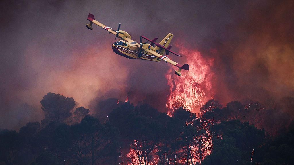
A catastrophic wave of unprecedented wildfires is sweeping across large swathes of France and Spain, triggering mass evacuation orders for more than 300,000 residents as climate-fueled heatwaves create extreme, fire-friendly conditions across Southern Europe.
In France, the country is facing its most destructive wildfire season in 22 years, with the southwestern Gironde region surrounding Bordeaux bearing the brunt of the destruction. More than 200,000 local residents have already been forced to flee their homes, as flames have consumed more than 420 square kilometers of land—an area four times the size of the French capital—in less than four days. The fire line currently sits just 15 kilometers from the southern edge of Bordeaux, advancing rapidly through the country’s iconic wine-growing region, destroying forests, agricultural land and threatening critical infrastructure along the way.
The blazes have even put sensitive military and industrial sites at risk, including facilities involved in ballistic missile development, rocket motor production and hazardous chemical processing. Satellite imagery captured over Gironde reveals a vast, scorched black landscape, with plumes of thick smoke drifting hundreds of kilometers inland. Most alarmingly, the extreme intensity of the fires has spawned a rare fire-generated thunderstorm, a meteorological phenomenon that occurs when intense wildfire heat pulls smoke, ash and water vapor rapidly into the upper atmosphere. As the heated air cools, it forms cumulonimbus thunderclouds capable of producing lightning that can ignite new blazes, alongside unpredictable hail and rain outbreaks. These erratic conditions have made containing the fires far more challenging for emergency crews.
To the west, in the mountainous region surrounding the Spanish capital Madrid, three separate large wildfires have burned roughly 770 square kilometers of land, with regional officials labeling the event the worst wildfire disaster in the region’s recorded history.
Thousands of emergency responders have been deployed across both countries to combat the spreading blazes. In Gironde alone, the response effort includes 2,500 firefighters, 1,500 military personnel and 1,200 police officers and gendarmes. Aerial firefighting assets, including Canadair water-bomber aircraft capable of scooping 6,000 liters of water from nearby lakes or the Atlantic Ocean in just 12 seconds, have conducted continuous shuttle missions to drop water and fire retardant along fire perimeters. Near the coastal town of Lacanau, heavy construction equipment has been used to carve 100-meter-wide firebreaks, stripping all vegetation from strips of land to starve advancing flames of fuel. Spanish emergency teams have deployed similar tactics to contain their blazes.
This year’s extreme wildfire season comes on the heels of a record-breaking sweltering summer across Europe, where widespread heatwaves have pushed temperatures above 40°C (104°F) across much of the continent. Climate scientists and on-the-ground officials warn that rising global temperatures driven by climate change have created the hotter, drier conditions that allow wildfires to spread faster and burn with far greater intensity. With forecasts calling for sustained high pressure that will bring continued dry, rising temperatures across the region over the coming week, officials and residents in both countries are bracing for worsening conditions as emergency crews work around the clock to contain the unprecedented disaster.