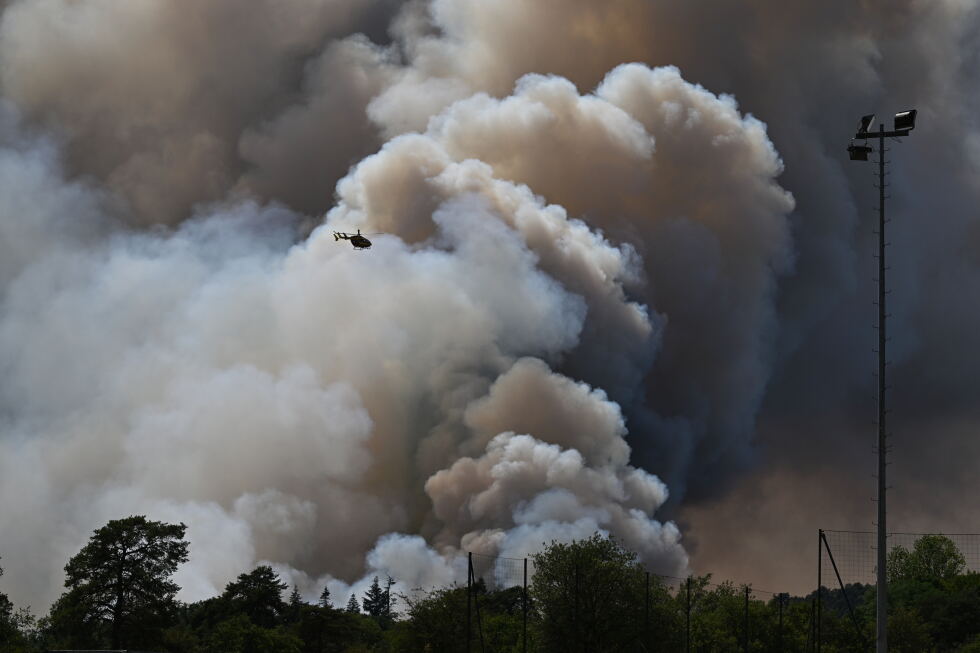
In a groundbreaking and alarming development that underscores the growing risk of extreme wildfire behavior linked to climate change, French officials have confirmed that an out-of-control wildfire in southwest France grew powerful enough to spawn its own thunderstorm — a rare weather event never before recorded in the nation’s history.
The massive blaze, which ignited near the commune of Saumos in the Gironde region on July 22, has already carved a devastating path across the region. As of official updates, it has consumed more than 420 square kilometers of protected forest and dry scrubland, ruined or completely destroyed over 240 residential structures, and forced an unprecedented 220,000 local residents to flee their homes to escape the advancing flames.
Two days after the fire first broke out, at approximately 6:20 p.m. local time on Friday, Gironde’s departmental fire and rescue service confirmed the formation of a pyrocumulonimbus, or pyroCb — an enormous, storm-forming cloud generated entirely by the extreme heat of an intense wildfire. The cloud weakened temporarily overnight as atmospheric humidity climbed, but reformed repeatedly in subsequent days as the inferno continued to rage.
Unlike ordinary thunderstorms that form from atmospheric heat exchange, a pyrocumulonimbus is born directly from the extreme heat of a large wildfire. Theodore M. Giannaros, a fire meteorologist at the National Observatory of Athens, explains the phenomenon simply: it is what happens when a wildfire grows so large and hot that the smoke and hot air rising from its flames condense into a full-fledged storm cloud.
The conditions required to spawn a pyroCb are very specific. There is no set threshold temperature for formation, but the atmosphere must match the structure that breeds dry thunderstorms: extremely hot, parched air close to the ground, capped by a layer of cooler, more moisture-rich air higher in the atmosphere. As superheated air loaded with smoke, ash and water vapor surges upward from the wildfire, it cools as it climbs, and water vapor condenses around tiny ash particles. Above the freezing altitude, these condensing droplets turn to ice crystals, whose collisions separate electrical charges just as they do in a regular thunderstorm.
The result is an electrified black storm cloud that generates lightning, erratic winds and unpredictable fire behavior. Unlike a normal storm that forms independent of a fire, this storm system amplifies the disaster that created it. Rising air pulls powerful gusts of wind straight toward the heart of the blaze, while cold downdrafts hurl strong gusts back to the surface across the surrounding landscape. These sudden wind shifts can redirect the fire’s path, split it into multiple separate fire fronts, or send flames racing into untouched areas that were previously considered safe.
Giannaros notes that this is a self-reinforcing feedback loop, not a one-sided side effect of the fire. “Once it forms, the cloud becomes its own weather system, sitting on top of the fire and making it harder to predict,” he explained. In the most extreme cases, these systems can even spawn rotating fire columns called fire whirls — essentially fire-fueled devils that move across the landscape spreading destruction. True fire tornadoes are far rarer, but one such event hit Redding, California during the 2018 Carr Fire, packing EF-3 equivalent winds and killing a fire inspector.
For frontline firefighting crews, the formation of a pyroCb creates unprecedented danger. Escape routes can be cut off without warning when lightning sparks new wildfires far beyond the reach of deployed crews and equipment. Direct attacks on the main blaze become impossible, forcing teams to abandon containment efforts and retreat to defend populated communities at risk. The biggest threat, Giannaros emphasized, is that the fire can spread faster than emergency managers can organize evacuation orders for at-risk populations.
Until this event, pyrocumulonimbus events were almost exclusively documented in North America and Australia, where they only form over the most extreme large-scale wildfires. Canada alone recorded a staggering record 142 pyroCb events in 2023. In Europe, the phenomenon has been extremely rare: only one confirmed event was recorded in Portugal during the catastrophic 2017 wildfire season. France’s 2022 Gironde fire marks the first confirmed pyroCb in the nation’s recorded history, according to the French National Firefighters Federation.
The emergence of this rare extreme fire event in France aligns with broader climate trends across the European continent. Data from the EU’s Copernicus Climate Change Service and the World Meteorological Organization shows that Europe has been warming faster than any other continent on Earth — at roughly twice the global average rate since the 1980s. As a result, heat waves have grown far more frequent and severe, widespread drought has parched much of southern Europe, and dense forests have dried out into ideal wildfire fuel.
Giannaros explained that hotter, drier conditions create far more opportunities for the extreme wildfires that can spawn pyroCbs, but the scientific community still lacks sufficient long-term data to confirm a clear upward trend in these events across Europe. The European research project ROSETTA is currently working to close this knowledge gap, to help emergency managers better prepare for and respond to these extreme events in the future.
Giannaros added that one of the most common public misunderstandings about pyrocumulonimbus is that the storm cloud is just an inconsequential side effect of a large fire. In reality, for as long as the storm sits above the flames, it actively shapes the fire’s future path and intensity, turning a predictable blaze into an unpredictable, deadly disaster.