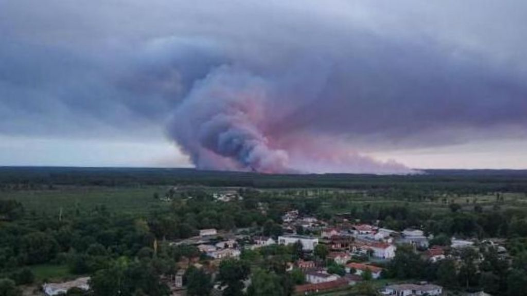
As record-breaking heatwaves parched much of Western Europe this summer, France is confronting a new, unprecedented threat linked to its raging wildfires: the formation of pyrocumulonimbus clouds, rare fire-generated thunderstorms that have never before been documented in the country.
Tens of thousands of residents have already been evacuated from the Gironde region surrounding Bordeaux, as authorities battle blazes supercharged by this extreme meteorological phenomenon. Scientists explain that pyrocumulonimbus clouds form when the intense heat from large wildfires forces hot air, filled with smoke, ash and water vapor, to surge rapidly into the upper atmosphere. As this rising air cools, water vapor condenses, and if the wildfire is powerful enough and atmospheric conditions are unstable, the formation grows into a towering cumulonimbus cloud — the same storm structure that produces ordinary thunderstorms.
Unlike regular thunderstorms, these fire-generated storms make containing wildfires far more dangerous and unpredictable. Turbulent winds whipped up by the clouds hurl embers dozens of kilometers ahead of the main fire line, sparking new blazes in untouched areas. Lightning strikes from the clouds also ignite secondary fires, creating multiple fronts that stretch firefighting resources dangerously thin.
This extreme event comes amid a summer of climate-fueled extreme heat across the continent. Unprecedented high temperatures and near-total lack of rainfall have left vast swathes of France, Spain and the United Kingdom tinder-dry, primed for destructive wildfires. As of Monday, local authorities in Gironde reported that the fire situation had stabilized overnight, but new threats loom on the horizon: a second heatwave, with forecasted highs reaching 40 degrees Celsius (104 degrees Fahrenheit), is expected to hit France later this week. A senior French response official has warned that the Gironde blazes will likely continue burning for “many weeks,” and could take months to fully extinguish.
Pyrocumulonimbus clouds form most often under the exact dangerous conditions amplified by human-caused climate change: extreme heat, strong winds, and near-zero soil moisture. Climate scientists have long warned that rising global temperatures will make these rare extreme events far more common. While pyrocumulonimbus were once considered uncommon, major fire events around the world in recent years have already proven this prediction correct.
The most prominent previous example occurred during Australia’s catastrophic 2019–2020 Black Summer bushfires, when dozens of pyrocumulonimbus clouds formed, creating self-sustaining “firestorms” that generated their own weather systems. That fire season remains one of the most destructive in Australia’s recorded history: it killed at least 33 people, including four firefighters, and burned more than 11 million hectares of land, an area roughly the size of Portugal. Fire officials in New South Wales recorded embers from the firestorms landing as far as 30 kilometers (18 miles) ahead of the main fire front — three times the typical spread distance for regular wildfires. NASA once nicknamed pyrocumulonimbus “the fire-breathing dragon of clouds,” noting that they act as chimneys that funnel massive amounts of smoke high into the stratosphere, while unleashing lightning, destructive winds and sporadic rain.
Just a year later, extreme wildfires across the western U.S. state of California also generated multiple pyrocumulonimbus events in summer 2021, with smoky storm clouds towering more than 1.6 kilometers (a mile) above active blaze lines. That season, more than 7,300 wildfires burned 1 million hectares of land across California, killing at least three firefighters.