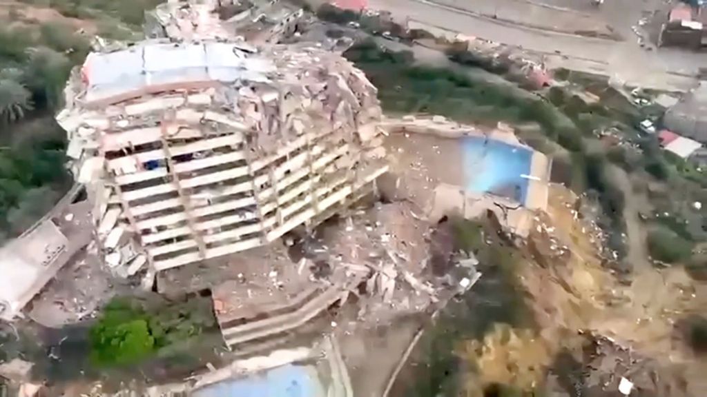
Fresh aerial imagery captured this week has laid bare the full scale of destruction along Venezuela’s northern coastline, where two powerful back-to-back earthquakes triggered catastrophic structural failure on Wednesday.
The port city of La Guaira, which sits just north of the Venezuelan capital Caracas along the rugged Caribbean shore, has borne the brunt of the seismic activity. Multiple multi-story residential and commercial buildings across the city have crumpled, leaving piles of concrete and twisted steel where intact structures stood just days prior. Surveys conducted by aerial drones and aircraft have allowed emergency response teams to map the full scope of the damage, much of which was difficult to access from the ground in the immediate aftermath of the quakes.
The two major tremors, which struck within hours of one another, sent panicked residents running into open spaces across the coastal region. Local authorities have not yet released full casualty figures or details of the full impact to infrastructure, but the aerial footage makes clear that the damage is widespread. The disaster comes as Venezuela already grapples with long-running economic challenges that have stretched emergency response and public works capabilities thin, raising concerns about the speed and scope of recovery efforts in the coming weeks.