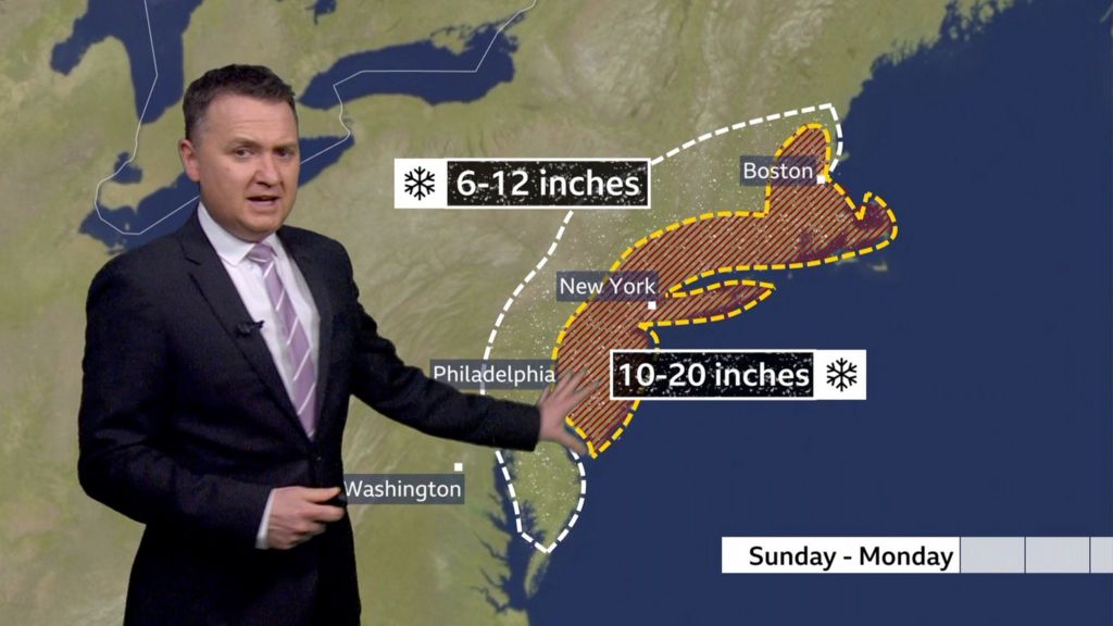
Meteorological authorities have issued urgent warnings as a powerful Nor’easter storm system prepares to unleash severe winter conditions across the northeastern United States. The developing weather pattern is expected to generate hurricane-force wind gusts reaching 70 miles per hour alongside significant snowfall accumulation, creating potentially dangerous blizzard conditions throughout the region.
The approaching storm represents a substantial atmospheric disturbance characterized by rapidly dropping barometric pressure and intense precipitation bands. Weather modeling indicates the system will follow a classic Nor’easter trajectory, developing along the Atlantic coastline before moving northward parallel to the eastern seaboard. This meteorological setup typically produces the most severe impacts across coastal New England states through interior regions.
Emergency management agencies across multiple states have initiated preparedness protocols, advising residents to complete storm preparations immediately. The anticipated combination of heavy snowfall and extreme winds threatens to create whiteout conditions that would make travel virtually impossible and potentially knock out power infrastructure. Transportation departments have pre-positioned snow removal equipment and are prepared to implement travel restrictions if conditions deteriorate as forecasted.
Meteorologists emphasize this particular storm’s unusual intensity for early winter, noting the rapid intensification process occurring over unusually warm Atlantic waters. The temperature contrast between cold continental air and warmer ocean moisture is fueling the storm’s development, creating conditions ripe for explosive cyclogenesis. This rapid strengthening phenomenon explains the forecasted extreme wind fields that will accompany the precipitation.
The National Weather Service has highlighted particular concerns for coastal communities where wind-driven storm surges may compound the blizzard conditions. Emergency officials recommend that residents in affected areas maintain emergency supplies adequate for several days of potential isolation due to impassable roads and possible power outages. The storm’s timing suggests impacts will be felt most severely during overnight and early morning hours, potentially extending through multiple tidal cycles in coastal zones.