A significant tropical weather system is advancing toward Queensland’s northeastern coastline, placing millions of Australian residents under severe weather advisories. Meteorological authorities have issued alerts indicating potential rainfall exceeding 200mm in certain regions, accompanied by destructive wind gusts reaching 90km/h.
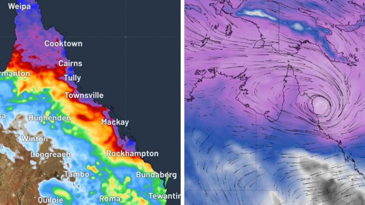
The developing system, designated Tropical Low 12U, has formed within the Coral Sea and demonstrates a gradual westward trajectory toward coastal communities. While the Bureau of Meteorology indicates a 25-35% probability of cyclonic development by Friday, the immediate concern remains intense precipitation and powerful winds affecting coastal towns from Hope Vale to Hamilton Island.
Forecast models project the most severe conditions developing throughout Friday and persisting into Saturday, with six-hour rainfall accumulations potentially reaching 150mm and isolated areas experiencing over 200mm. Concurrently, easterly wind systems are expected to generate sustained winds of 55-65km/h with significantly stronger gusts.
This meteorological event compounds existing weather challenges across Queensland, where northwestern regions have already experienced substantial flooding. Preliminary reports indicate exceptional rainfall totals, including Cowley Beach recording 1284mm within a seven-day period and Townsville receiving over 500mm recently.
Federal and state authorities have initiated disaster response measures, announcing a $38 million relief package targeting agricultural recovery and infrastructure repairs. Prime Minister Anthony Albanese emphasized coordinated government efforts to address both immediate response needs and long-term resilience building.
Simultaneously, southeastern Australia confronts contrasting extreme conditions as heatwave alerts cover multiple regions and firefighters combat uncontrolled bushfires in Victoria. Emergency management officials have highlighted the compound risks presented by concurrent weather extremes across the nation.