Indonesia is grappling with the aftermath of a powerful 7.7-magnitude earthquake that hit the island of Flores just before 5 a.m. local time on Saturday, claiming the lives of at least 47 people and leaving dozens more injured, according to official updates from the country’s disaster management agencies.
Indonesia’s Meteorology, Climatology, and Geophysical Agency confirmed the quake originated at a depth of 15 kilometers, roughly 1,000 kilometers northeast of the popular tourist island of Bali. Tremors from the powerful seismic event were felt as far west as Bima Regency and Bima City, with the worst damage concentrated across multiple districts in East Nusa Tenggara province. As of preliminary counts, 24 fatalities were recorded in Manggarai, 17 in East Manggarai, three in Sikka, and one each in Ngada, Ende, and West Manggarai. At least two people sustained critical injuries, while 11 others suffered minor harm.
In the hours after the initial quake, dozens of aftershocks rippled through the region, worsening structural damage. Early assessments confirm more than 150 private homes have been severely destroyed, alongside dozens of schools, multiple healthcare clinics, places of worship, government offices, and other public infrastructure. Footage captured at the port in Maumere, Flores’ largest urban center, shows large sections of concrete breaking away from the terminal building and falling onto passengers waiting for an inter-island ferry. When the ship’s gangway collapsed during the tremor, several people were thrown into the surrounding sea.
Emanuel Melkiades Laka Lena, governor of East Nusa Tenggara province, told reporters that most victims were killed in their sleep as crumbling buildings and rubble collapsed on them. For many residents, the early-morning jolt threw them abruptly out of bed. Arnold Welianto, a resident of the coastal village Talibura in Sikka district, recalled waking in a panic and rushing to check on his child. Speaking to the BBC, he added that many local residents immediately fled to higher inland ground after noticing the sea had receded, a common warning sign of an incoming tsunami.
Authorities initially issued a nationwide tsunami warning following the quake, prompting roughly 2,000 people in at-risk coastal areas to evacuate on their own. The warning was lifted roughly three hours later after monitoring detected no significant abnormal sea level changes. Despite the cancelled tsunami alert, secondary hazards including landslides have blocked road access to multiple remote mountain villages, slowing down damage assessments and rescue deployments.
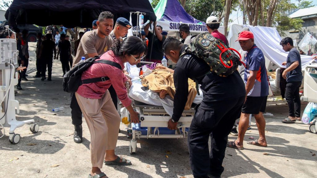
Search-and-rescue teams have worked around the clock to pull survivors trapped under collapsed rubble. In Ruteng, one of the hardest-hit urban areas, emergency workers have set up a temporary field medical tent outside the main local hospital to treat injured patients who cannot be accommodated inside the damaged facility. The country’s National Disaster Management Agency (BNPB) reported that as of Sunday, more than 10,500 emergency aid packages have arrived at regional base operations, with more supplies en route to remote communities.
Officials note that full assessments of the disaster’s scale will take time, as much of the affected region is made up of rugged, remote mountain terrain with limited transportation infrastructure. Adding to the sense of urgency, a separate 6.9-magnitude earthquake struck the opposite end of Indonesia just days later, a stark reminder of the country’s location along the Pacific Ring of Fire, a geologically active zone where three major tectonic plates meet. Thousands of seismic events are recorded across Indonesia every year, ranging from minor tremors to major destructive quakes.
In the latest public advisory, BNPB has urged all residents in affected areas to remain calm, avoid coastal lowlands as a precaution, and steer clear of any buildings that show visible signs of structural damage following the quake.