On Tuesday, a 6.7-magnitude seismic event rattled a large section of Indonesia’s Sulawesi island, triggering a series of powerful aftershocks that heightened anxiety among local residents still recovering from devastating quakes in recent years. The initial tremor produced intense shaking that persisted for over one minute across Palu, a coastal city of roughly 400,000 people that serves as the administrative capital of Central Sulawesi province.
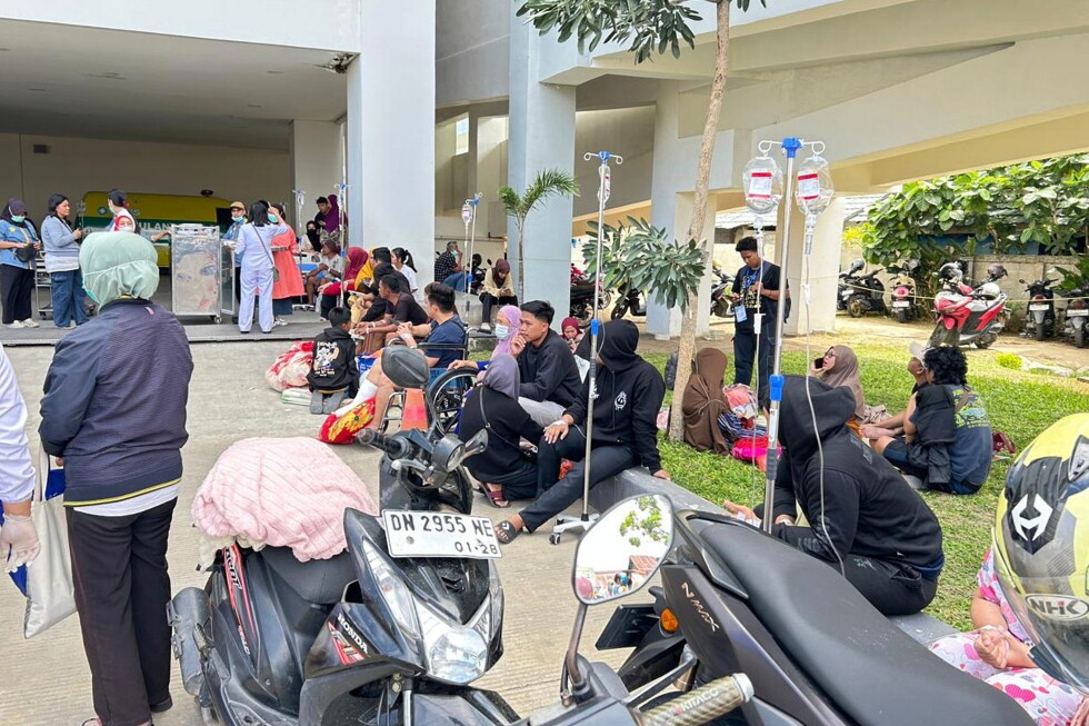
Preliminary assessments confirm scattered structural damage across the affected area. As a precautionary safety step, multiple medical facilities in the region moved all patients outdoors, with some patients remaining connected to intravenous drips during the evacuation. As of the latest updates, official data on injuries or fatalities has not yet been released.
According to the U.S. Geological Survey, the epicenter of the main quake was located 43 kilometers east-southeast of Palu, at a relatively shallow depth of approximately 10 kilometers below the Earth’s surface. Among the aftershocks recorded in the hours after the initial temblor, the strongest registered a magnitude of 5.2. Authorities have ruled out any risk of a tsunami following the seismic activity.
Indonesia sits along the Pacific Ring of Fire, a geologically active region crisscrossed by numerous tectonic faults that make frequent earthquakes and volcanic eruptions a regular threat for the archipelago nation. For residents of Sulawesi, this latest quake has revived painful memories of the 2018 7.5-magnitude disaster that destroyed much of Palu. That event spawned a 3-meter-high tsunami and triggered destructive soil liquefaction, which caused entire neighborhoods to collapse into the ground. The 2018 disaster claimed the lives of more than 4,000 people.
More recently, in January 2021, a 6.2-magnitude quake struck near the Sulawesi city of Mamuju, killing at least 100 people and forcing thousands of survivors to camp outdoors for multiple days amid ongoing fears of additional aftershocks.