A formidable bomb cyclone unleashed its fury across North Carolina and the mid-Atlantic region over the weekend, triggering a state of emergency characterized by paralyzing snowfall, hurricane-force winds, and perilous travel conditions. The tempest, which commenced its onslaught late Friday, persisted relentlessly through the weekend, with coastal territories and the Outer Banks bearing the brunt of its force and accumulating up to 15 inches of snow.
The National Weather Service has officially designated this meteorological event a ‘historic storm,’ a classification underscored by data from the North Carolina State Climate Office. Their analysis confirms that snowfall volumes in certain state districts have exceeded all other winter occurrences recorded thus far in the 21st century. The rapid intensification of the cyclone, meeting the criteria for ‘bombogenesis,’ resulted in a precipitous drop in atmospheric pressure, fueling the violent winds that compounded the blinding snow and created near-zero visibility.
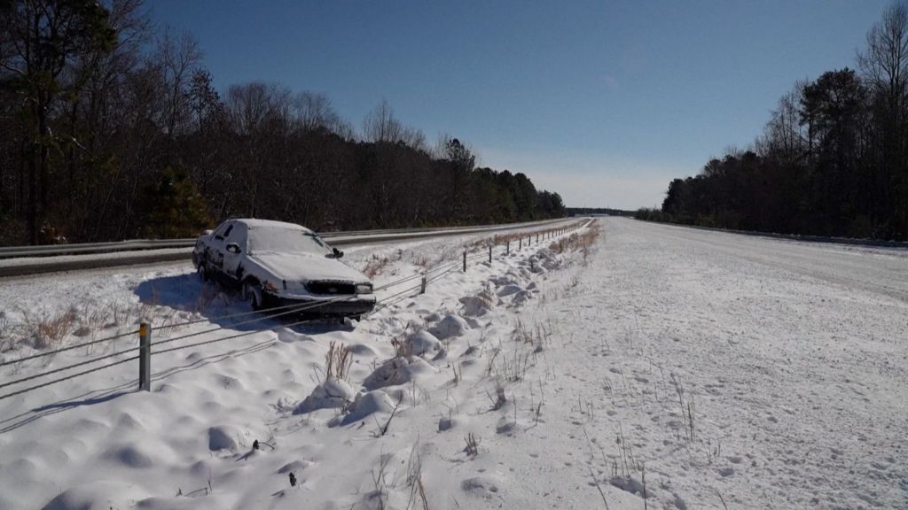
Transportation networks experienced severe disruptions as major highways became impassable, forcing numerous road closures and stranding motorists. Emergency services issued stern warnings for residents to remain indoors, citing life-threatening wind chills and the high risk of hypothermia. Utility companies reported widespread power outages as heavy, wet snow and gusty winds downed trees and power lines across the affected states.
The extensive impact of this extreme weather event underscores the growing challenges communities face from rapidly intensifying winter storms, prompting discussions on infrastructure resilience and emergency preparedness for future climatic anomalies.