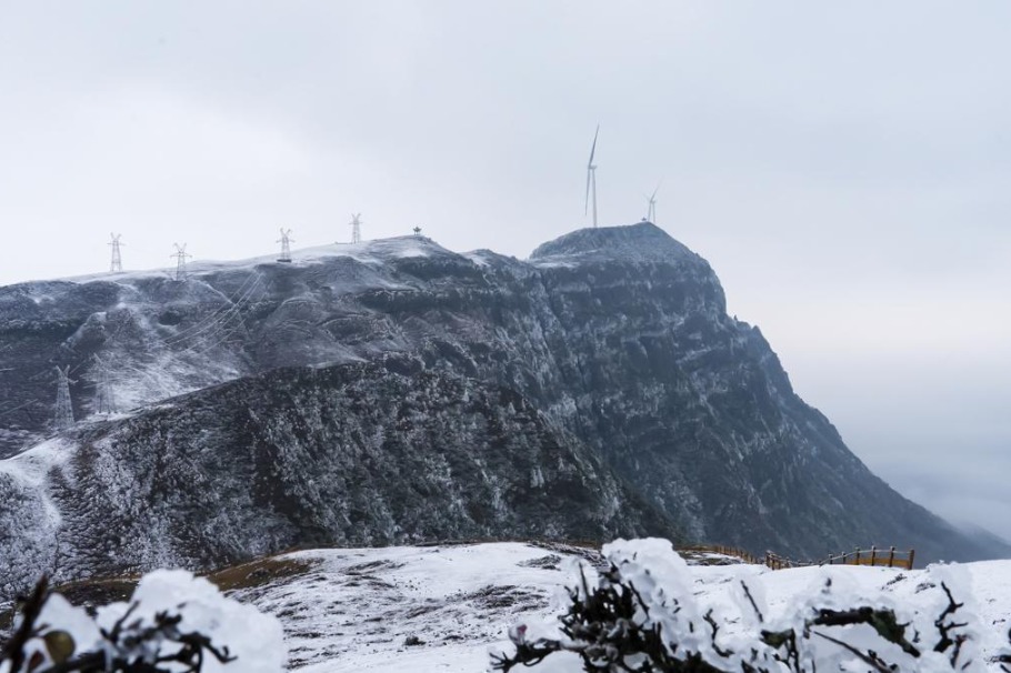
Spectacular aerial photography has documented the mesmerizing transformation of Wumeng Grassland in Panzhou City, Guizhou Province, as winter’s first snow blanket begins its seasonal retreat. The breathtaking images reveal ethereal mist formations rising from the melting snowscape, creating a dramatic visual contrast between the lingering winter whiteness and the emerging spring terrain.
Located within the prestigious Wumeng Mountain National Geopark, this expansive grassland ecosystem spans elevations ranging from 2,000 to 2,857 meters above sea level. As one of Guizhou’s most significant high-altitude natural pastures, the area represents a critical component of the region’s unique ecological and geological heritage.
The photographic documentation, captured by Deng Yongchang, provides valuable visual data regarding seasonal transition patterns in high-altitude environments. The imagery not only showcases nature’s artistic beauty but also serves as an important record of environmental processes occurring within China’s protected geopark system. These visual documents offer researchers and conservationists insights into microclimatic conditions and hydrological cycles characteristic of southwestern China’s highland regions.
The mist phenomena observed during the snowmelt process result from specific temperature differentials between the cold snow surface and the gradually warming spring air. This atmospheric interaction creates the visually stunning evaporation effects captured in the aerial photographs, demonstrating the dynamic interplay between geological formations, elevation factors, and seasonal weather patterns.