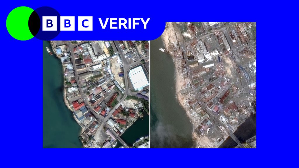
Jamaica is grappling with the aftermath of Hurricane Melissa, a Category 5 storm that has left widespread devastation across the island. With power outages, communication breakdowns, and treacherous conditions hampering relief efforts, authorities have yet to provide a comprehensive damage assessment. However, satellite imagery analyzed by BBC Verify is beginning to reveal the storm’s catastrophic impact on communities. The southwestern coastal port of Black River, described by Prime Minister Andrew Holness as ‘ground zero,’ has suffered severe destruction. Key structures, including a market building, a café, and a warehouse, have been obliterated or heavily damaged. The fishing village of White House, home to thousands, bore the brunt of the hurricane’s 185 mph winds, with nearly every structure either damaged or destroyed. Montego Bay, a major tourist hub, now resembles a brown swamp, with floodwaters inundating the port, industrial park, and nearby facilities. Mayor Richard Vernon described the area as ‘devastated,’ praising locals for their resilience and mutual support. As Jamaica begins the long road to recovery, the full scale of the disaster remains to be seen.
Before and after: Satellite images reveal hurricane devastation in Jamaica