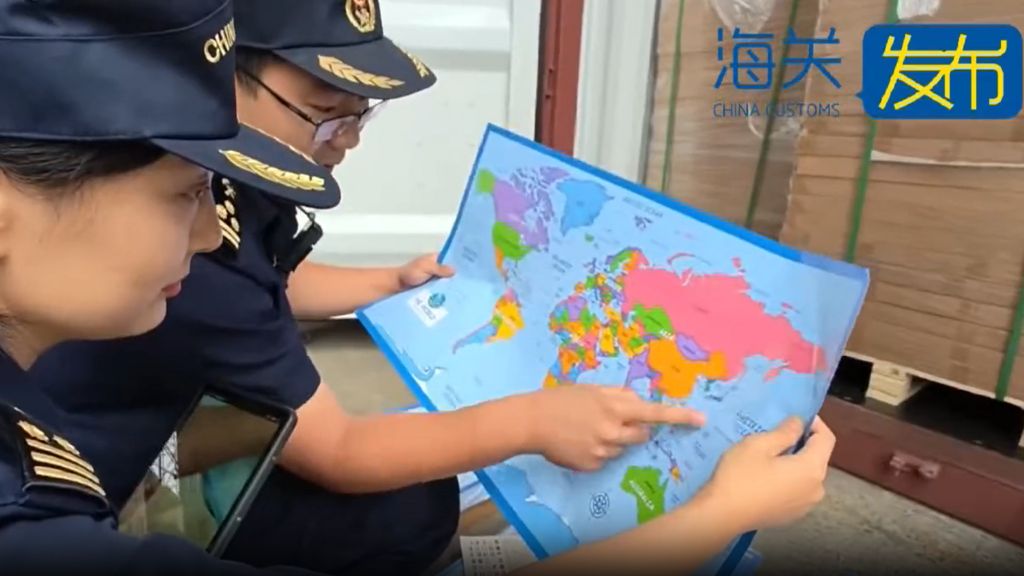
Chinese customs authorities in Shandong province have intercepted a significant shipment of 60,000 maps destined for export, citing serious concerns over national sovereignty and territorial integrity. The maps were deemed ‘problematic’ due to their mislabelling of Taiwan, which China claims as an integral part of its territory, and the omission of key islands in the South China Sea. Beijing’s claims in the South China Sea overlap with those of neighboring countries, including the Philippines and Vietnam, making cartographic accuracy a highly sensitive issue. The seized maps also failed to include the controversial nine-dash line, which demarcates China’s expansive claims over nearly the entire South China Sea, as well as the maritime boundary between China and Japan. Authorities emphasized that such maps ‘endanger national unity, sovereignty, and territorial integrity,’ rendering them unfit for sale. This incident underscores the heightened tensions in the region, particularly following recent confrontations between Chinese and Philippine vessels in the South China Sea. The Philippines accused a Chinese ship of ramming and firing a water cannon at a Philippine government vessel, while Beijing claimed the incident occurred after repeated warnings were ignored. The confiscation of ‘problematic maps’ is not unprecedented, but the scale of this seizure is notable. Earlier this year, customs officers in Qingdao and Hebei provinces also intercepted similar shipments containing errors in national borders and territorial depictions. The sensitivity surrounding maps in the region was further highlighted by the 2023 Barbie movie, which faced bans and censorship in Vietnam and the Philippines for depicting the nine-dash line. China Customs did not disclose the intended destination of the seized maps, but the incident reflects Beijing’s unwavering stance on territorial issues and its commitment to enforcing strict standards on cartographic representations.