Meteorological authorities have issued urgent warnings for Australia’s New South Wales region as an extreme weather system threatens to unleash dangerous conditions through Thursday. The Bureau of Meteorology has elevated alerts to severe levels, particularly for the Upper Western District near the South Australian border, where intense rainfall could trigger significant flash flooding events.
Senior meteorologist Dean Narramore from the Bureau provided concerning projections, indicating widespread rainfall accumulations of 100-200mm across affected regions, with isolated areas potentially receiving 250-300mm by week’s end. Such precipitation levels are expected to create major flooding conditions and substantial operational challenges for emergency services.
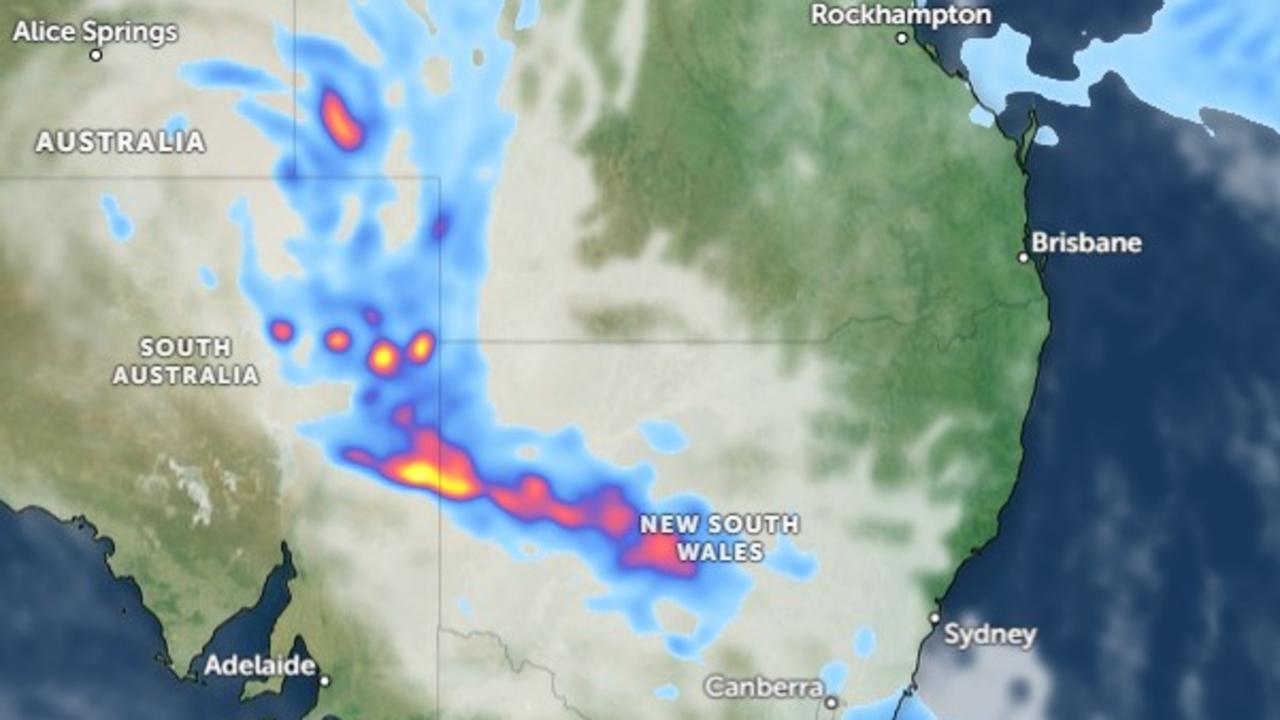
The developing situation stems from an unusual convergence of meteorological phenomena. A persistent tropical low-pressure system originating from central inland Australia has been interacting with a cold front and upper trough system, creating optimal conditions for sustained heavy precipitation and severe thunderstorms.
Specific communities including Tibooburra, White Cliffs, Wanaaring, Louth, Tilpa and Fords Bridge have been identified as high-risk zones. Preliminary data shows Tibooburra already received 20mm of rainfall within hours since Monday morning, providing a precursor of more substantial rainfall to come.
The weather system’s influence extends beyond immediate flood concerns. Sydney residents should prepare for increased precipitation probabilities, with forecasts indicating 60% chance of rainfall by Wednesday, escalating to 70% likelihood during the weekend alongside seasonal temperatures ranging from 22°C to 30°C.
Authorities have expanded monitoring efforts, issuing Flood Watch advisories across multiple jurisdictions including Queensland, South Australia and the Northern Territory, indicating the broad geographical impact of this developing weather pattern.