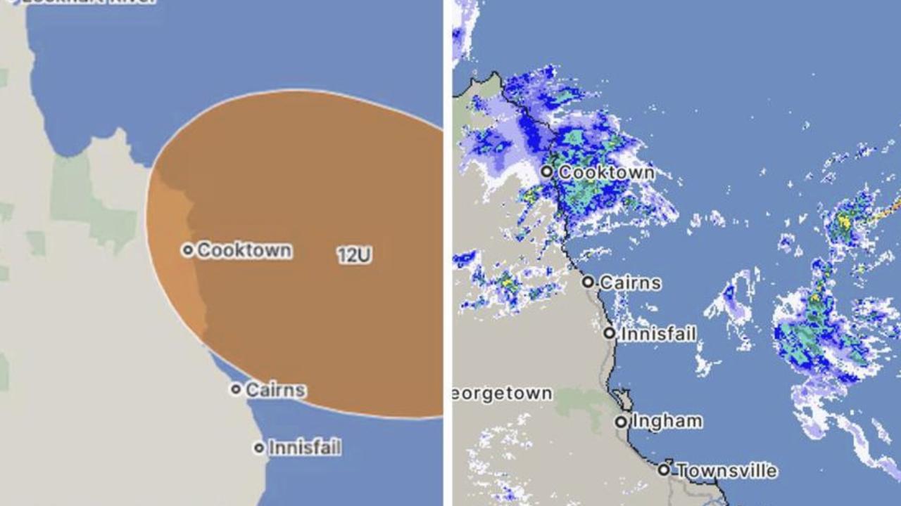
Far North Queensland remains on heightened alert as meteorological authorities warn of a developing tropical low with significant potential to intensify into a cyclonic system. The Bureau of Meteorology indicates a 35% probability of cyclone formation as this weather pattern approaches the coastline between Cooktown and Townsville later this week.
Meteorologist Miriam Bradbury emphasized the compound risks presented by converging weather systems. “The combination of this developing low-pressure trough with strengthening monsoonal flows creates multiple hazard scenarios,” she stated. The system is projected to deliver substantial rainfall from Wednesday onward, with precipitation estimates ranging from 50-100mm in urban centers to exceeding 200mm in localized areas.
The immediate concerns focus on flash flooding threats to both populated areas and agricultural regions. Bradbury cautioned that “the risk of flash flooding with heavy falls could threaten property and even life, depending on their intensity and location.” The persistent saturation has already resulted in major flooding events along the Flinders River at Richmond and Walkers Bend, plus the Western River at Winton, with expectations of further rises as upstream flows arrive.
Emergency management authorities anticipate continued road closures and community isolation throughout the region. The agricultural sector faces particular vulnerability with ongoing risks to livestock and crops under persistently cool, wet conditions. Meteorological specialists are maintaining continuous monitoring as the situation evolves, with the most critical period expected during Friday and throughout the upcoming weekend.